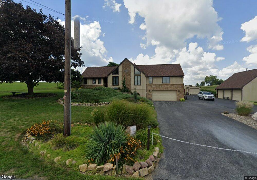
2637 Stumptown Rd Bird In Hand, PA 17505
Estimated Value: $503,750 - $672,000
5
Beds
3
Baths
3,096
Sq Ft
$184/Sq Ft
Est. Value
About This Home
This home is located at 2637 Stumptown Rd, Bird In Hand, PA 17505 and is currently estimated at $569,938, approximately $184 per square foot. 2637 Stumptown Rd is a home located in Lancaster County with nearby schools including Leola Elementary School, Gerald G. Huesken Middle School, and Conestoga Valley High School.
Ownership History
Date
Name
Owned For
Owner Type
Purchase Details
Closed on
Apr 1, 2014
Sold by
Lee Donald R and Lee Hilda W
Bought by
Hill Brian S
Current Estimated Value
Home Financials for this Owner
Home Financials are based on the most recent Mortgage that was taken out on this home.
Original Mortgage
$140,000
Outstanding Balance
$106,145
Interest Rate
4.27%
Mortgage Type
New Conventional
Estimated Equity
$463,793
Purchase Details
Closed on
May 31, 2006
Sold by
Lee Donald R and Lee Hilda W
Bought by
Lee Donald R and Lee Hilda W
Create a Home Valuation Report for This Property
The Home Valuation Report is an in-depth analysis detailing your home's value as well as a comparison with similar homes in the area
Home Values in the Area
Average Home Value in this Area
Purchase History
| Date | Buyer | Sale Price | Title Company |
|---|---|---|---|
| Hill Brian S | $289,000 | None Available | |
| Lee Donald R | -- | None Available | |
| Lee Donald R | -- | None Available |
Source: Public Records
Mortgage History
| Date | Status | Borrower | Loan Amount |
|---|---|---|---|
| Open | Hill Brian S | $140,000 |
Source: Public Records
Tax History Compared to Growth
Tax History
| Year | Tax Paid | Tax Assessment Tax Assessment Total Assessment is a certain percentage of the fair market value that is determined by local assessors to be the total taxable value of land and additions on the property. | Land | Improvement |
|---|---|---|---|---|
| 2025 | $5,571 | $278,800 | $93,600 | $185,200 |
| 2024 | $5,571 | $278,800 | $93,600 | $185,200 |
| 2023 | $5,457 | $278,800 | $93,600 | $185,200 |
| 2022 | $5,319 | $278,800 | $93,600 | $185,200 |
| 2021 | $5,130 | $278,800 | $93,600 | $185,200 |
| 2020 | $5,130 | $278,800 | $93,600 | $185,200 |
| 2019 | $5,018 | $278,800 | $93,600 | $185,200 |
| 2018 | $7,276 | $278,800 | $93,600 | $185,200 |
| 2017 | $4,185 | $193,200 | $53,900 | $139,300 |
| 2016 | $4,127 | $193,200 | $53,900 | $139,300 |
| 2015 | $1,050 | $193,200 | $53,900 | $139,300 |
| 2014 | $2,770 | $193,200 | $53,900 | $139,300 |
Source: Public Records
Map
Nearby Homes
- 425 Mill Creek Rd
- 103 Fairhill Dr
- 339 Enterprise Dr
- 323 Enterprise Dr
- 2596 Old Philadelphia Pike
- 2498 Old Philadelphia Park
- 70 Hellers Church Rd
- 71 Apricot Ave
- 68 Horseshoe Rd
- 259 Raspberry Rd
- 39 N Maple Ave
- 2453 Lincoln Hwy E
- 7 Pleasant Dr
- 466 Eastwood Ln
- 130 Snapdragon Dr
- 403 Eastwood Ln
- 2234 Coach Light Ln
- 248 E Main St
- 117 Summers Dr
- 918 Krista Ct
- 2645 Stumptown Rd
- 2649 Stumptown Rd
- 2605 Stumptown Rd
- 566 Gibbons Rd
- 574 Gibbons Rd
- 2601 Stumptown Rd
- 557 Beechdale Rd
- 2683 Evergreen Dr
- 2683 Evergreen Dr
- 2684 Evergreen Dr
- 2690 Stumptown Rd
- 2694 Stumptown Rd
- 2691 Evergreen Dr
- 462 Mill Creek Rd
- 533 Beechdale Rd
- 2688 Evergreen Dr
- 2692 Evergreen Dr
- 571 Gibbons Rd
- 558 Gibbons Rd
- 554 Gibbons Rd