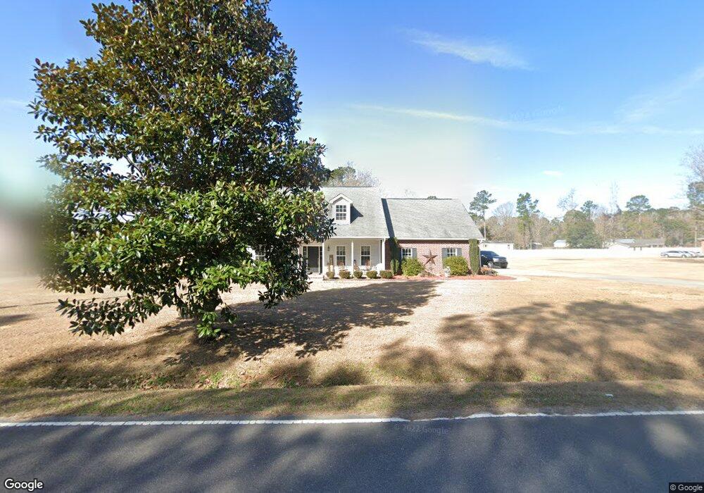
264 Airport Dr Moncks Corner, SC 29461
Estimated Value: $250,000 - $478,000
4
Beds
3
Baths
2,500
Sq Ft
$161/Sq Ft
Est. Value
About This Home
This home is located at 264 Airport Dr, Moncks Corner, SC 29461 and is currently estimated at $402,054, approximately $160 per square foot. 264 Airport Dr is a home located in Berkeley County with nearby schools including Berkeley Elementary School, Berkeley Middle School, and Berkeley High School.
Ownership History
Date
Name
Owned For
Owner Type
Purchase Details
Closed on
Aug 22, 2008
Sold by
Star Construction Llc
Bought by
Kornahrens David M
Current Estimated Value
Home Financials for this Owner
Home Financials are based on the most recent Mortgage that was taken out on this home.
Original Mortgage
$272,975
Outstanding Balance
$179,073
Interest Rate
6.32%
Mortgage Type
FHA
Estimated Equity
$222,981
Purchase Details
Closed on
May 1, 2007
Sold by
Swamp Fox Developers Inc
Bought by
Star Construction Llc
Home Financials for this Owner
Home Financials are based on the most recent Mortgage that was taken out on this home.
Original Mortgage
$224,315
Interest Rate
6.11%
Mortgage Type
Credit Line Revolving
Create a Home Valuation Report for This Property
The Home Valuation Report is an in-depth analysis detailing your home's value as well as a comparison with similar homes in the area
Home Values in the Area
Average Home Value in this Area
Purchase History
| Date | Buyer | Sale Price | Title Company |
|---|---|---|---|
| Kornahrens David M | $275,900 | -- | |
| Star Construction Llc | $175,000 | None Available |
Source: Public Records
Mortgage History
| Date | Status | Borrower | Loan Amount |
|---|---|---|---|
| Open | Kornahrens David M | $272,975 | |
| Previous Owner | Star Construction Llc | $224,315 |
Source: Public Records
Tax History Compared to Growth
Tax History
| Year | Tax Paid | Tax Assessment Tax Assessment Total Assessment is a certain percentage of the fair market value that is determined by local assessors to be the total taxable value of land and additions on the property. | Land | Improvement |
|---|---|---|---|---|
| 2025 | $1,237 | $258,946 | $50,431 | $208,515 |
| 2024 | $1,188 | $10,358 | $2,017 | $8,341 |
| 2023 | $1,188 | $10,358 | $2,017 | $8,341 |
| 2022 | $1,187 | $9,006 | $1,252 | $7,754 |
| 2021 | $1,215 | $9,000 | $1,252 | $7,754 |
| 2020 | $1,230 | $9,006 | $1,252 | $7,754 |
| 2019 | $1,222 | $9,006 | $1,252 | $7,754 |
| 2018 | $1,126 | $7,832 | $1,200 | $6,632 |
| 2017 | $1,007 | $7,832 | $1,200 | $6,632 |
| 2016 | $1,031 | $7,830 | $1,200 | $6,630 |
| 2015 | $951 | $7,830 | $1,200 | $6,630 |
| 2014 | $847 | $6,910 | $1,200 | $5,710 |
| 2013 | -- | $6,910 | $1,200 | $5,710 |
Source: Public Records
Map
Nearby Homes
- 226 Collier Ln
- 758 S Live Oak Dr
- 2090 S Live Oak Dr
- 231 S Live Oak Dr
- 113 Center St
- 120 State Road S-8-458
- 419 Kerria Cir
- 0000 Winter St
- 0 Hammer Ln
- 301 S Live Oak Dr
- 122 Pinewood Dr
- 00 Haynesville Rd Extension
- 125 Orchid Bloom Cir
- 403 White Bluff Ct
- 115 Merrimack Blvd
- 283 W End Dr
- 2015 Robin Wood Blvd
- 2033 Robin Wood Blvd
- 111 Heatley St Unit A
- Lot 0 Simmonsfield Ln
- 270 Airport Dr
- 106 Three Oaks Ct
- 109 Three Oaks Ct
- 228 Airport Dr
- 400 Airport Dr
- 3 Airport Dr
- 1 Airport Dr
- 217 Collier Ln
- 105 Three Oaks Ct
- 220 Airport Dr
- 274 Airport Dr
- 221 Airport Dr
- 216 Collier Ln
- 234 Collier Ln
- 216 Airport Dr
- 276 Airport Dr
- 278 Airport Dr
- 205 Airport Dr
- 729 S Live Oak Dr
- 216 Motte Ln