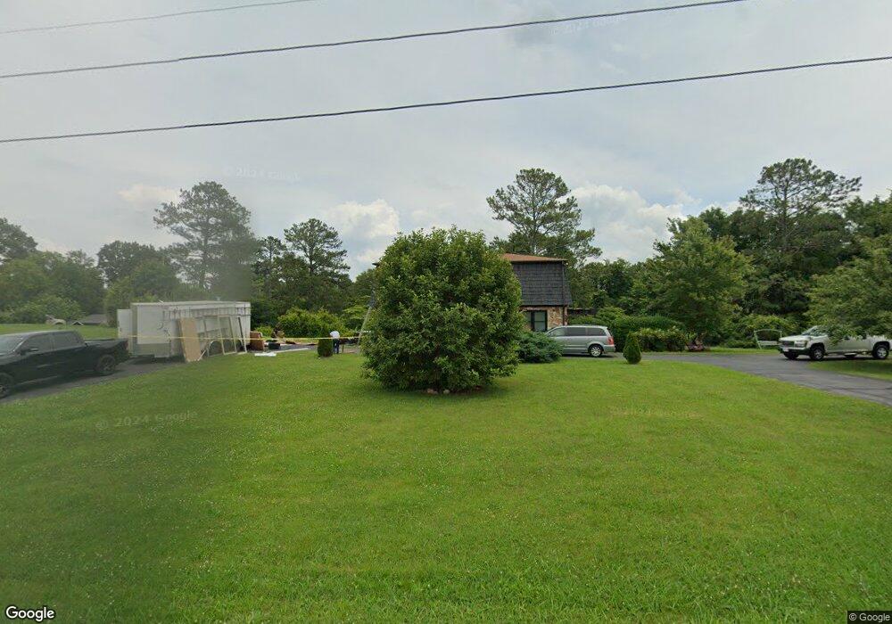
264 Countryside Dr SW Calhoun, GA 30701
Estimated Value: $291,444 - $404,000
3
Beds
2
Baths
2,050
Sq Ft
$169/Sq Ft
Est. Value
About This Home
This home is located at 264 Countryside Dr SW, Calhoun, GA 30701 and is currently estimated at $346,111, approximately $168 per square foot. 264 Countryside Dr SW is a home located in Gordon County with nearby schools including Swain Elementary School, Ashworth Middle School, and Gordon Central High School.
Ownership History
Date
Name
Owned For
Owner Type
Purchase Details
Closed on
Jun 21, 1998
Bought by
Krusac Bela Michael
Current Estimated Value
Create a Home Valuation Report for This Property
The Home Valuation Report is an in-depth analysis detailing your home's value as well as a comparison with similar homes in the area
Home Values in the Area
Average Home Value in this Area
Purchase History
| Date | Buyer | Sale Price | Title Company |
|---|---|---|---|
| Krusac Bela Michael | -- | -- |
Source: Public Records
Tax History Compared to Growth
Tax History
| Year | Tax Paid | Tax Assessment Tax Assessment Total Assessment is a certain percentage of the fair market value that is determined by local assessors to be the total taxable value of land and additions on the property. | Land | Improvement |
|---|---|---|---|---|
| 2024 | $626 | $71,188 | $12,400 | $58,788 |
| 2023 | $589 | $67,188 | $12,400 | $54,788 |
| 2022 | $584 | $63,428 | $12,400 | $51,028 |
| 2021 | $490 | $53,508 | $12,400 | $41,108 |
| 2020 | $501 | $54,188 | $12,400 | $41,788 |
| 2019 | $503 | $54,188 | $12,400 | $41,788 |
| 2018 | $472 | $50,988 | $12,400 | $38,588 |
| 2017 | $458 | $48,628 | $12,400 | $36,228 |
| 2016 | $631 | $48,628 | $12,400 | $36,228 |
| 2015 | $1,375 | $47,868 | $12,400 | $35,468 |
| 2014 | $1,315 | $47,169 | $12,411 | $34,758 |
Source: Public Records
Map
Nearby Homes
- 110 Darby Rd SW
- 211 Darby Rd SW
- 261 Liberty Ln SW
- 1653 Miller Ferry Rd SW
- L2 Taylor Bridge Rd SW
- 271 Old Belwood Rd SE
- 0 Reeves Station Rd SW Unit 10548197
- 0 Reeves Station Rd SW Unit 7601645
- 19 Dublin Way NW
- 490 McDaniel Station Rd SW
- 506 McDaniel Station Rd SW
- 458 McDaniel Station Rd SW
- 474 McDaniel Station Rd SW
- 365 Riverboat Dr
- 1943 Rome Rd SW
- 269 Riverboat Dr
- 238 Lighthouse Cove SW
- 114 Belwood Dr SE
- Woodridge Plan at The Landing at Miller’s Ferry
- Kensington Plan at The Landing at Miller’s Ferry
- 00 Darby Rd SW
- 0 Darby Rd SW
- 0 Darby Rd SW Unit 7176524
- 0 Darby Rd SW Unit 7438149
- 0 Darby Rd SW Unit 9061095
- 0 Darby Rd SW Unit 8936785
- 0 Darby Rd SW Unit 8355499
- 0 Darby Rd SW Unit 8300625
- 0 Darby Rd SW Unit 8642149
- 234 Countryside Dr SW
- 283 Countryside Dr SW
- 298 Countryside Dr SW
- 326 Countryside Dr SW
- 194 Countryside Dr SW
- 1771 McDaniel Station Rd SW
- 205 Countryside Dr SW
- 0 Countryside Dr SW Unit 8601344
- 229 Countryside Dr SW
- 327 Countryside Dr SW
- 1755 McDaniel Station Rd SW