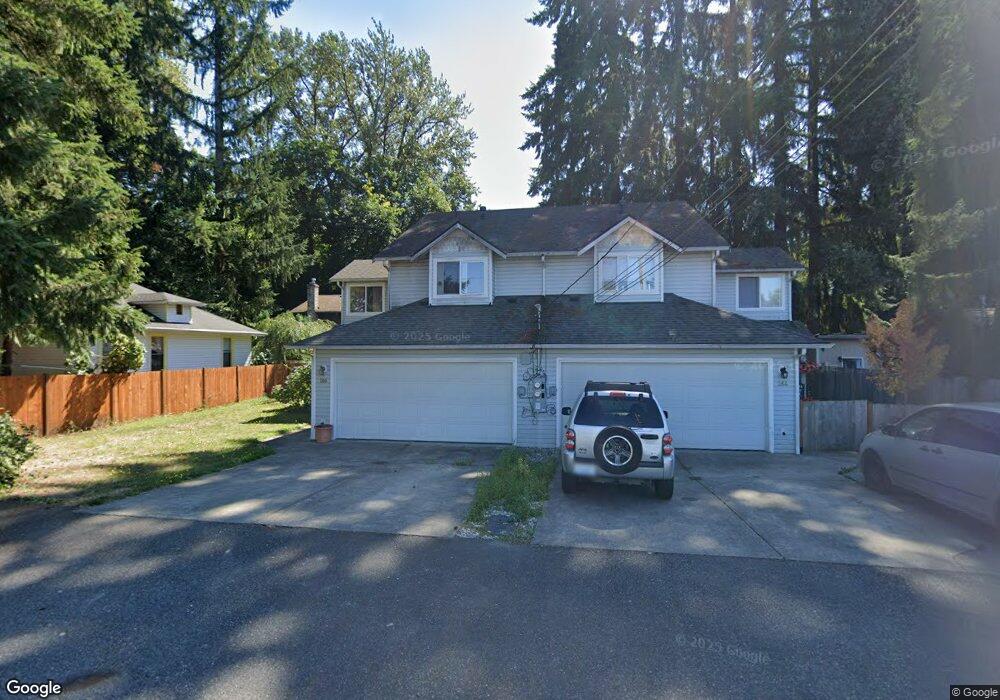
264 E Mcdougall St Monroe, WA 98272
Estimated Value: $826,727 - $900,000
6
Beds
4
Baths
2,559
Sq Ft
$342/Sq Ft
Est. Value
About This Home
This home is located at 264 E Mcdougall St, Monroe, WA 98272 and is currently estimated at $874,242, approximately $341 per square foot. 264 E Mcdougall St is a home with nearby schools including Frank Wagner Elementary School, Monroe High School, and Monroe Montessori School.
Ownership History
Date
Name
Owned For
Owner Type
Purchase Details
Closed on
Mar 23, 2000
Sold by
Laz Stanley
Bought by
Jessop Enterprises
Current Estimated Value
Purchase Details
Closed on
Sep 30, 1998
Sold by
Magness Kelsey J
Bought by
Laz Stanley R
Create a Home Valuation Report for This Property
The Home Valuation Report is an in-depth analysis detailing your home's value as well as a comparison with similar homes in the area
Home Values in the Area
Average Home Value in this Area
Purchase History
We collect this data history from publicly available records. To have your information removed, we recommend requesting removal directly through your county’s website.
| Date | Buyer | Sale Price | Title Company |
|---|---|---|---|
| Jessop Enterprises | $65,500 | Pacific Nw Title | |
| Laz Stanley R | -- | -- |
Source: Public Records
Tax History
| Year | Tax Paid | Tax Assessment Tax Assessment Total Assessment is a certain percentage of the fair market value that is determined by local assessors to be the total taxable value of land and additions on the property. | Land | Improvement |
|---|---|---|---|---|
| 2026 | $5,800 | $741,300 | $339,000 | $402,300 |
| 2025 | $5,707 | $741,500 | $306,000 | $435,500 |
| 2024 | $5,707 | $706,400 | $286,000 | $420,400 |
| 2023 | $5,481 | $736,000 | $306,000 | $430,000 |
| 2022 | $5,374 | $575,600 | $216,000 | $359,600 |
| 2020 | $4,803 | $495,800 | $195,000 | $300,800 |
| 2019 | $3,896 | $397,000 | $167,000 | $230,000 |
| 2018 | $4,450 | $371,500 | $142,000 | $229,500 |
| 2017 | $3,889 | $339,600 | $129,000 | $210,600 |
| 2016 | $3,866 | $310,700 | $106,000 | $204,700 |
| 2015 | $3,737 | $282,600 | $93,000 | $189,600 |
| 2013 | $3,798 | $262,700 | $70,000 | $192,700 |
Source: Public Records
Map
Nearby Homes
- 234 S Ferry Ave
- 433 S Lewis St Unit A & B
- 118 Morris St
- 520 S Kelsey St
- 654 W Main St
- 523 Park St
- 807 W Main St Unit B
- 1017 W Main St Unit C102
- 19875 Mountain Ridge Rd SE
- 315 Dennis Way
- 20066 Ambers Place SE
- 1152 Johnson St SE
- 1201 Pattison Place
- 18621 Blueberry Ln Unit A104
- 18621 Blueberry Ln Unit A204
- 18621 Blueberry Ln Unit A106
- 18621 Blueberry Ln Unit A202
- 18621 Blueberry Ln Unit A205
- 174 Countryman Dr
- 20074 Ramblewood Rd SE
- 313 Thompson Ln
- 315 Thompson Ln
- 276 E Mcdougall St
- 334 Thompson Ln
- 252 E Mcdougall St
- 255 E Mcdougall St
- 311 S Ferry St
- 322 Thompson Ln
- 245 E Mcdougall St
- 301 S Ferry St
- 235 S Ferry St
- 325 S Ferry St
- 233 S Ferry St
- 310 Thompson Ln
- 327 S Ferry St
- 26 XX E Mcdougall St
- 381 S Ferry St
- 322 S Ferry St
- 314 S Ferry St
- 302 S Ferry St
Your Personal Tour Guide
Ask me questions while you tour the home.