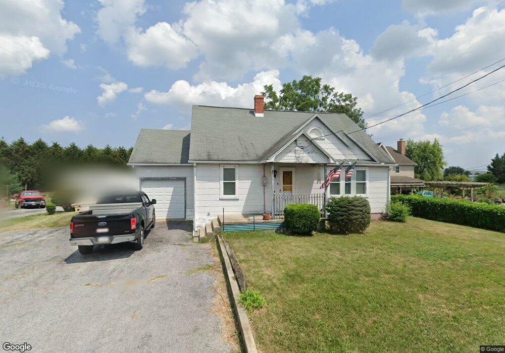
264 N Locust Point Rd Mechanicsburg, PA 17050
Estimated Value: $230,705 - $280,000
3
Beds
1
Bath
1,322
Sq Ft
$190/Sq Ft
Est. Value
About This Home
This home is located at 264 N Locust Point Rd, Mechanicsburg, PA 17050 and is currently estimated at $251,176, approximately $189 per square foot. 264 N Locust Point Rd is a home located in Cumberland County with nearby schools including Silver Spring Elementary School, Eagle View Middle School, and Cumberland Valley High School.
Ownership History
Date
Name
Owned For
Owner Type
Purchase Details
Closed on
Jun 30, 2000
Sold by
Leach Jack C
Bought by
White Joseph J
Current Estimated Value
Home Financials for this Owner
Home Financials are based on the most recent Mortgage that was taken out on this home.
Original Mortgage
$62,500
Outstanding Balance
$22,871
Interest Rate
8.55%
Estimated Equity
$228,305
Create a Home Valuation Report for This Property
The Home Valuation Report is an in-depth analysis detailing your home's value as well as a comparison with similar homes in the area
Home Values in the Area
Average Home Value in this Area
Purchase History
| Date | Buyer | Sale Price | Title Company |
|---|---|---|---|
| White Joseph J | $81,000 | -- |
Source: Public Records
Mortgage History
| Date | Status | Borrower | Loan Amount |
|---|---|---|---|
| Open | White Joseph J | $62,500 |
Source: Public Records
Tax History Compared to Growth
Tax History
| Year | Tax Paid | Tax Assessment Tax Assessment Total Assessment is a certain percentage of the fair market value that is determined by local assessors to be the total taxable value of land and additions on the property. | Land | Improvement |
|---|---|---|---|---|
| 2025 | $2,347 | $145,600 | $31,900 | $113,700 |
| 2024 | $2,232 | $145,600 | $31,900 | $113,700 |
| 2023 | $2,119 | $145,600 | $31,900 | $113,700 |
| 2022 | $2,067 | $145,600 | $31,900 | $113,700 |
| 2021 | $2,023 | $145,600 | $31,900 | $113,700 |
| 2020 | $1,985 | $145,600 | $31,900 | $113,700 |
| 2019 | $1,952 | $145,600 | $31,900 | $113,700 |
| 2018 | $1,919 | $145,600 | $31,900 | $113,700 |
| 2017 | $1,885 | $145,600 | $31,900 | $113,700 |
| 2016 | -- | $145,600 | $31,900 | $113,700 |
| 2015 | -- | $145,600 | $31,900 | $113,700 |
| 2014 | -- | $145,600 | $31,900 | $113,700 |
Source: Public Records
Map
Nearby Homes
- 56 W Main St
- 122 Silver Cir Unit HAWTHORNE
- 122 Silver Cir Unit DEVONSHIRE
- 32 Pamela Dr
- 312 Bahama Cir
- 404 Venice Ave
- 76 Malibu Blvd
- 506 Palm Beach Ave
- 240 Key West Blvd
- 44 Sarasota Cir
- 35 Hathaway Dr
- 24 Hathaway Dr
- 121 Rich Valley Rd
- 265 Founders Way
- Glenmoore Plan at Spring Meadow Reserve
- 86 Presidents Dr
- 75 Presidents Dr
- 111 N Old Stonehouse Rd
- 110 Madison Dr
- 111 Madison Dr
- 266 N Locust Point Rd
- 260 N Locust Point Rd
- 258-C N Locust Point Rd
- 272 N Locust Point Rd
- 258 N Locust Point Rd
- 258 N Locust Point Rd
- 258 A N Locust Point Rd
- 258 N Locust Point Rd
- 258 N Locust Point Rd Unit A
- 258 N Locust Point Rd Unit B
- 258 N Locust Point Rd Unit C
- 258 N Locust Point Rd Unit D
- 274 N Locust Point Rd
- 256 N Locust Point Rd
- 0 N Locust Point Rd
- 278 N Locust Point Rd
- 254 N Locust Point Rd
- 280 N Locust Point Rd
- 281 N Locust Point Rd
- 252 N Locust Point Rd