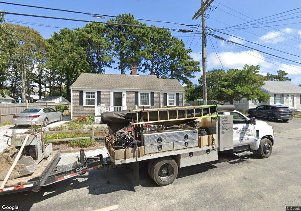
264 Shad Hole Rd Dennis Port, MA 02639
Dennis Port NeighborhoodEstimated Value: $513,000 - $592,230
3
Beds
1
Bath
1,001
Sq Ft
$556/Sq Ft
Est. Value
About This Home
This home is located at 264 Shad Hole Rd, Dennis Port, MA 02639 and is currently estimated at $556,808, approximately $556 per square foot. 264 Shad Hole Rd is a home located in Barnstable County with nearby schools including Dennis-Yarmouth Regional High School and St. Pius X. School.
Ownership History
Date
Name
Owned For
Owner Type
Purchase Details
Closed on
Jul 12, 1999
Sold by
Mccauley Helen M and Mccauley Patrick J
Bought by
Delvecchio Kimberly A
Current Estimated Value
Home Financials for this Owner
Home Financials are based on the most recent Mortgage that was taken out on this home.
Original Mortgage
$92,000
Outstanding Balance
$25,017
Interest Rate
7.19%
Mortgage Type
Purchase Money Mortgage
Estimated Equity
$531,791
Create a Home Valuation Report for This Property
The Home Valuation Report is an in-depth analysis detailing your home's value as well as a comparison with similar homes in the area
Home Values in the Area
Average Home Value in this Area
Purchase History
| Date | Buyer | Sale Price | Title Company |
|---|---|---|---|
| Delvecchio Kimberly A | $115,000 | -- |
Source: Public Records
Mortgage History
| Date | Status | Borrower | Loan Amount |
|---|---|---|---|
| Open | Delvecchio Kimberly A | $92,000 |
Source: Public Records
Tax History Compared to Growth
Tax History
| Year | Tax Paid | Tax Assessment Tax Assessment Total Assessment is a certain percentage of the fair market value that is determined by local assessors to be the total taxable value of land and additions on the property. | Land | Improvement |
|---|---|---|---|---|
| 2025 | $2,298 | $530,800 | $266,500 | $264,300 |
| 2024 | $2,133 | $485,800 | $256,300 | $229,500 |
| 2023 | $2,056 | $440,300 | $233,000 | $207,300 |
| 2022 | $1,877 | $335,200 | $183,700 | $151,500 |
| 2021 | $1,830 | $303,400 | $180,100 | $123,300 |
| 2020 | $6,912 | $291,900 | $180,100 | $111,800 |
| 2019 | $1,795 | $290,900 | $191,700 | $99,200 |
| 2018 | $6,309 | $273,700 | $182,500 | $91,200 |
| 2017 | $6,271 | $256,300 | $168,100 | $88,200 |
| 2016 | $1,527 | $233,800 | $158,500 | $75,300 |
| 2015 | $1,496 | $233,800 | $158,500 | $75,300 |
| 2014 | $1,424 | $224,200 | $148,900 | $75,300 |
Source: Public Records
Map
Nearby Homes
- 37-A Beach Hills Rd
- 37 Beach Hills Rd
- 22 Ferncliff Rd
- 262 Old Wharf Rd Unit 67
- 262 Old Wharf Rd Unit 5
- 262 Old Wharf Rd Unit 5
- 262 Old Wharf Rd Unit 20
- 262 Old Wharf Rd Unit 87
- 102 Sea St
- 241 Old Wharf Rd Unit 82
- 241 Old Wharf Rd Unit 127
- 241 Old Wharf Rd Unit 90
- 402 Old Wharf Rd
- 402 Old Wharf Rd
- 217 Old Wharf Rd Unit 64
- 405 Old Wharf Rd Unit B204
- 405 Old Wharf Rd Unit B204
- 31 Easy St
- 9 Chase Ave Unit 6
- 11 Ocean Park W
- 61 Ferncliff Rd
- 57 Ferncliff Rd
- 13 Maloney Ln
- 268 Shad Hole Rd
- 45 Beach Hills Rd
- 53 Ferncliff Rd
- 11 Maloney Ln
- 257 Shad Hole Rd
- 272 Shad Hole Rd
- 56 Ferncliff Rd
- 60 Ferncliff Rd
- 41 Beach Hills Rd
- 5 Poor Bob's Ln Unit 5A
- 49 Ferncliff Rd
- 20 Windwood Ln
- 39 Beach Hills Rd
- 14 Windwood Ln
- 274 Shad Hole Rd
- 44 Myrtle Rd
- 254 Shad Hole Rd