Estimated Value: $520,000 - $610,000
5
Beds
3
Baths
2,802
Sq Ft
$198/Sq Ft
Est. Value
About This Home
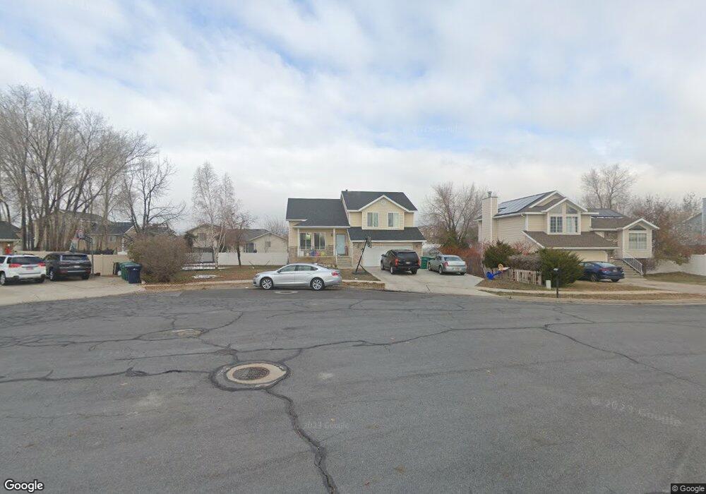
This home is located at 264 W 1650 N, Ogden, UT 84404 and is currently estimated at $555,473, approximately $198 per square foot. 264 W 1650 N is a home located in Weber County with nearby schools including Pioneer School, Orion Junior High School, and Weber High School.
Ownership History
Date
Name
Owned For
Owner Type
Purchase Details
Closed on
Oct 30, 2020
Sold by
Stock Ryan C
Bought by
Duarte Israel
Current Estimated Value
Home Financials for this Owner
Home Financials are based on the most recent Mortgage that was taken out on this home.
Original Mortgage
$300,400
Outstanding Balance
$267,313
Interest Rate
2.8%
Mortgage Type
New Conventional
Estimated Equity
$288,160
Purchase Details
Closed on
Sep 12, 2012
Sold by
Stock Crystal L
Bought by
Stock Ryan C
Home Financials for this Owner
Home Financials are based on the most recent Mortgage that was taken out on this home.
Original Mortgage
$177,244
Interest Rate
3.5%
Mortgage Type
FHA
Purchase Details
Closed on
Aug 19, 2002
Sold by
Palmer Wesley N and Palmer Hope M
Bought by
Stock Ryan C and Stock Crystal L
Home Financials for this Owner
Home Financials are based on the most recent Mortgage that was taken out on this home.
Original Mortgage
$152,840
Interest Rate
6.52%
Mortgage Type
FHA
Create a Home Valuation Report for This Property
The Home Valuation Report is an in-depth analysis detailing your home's value as well as a comparison with similar homes in the area
Home Values in the Area
Average Home Value in this Area
Purchase History
| Date | Buyer | Sale Price | Title Company |
|---|---|---|---|
| Duarte Israel | -- | Vanguard Title Ins Agcy | |
| Stock Ryan C | -- | First American Title Company | |
| Stock Ryan C | -- | Backman Stewart Title |
Source: Public Records
Mortgage History
| Date | Status | Borrower | Loan Amount |
|---|---|---|---|
| Open | Duarte Israel | $300,400 | |
| Previous Owner | Stock Ryan C | $177,244 | |
| Previous Owner | Stock Ryan C | $152,840 |
Source: Public Records
Tax History Compared to Growth
Tax History
| Year | Tax Paid | Tax Assessment Tax Assessment Total Assessment is a certain percentage of the fair market value that is determined by local assessors to be the total taxable value of land and additions on the property. | Land | Improvement |
|---|---|---|---|---|
| 2025 | $3,372 | $491,647 | $137,129 | $354,518 |
| 2024 | $3,320 | $265,649 | $75,420 | $190,229 |
| 2023 | $3,453 | $281,050 | $75,627 | $205,423 |
| 2022 | $3,322 | $276,101 | $64,686 | $211,415 |
| 2021 | $2,502 | $377,000 | $67,950 | $309,050 |
| 2020 | $2,247 | $311,000 | $53,512 | $257,488 |
| 2019 | $2,240 | $294,000 | $53,512 | $240,488 |
| 2018 | $2,097 | $262,000 | $46,631 | $215,369 |
| 2017 | $2,060 | $243,000 | $42,700 | $200,300 |
| 2016 | $1,841 | $116,297 | $22,015 | $94,282 |
| 2015 | $1,820 | $114,255 | $22,015 | $92,240 |
| 2014 | $1,702 | $104,047 | $22,015 | $82,032 |
Source: Public Records
Map
Nearby Homes
- 1743 N 400 W
- 178 W 1750 N
- 247 E 1825 N Unit 10
- 247 E 1825 N Unit 11
- 2458 N Highway 89 Hwy
- 1964 N 225 W
- 1953 N 275 W Unit 13
- 112 E 1475 N
- 1960 N 275 W Unit 29
- 108 W 1875 N
- 2440 U S Highway 89
- 1307 N 225 W
- 416 W 1925 N
- 247 E 1850 N Unit 5
- 1759 N 300 E Unit 128
- 315 E 1650 N Unit 129
- 265 E 1900 N
- 270 E 1825 N Unit 53
- 1196 N 375 W Unit 1
- Dearborn Plan at Ashlar Cove