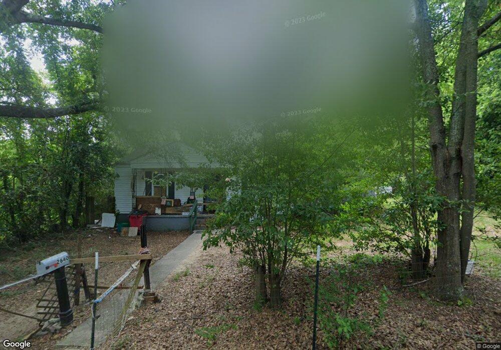
2640 Date Ave Macon, GA 31204
Napier Heights Historic District NeighborhoodEstimated Value: $70,000 - $83,000
3
Beds
2
Baths
1,410
Sq Ft
$53/Sq Ft
Est. Value
About This Home
This home is located at 2640 Date Ave, Macon, GA 31204 and is currently estimated at $74,124, approximately $52 per square foot. 2640 Date Ave is a home located in Bibb County with nearby schools including Brookdale Elementary School, Miller Fine Arts Magnet Middle School, and Central High School.
Ownership History
Date
Name
Owned For
Owner Type
Purchase Details
Closed on
Sep 19, 2017
Sold by
Oakstone Llc
Bought by
Pettiford Elizabeth
Current Estimated Value
Purchase Details
Closed on
Jul 20, 2017
Sold by
Mcelroy Myron J
Bought by
Oakstone Llc
Purchase Details
Closed on
Nov 3, 2016
Sold by
James M
Bought by
Mcelroy Myron J
Purchase Details
Closed on
Jan 21, 2014
Sold by
Sandra K West Properties Llc
Bought by
West James M
Purchase Details
Closed on
Aug 1, 2013
Sold by
Mcnair Conrad B
Bought by
Sandra K West Properties Llc
Purchase Details
Closed on
Mar 13, 1995
Sold by
Mcnair Conrad B
Bought by
Bank South N A
Purchase Details
Closed on
Dec 16, 1994
Sold by
Assoc Financial Services Of America Inc
Bought by
Mcnair Conrad B
Create a Home Valuation Report for This Property
The Home Valuation Report is an in-depth analysis detailing your home's value as well as a comparison with similar homes in the area
Home Values in the Area
Average Home Value in this Area
Purchase History
| Date | Buyer | Sale Price | Title Company |
|---|---|---|---|
| Pettiford Elizabeth | $36,500 | None Available | |
| Oakstone Llc | $8,500 | None Available | |
| Mcelroy Myron J | $1,000 | -- | |
| West James M | -- | None Available | |
| Sandra K West Properties Llc | $2,218 | None Available | |
| Bank South N A | -- | None Available | |
| Mcnair Conrad B | $16,000 | -- |
Source: Public Records
Tax History Compared to Growth
Tax History
| Year | Tax Paid | Tax Assessment Tax Assessment Total Assessment is a certain percentage of the fair market value that is determined by local assessors to be the total taxable value of land and additions on the property. | Land | Improvement |
|---|---|---|---|---|
| 2025 | $664 | $27,008 | $3,360 | $23,648 |
| 2024 | $686 | $27,008 | $3,360 | $23,648 |
| 2023 | $612 | $24,094 | $1,760 | $22,334 |
| 2022 | $397 | $11,464 | $2,653 | $8,811 |
| 2021 | $413 | $10,857 | $2,653 | $8,204 |
| 2020 | $398 | $10,249 | $2,653 | $7,596 |
| 2019 | $586 | $14,982 | $2,712 | $12,270 |
| 2018 | $1,055 | $15,800 | $2,712 | $13,088 |
| 2017 | $15 | $5,572 | $2,712 | $2,860 |
| 2016 | $225 | $6,516 | $2,712 | $3,804 |
| 2015 | $273 | $5,584 | $2,712 | $2,872 |
| 2014 | $105 | $5,584 | $2,712 | $2,872 |
Source: Public Records
Map
Nearby Homes
- 1285 Pio Nono Ave
- 1340 Courtland Ave
- 2534 Napier Ave
- 2485 Beech Ave
- 1148 Hillyer Ave
- 2686 Napier Ave
- 1518 Marigold Ave
- 2497 Napier Ave
- 1198 Winton Ave
- 1495 Ninadel Dr
- 2435 Napier Ave
- 1568 Marigold Ave
- 1181 Hendley St
- 2773 Beech Ave
- 2334 Napier Ave
- 1580 Marigold Ave
- 1198 Brentwood Ave
- 1195 Brentwood Ave
- 1171 Brentwood Ave
- 1485 Brentwood Ave
- 1307 Pio Nono Ave
- 1324 Courtland Ave
- 1295 Pio Nono Ave
- 1294 Courtland Ave
- 1356 Courtland Ave
- 1282 Courtland Ave
- 1277 Pio Nono Ave
- 2592 Date Ave
- 1370 Courtland Ave
- 1258 Courtland Ave
- 2587 Date Ave
- 1384 Courtland Ave
- 2584 Date Ave
- 1290 Pio Nono Ave
- 1247 Pio Nono Ave
- 1396 Courtland Ave
- 1331 Courtland Ave
- 1315 Courtland Ave
- 1343 Courtland Ave
- 1242 Courtland Ave