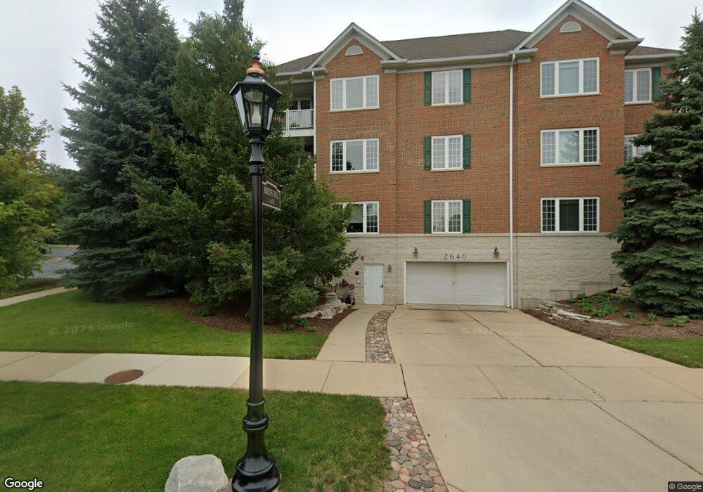
2640 Summit Dr Unit 501301 Glenview, IL 60025
Estimated Value: $451,000 - $472,000
2
Beds
--
Bath
60,000
Sq Ft
$8/Sq Ft
Est. Value
About This Home
This home is located at 2640 Summit Dr Unit 501301, Glenview, IL 60025 and is currently estimated at $463,617, approximately $7 per square foot. 2640 Summit Dr Unit 501301 is a home located in Cook County with nearby schools including Lyon Elementary School, Pleasant Ridge Elementary School, and Attea Middle School.
Ownership History
Date
Name
Owned For
Owner Type
Purchase Details
Closed on
Feb 2, 2025
Sold by
Sook Y Mang Trust and Mang Sook Y
Bought by
Irma I Nakachi Revocable Living Trust and Nakachi
Current Estimated Value
Purchase Details
Closed on
Oct 16, 2019
Sold by
Mang Sooky Y and The Sook Y Mang Trust
Bought by
Mang Sook Y and The Sook Y Mang Trust
Purchase Details
Closed on
Nov 30, 2012
Sold by
Mang Sook Y and Mang Unmi
Bought by
Mang Sook Y and Sook Y Mang Trust
Purchase Details
Closed on
Aug 6, 2003
Sold by
Halloran Carlotta E and Carlotta E Halloran Trust
Bought by
Mang Sook Y and Mang Unmi
Home Financials for this Owner
Home Financials are based on the most recent Mortgage that was taken out on this home.
Original Mortgage
$272,000
Interest Rate
5.12%
Mortgage Type
Purchase Money Mortgage
Purchase Details
Closed on
Dec 14, 1999
Sold by
Heatherfield Venture
Bought by
Oneil William J and Oneil Patricia A
Create a Home Valuation Report for This Property
The Home Valuation Report is an in-depth analysis detailing your home's value as well as a comparison with similar homes in the area
Home Values in the Area
Average Home Value in this Area
Purchase History
| Date | Buyer | Sale Price | Title Company |
|---|---|---|---|
| Irma I Nakachi Revocable Living Trust | $450,000 | Pro Title | |
| Mang Sook Y | -- | None Available | |
| Mang Sook Y | -- | None Available | |
| Mang Sook Y | $340,000 | Cti | |
| Oneil William J | $357,000 | -- |
Source: Public Records
Mortgage History
| Date | Status | Borrower | Loan Amount |
|---|---|---|---|
| Previous Owner | Mang Sook Y | $272,000 |
Source: Public Records
Tax History Compared to Growth
Tax History
| Year | Tax Paid | Tax Assessment Tax Assessment Total Assessment is a certain percentage of the fair market value that is determined by local assessors to be the total taxable value of land and additions on the property. | Land | Improvement |
|---|---|---|---|---|
| 2024 | $5,146 | $29,217 | $1,708 | $27,509 |
| 2023 | $4,960 | $29,217 | $1,708 | $27,509 |
| 2022 | $4,960 | $29,217 | $1,708 | $27,509 |
| 2021 | $5,071 | $26,370 | $819 | $25,551 |
| 2020 | $5,112 | $26,370 | $819 | $25,551 |
| 2019 | $4,758 | $28,983 | $819 | $28,164 |
| 2018 | $3,754 | $22,504 | $409 | $22,095 |
| 2017 | $5,038 | $22,504 | $409 | $22,095 |
| 2016 | $4,760 | $22,504 | $409 | $22,095 |
| 2015 | $5,327 | $22,371 | $580 | $21,791 |
| 2014 | $5,230 | $22,371 | $580 | $21,791 |
| 2013 | $3,623 | $22,371 | $580 | $21,791 |
Source: Public Records
Map
Nearby Homes
- 2688 Summit Dr
- 2700 Summit Dr Unit 101
- 804 8th St
- 1300 W Branch Rd
- 2430 Dorina Dr
- 1833 Wildberry Dr Unit E
- 455 Sunset Ridge Rd
- 955 Kensington Dr Unit 8B1
- 2101 Valley lo Ln
- 2301 Clover Ln
- 970 Kensington Dr Unit 16B2
- 1410 Tuscany Ct
- 2202 Martin Ln
- 2220 Founders Dr Unit 116
- 2220 Founders Dr Unit P102
- 2220 Founders Dr Unit 316
- 2220 Founders Dr Unit 227
- 2220 Founders Dr Unit 215
- 2220 Founders Dr Unit 323
- 2220 Founders Dr Unit 314
- 2640 Summit Dr Unit 207
- 2640 Summit Dr
- 2640 Summit Dr Unit 501105
- 2640 Summit Dr Unit 501106
- 2640 Summit Dr Unit 501206
- 2640 Summit Dr Unit 501107
- 2640 Summit Dr Unit 501101
- 2640 Summit Dr Unit 501305
- 2640 Summit Dr Unit 501303
- 2640 Summit Dr Unit 501109
- 2640 Summit Dr Unit 501204
- 2640 Summit Dr Unit 501310
- 2640 Summit Dr Unit 501104
- 2640 Summit Dr Unit 501304
- 2640 Summit Dr Unit 501309
- 2640 Summit Dr Unit 501308
- 2640 Summit Dr Unit 501307
- 2640 Summit Dr Unit 501302
- 2640 Summit Dr Unit 501205
- 2640 Summit Dr Unit 501210