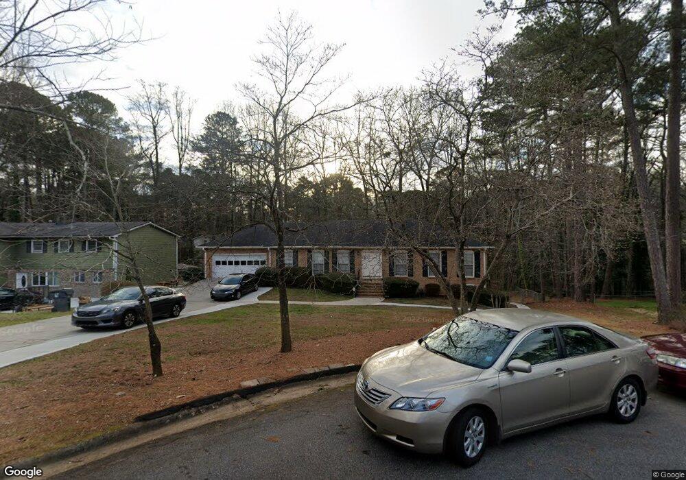
2641 Michael Cir Duluth, GA 30096
Estimated Value: $426,788 - $459,000
5
Beds
4
Baths
2,604
Sq Ft
$169/Sq Ft
Est. Value
About This Home
This home is located at 2641 Michael Cir, Duluth, GA 30096 and is currently estimated at $441,197, approximately $169 per square foot. 2641 Michael Cir is a home located in Gwinnett County with nearby schools including B.B. Harris Elementary School, Duluth Middle School, and Duluth High School.
Ownership History
Date
Name
Owned For
Owner Type
Purchase Details
Closed on
Jun 23, 2020
Sold by
Woo Sin Joo
Bought by
Woo Je Dong and Kim Sin Joo
Current Estimated Value
Purchase Details
Closed on
Aug 15, 2012
Sold by
Koo Yang Son
Bought by
Woo Sin Joo
Home Financials for this Owner
Home Financials are based on the most recent Mortgage that was taken out on this home.
Original Mortgage
$86,615
Interest Rate
3.58%
Mortgage Type
New Conventional
Purchase Details
Closed on
Oct 19, 2007
Sold by
Waldrop Dwight D
Bought by
Koo Yang S
Home Financials for this Owner
Home Financials are based on the most recent Mortgage that was taken out on this home.
Original Mortgage
$179,100
Interest Rate
6.26%
Mortgage Type
New Conventional
Create a Home Valuation Report for This Property
The Home Valuation Report is an in-depth analysis detailing your home's value as well as a comparison with similar homes in the area
Home Values in the Area
Average Home Value in this Area
Purchase History
| Date | Buyer | Sale Price | Title Company |
|---|---|---|---|
| Woo Je Dong | -- | -- | |
| Woo Sin Joo | $101,900 | -- | |
| Koo Yang S | $199,000 | -- | |
| Waldrop Dwight D | -- | -- |
Source: Public Records
Mortgage History
| Date | Status | Borrower | Loan Amount |
|---|---|---|---|
| Previous Owner | Woo Sin Joo | $86,615 | |
| Previous Owner | Waldrop Dwight D | $179,100 |
Source: Public Records
Tax History
| Year | Tax Paid | Tax Assessment Tax Assessment Total Assessment is a certain percentage of the fair market value that is determined by local assessors to be the total taxable value of land and additions on the property. | Land | Improvement |
|---|---|---|---|---|
| 2025 | $6,705 | $179,240 | $29,920 | $149,320 |
| 2024 | $6,239 | $164,760 | $28,800 | $135,960 |
| 2023 | $6,239 | $153,200 | $22,000 | $131,200 |
| 2022 | $5,795 | $153,200 | $22,000 | $131,200 |
| 2021 | $4,174 | $105,880 | $16,000 | $89,880 |
| 2020 | $4,198 | $105,880 | $16,000 | $89,880 |
| 2019 | $2,842 | $100,080 | $14,800 | $85,280 |
| 2018 | $2,515 | $84,920 | $14,800 | $70,120 |
| 2016 | $2,191 | $68,840 | $12,000 | $56,840 |
| 2015 | $1,988 | $58,960 | $8,000 | $50,960 |
| 2014 | $1,996 | $58,960 | $8,000 | $50,960 |
Source: Public Records
Map
Nearby Homes
- 2702 Davenport Rd
- 3576 Randy Place
- 2648 Irene Cir
- 3412 Davenport Park Ln
- 3493 Citrus Dr
- 3215 Oxwell Dr Unit 1B
- 3125 Oxwell Dr Unit IB
- 3053 Hartright Bend Ct
- 3049 Hartright Bend Ct
- 2830 Meadow Lark Trail
- 2829 Cardinal Trace
- 2816 Cardinal Lake Cir NW
- 3518 Tracey Dr
- 2535 Rhoanoke Dr
- 3695 Woodberry Dr
- 2961 Creek Dr
- 3593 Gainesway Ct
- 2869 Winchester Ct
- 2509 Village Park Bend
- 2590 Village Place Dr
- 2641 Michael Cir NW
- 2631 Michael Cir NW
- 2631 Michael Cir
- 2651 Michael Cir
- 5122 Micae Way
- 2634 Davenport Rd
- 2624 Davenport Rd
- 2621 Michael Cir
- 2654 Davenport Rd
- 2614 Davenport Rd
- 2660 Michael Cir
- 2650 Michael Cir NW
- 2674 Davenport Rd
- 2640 Michael Cir
- 2630 Michael Cir
- 2650 Michael Cir
- 2601 Michael Cir
- 3495 Hill Dr Unit 2
- 3495 Hill Dr
- 2620 Michael Cir
Your Personal Tour Guide
Ask me questions while you tour the home.