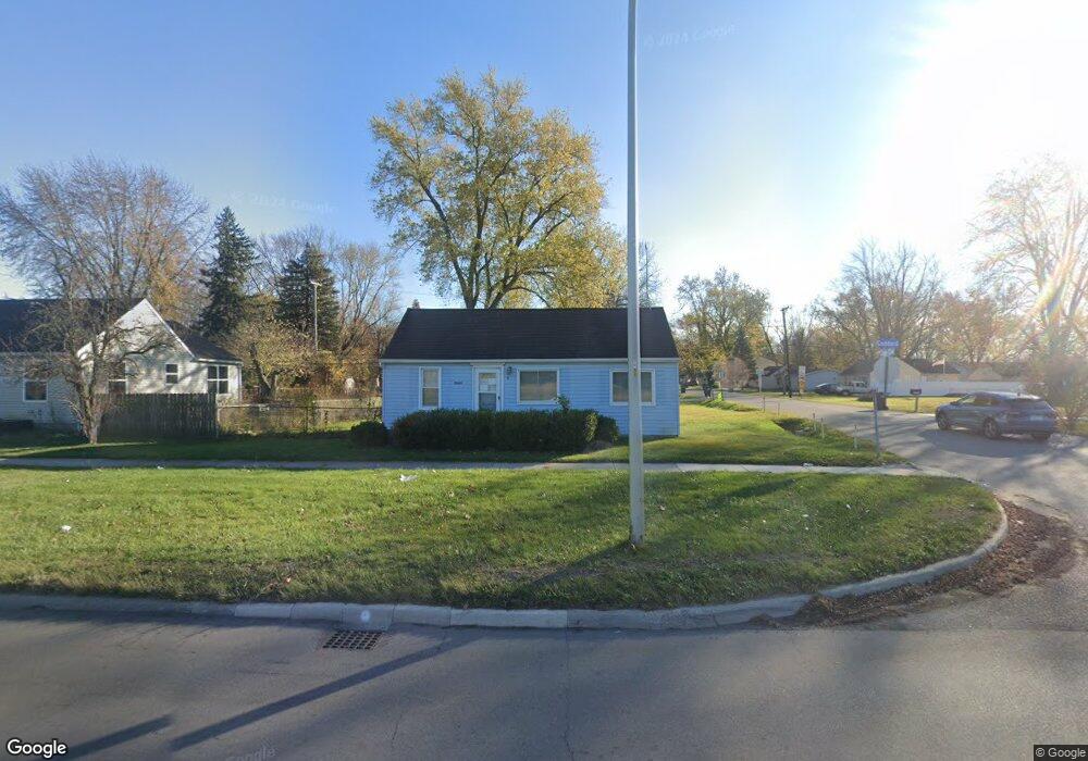
26415 Goddard Rd Taylor, MI 48180
Estimated Value: $180,000 - $200,000
2
Beds
1
Bath
1,080
Sq Ft
$172/Sq Ft
Est. Value
About This Home
This home is located at 26415 Goddard Rd, Taylor, MI 48180 and is currently estimated at $185,929, approximately $172 per square foot. 26415 Goddard Rd is a home located in Wayne County with nearby schools including Holland Elementary School, Hoover Middle School, and Taylor High School.
Ownership History
Date
Name
Owned For
Owner Type
Purchase Details
Closed on
Dec 14, 2013
Sold by
Saucier James and Saucier Cassandra
Bought by
Armstrong Shanon L
Current Estimated Value
Purchase Details
Closed on
Oct 24, 2008
Sold by
Federal National Mortgage Association
Bought by
Saucier James
Purchase Details
Closed on
Sep 28, 2007
Sold by
Jpmorgan Chase Bank Na
Bought by
Federal National Mortgage Association
Purchase Details
Closed on
Sep 19, 2007
Sold by
Wiper William E
Bought by
Jpmorgan Chase Bank Na
Create a Home Valuation Report for This Property
The Home Valuation Report is an in-depth analysis detailing your home's value as well as a comparison with similar homes in the area
Home Values in the Area
Average Home Value in this Area
Purchase History
| Date | Buyer | Sale Price | Title Company |
|---|---|---|---|
| Armstrong Shanon L | $25,040 | None Available | |
| Saucier James | $9,000 | Warranty Title Agency Llc | |
| Federal National Mortgage Association | -- | None Available | |
| Jpmorgan Chase Bank Na | $87,769 | None Available |
Source: Public Records
Tax History Compared to Growth
Tax History
| Year | Tax Paid | Tax Assessment Tax Assessment Total Assessment is a certain percentage of the fair market value that is determined by local assessors to be the total taxable value of land and additions on the property. | Land | Improvement |
|---|---|---|---|---|
| 2025 | $1,600 | $82,900 | $0 | $0 |
| 2024 | $1,600 | $73,000 | $0 | $0 |
| 2023 | $1,886 | $64,700 | $0 | $0 |
| 2022 | $1,461 | $56,000 | $0 | $0 |
| 2021 | $1,765 | $53,400 | $0 | $0 |
| 2020 | $1,751 | $49,700 | $0 | $0 |
| 2019 | $201,830 | $49,900 | $0 | $0 |
| 2018 | $1,255 | $36,500 | $0 | $0 |
| 2017 | $807 | $32,200 | $0 | $0 |
| 2016 | $2,360 | $31,300 | $0 | $0 |
| 2015 | $2,835 | $36,200 | $0 | $0 |
| 2013 | $2,820 | $29,100 | $0 | $0 |
| 2012 | $1,820 | $28,800 | $12,300 | $16,500 |
Source: Public Records
Map
Nearby Homes
- 11098 Partridge Dr Unit 12
- 11098 Partridge Dr
- Bayberry Plan at Cypress Garden
- Bannister Plan at Cypress Garden
- Cypress Plan at Cypress Garden
- Evanston IV Plan at Cypress Garden
- Cedar III Plan at Cypress Garden
- Aspen Plan at Cypress Garden
- Evanston III Plan at Cypress Garden
- Cedar IV Plan at Cypress Garden
- 11737 Partridge Dr Unit 70
- 11825 Partridge Dr Unit 74
- 11847 Partridge Dr Unit 75
- 11715 Partridge Dr Unit 69
- 0 Goddard Unit 20251010304
- 11693 Partridge Dr Unit 38
- 11693 Partridge Dr
- 25873 Cove Creek Dr Unit 7
- 25822 Cove Creek Dr
- 11081 Coventry Ct Unit 31
- 26395 Goddard Rd
- 26445 Goddard Rd
- 11071 Cape Cod St
- 26375 Goddard Rd
- 26375 Goddard Rd
- 26465 Goddard Rd
- 11080 Cape Cod St
- 11093 Cape Cod St
- 26335 Goddard Rd
- 26485 Goddard Rd
- 11125 Cape Cod St
- 26505 Goddard Rd
- 11100 Cape Cod St
- 11141 Cape Cod St
- 26525 Goddard Rd
- 11163 Cape Cod St
- 11154 Cape Cod St
- 26541 Goddard Rd
- 11171 Cape Cod St
- 11168 Cape Cod St