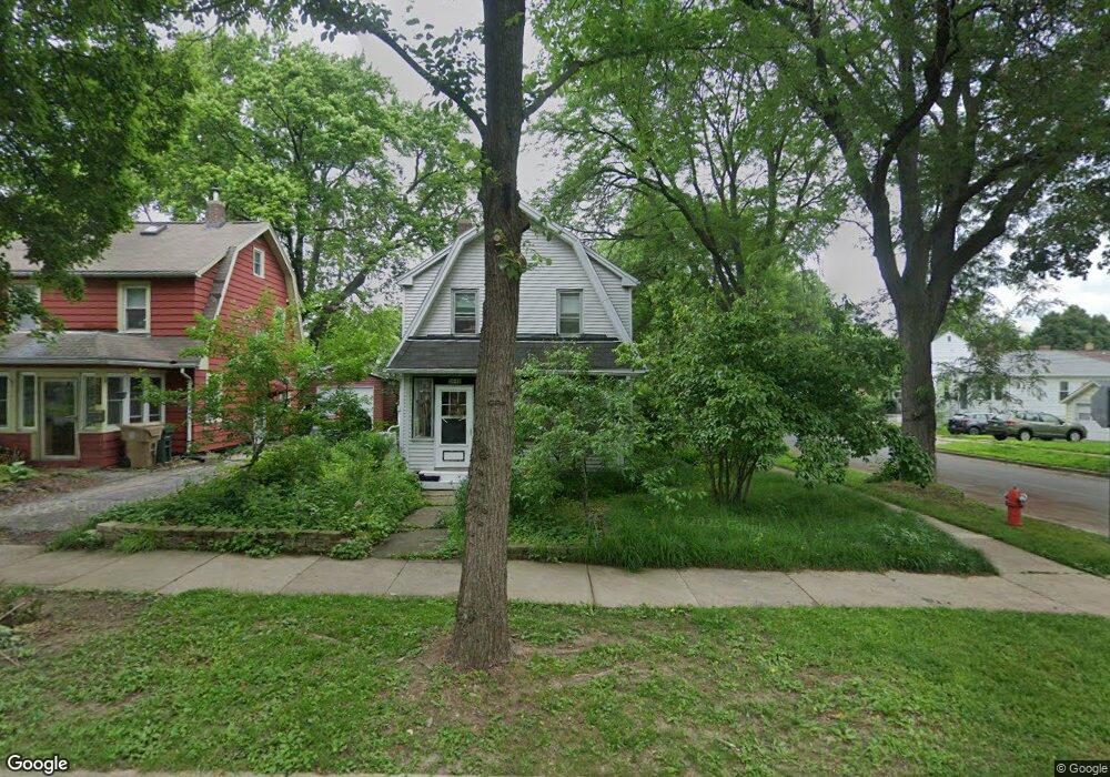
2642 Hoard St Madison, WI 53704
Eken Park NeighborhoodEstimated Value: $380,122 - $399,000
3
Beds
2
Baths
1,152
Sq Ft
$338/Sq Ft
Est. Value
About This Home
This home is located at 2642 Hoard St, Madison, WI 53704 and is currently estimated at $389,031, approximately $337 per square foot. 2642 Hoard St is a home located in Dane County with nearby schools including Emerson Elementary School, Sherman Middle School, and East High School.
Ownership History
Date
Name
Owned For
Owner Type
Purchase Details
Closed on
Dec 20, 2005
Sold by
Bond Lamberty Benjamin and Bond Lamberty Monica C
Bought by
Rhodes Conway Satya V
Current Estimated Value
Home Financials for this Owner
Home Financials are based on the most recent Mortgage that was taken out on this home.
Original Mortgage
$53,708
Outstanding Balance
$30,246
Interest Rate
6.4%
Mortgage Type
New Conventional
Estimated Equity
$358,785
Create a Home Valuation Report for This Property
The Home Valuation Report is an in-depth analysis detailing your home's value as well as a comparison with similar homes in the area
Home Values in the Area
Average Home Value in this Area
Purchase History
| Date | Buyer | Sale Price | Title Company |
|---|---|---|---|
| Rhodes Conway Satya V | $173,700 | None Available |
Source: Public Records
Mortgage History
| Date | Status | Borrower | Loan Amount |
|---|---|---|---|
| Open | Rhodes Conway Satya V | $53,708 |
Source: Public Records
Tax History Compared to Growth
Tax History
| Year | Tax Paid | Tax Assessment Tax Assessment Total Assessment is a certain percentage of the fair market value that is determined by local assessors to be the total taxable value of land and additions on the property. | Land | Improvement |
|---|---|---|---|---|
| 2024 | $11,453 | $343,400 | $62,000 | $281,400 |
| 2023 | $5,449 | $320,900 | $57,900 | $263,000 |
| 2021 | $4,786 | $240,700 | $43,400 | $197,300 |
| 2020 | $4,830 | $227,100 | $40,900 | $186,200 |
| 2019 | $4,629 | $218,400 | $39,300 | $179,100 |
| 2018 | $4,418 | $208,000 | $39,300 | $168,700 |
| 2017 | $4,206 | $189,600 | $36,700 | $152,900 |
| 2016 | $3,828 | $169,300 | $36,700 | $132,600 |
| 2015 | $3,625 | $158,200 | $32,400 | $125,800 |
| 2014 | $3,624 | $158,200 | $32,400 | $125,800 |
| 2013 | $3,738 | $158,200 | $32,400 | $125,800 |
Source: Public Records
Map
Nearby Homes
- 2502 E Mifflin St
- 2702 Coolidge St
- 322 N 6th St
- 2313 Myrtle St
- 2334 E Mifflin St
- 914 N Oak St
- 21 Wirth Ct
- 110 N 5th St
- 174 Talmadge St
- 2146 Winnebago St
- 2332 Superior St
- 206 Dixon St
- 241 Waubesa St
- 10 Roxbury Rd
- 280 Division St Unit 102
- 2005 E Mifflin St
- 2314 Sommers Ave
- 2118 Atwood Ave
- 21 S 2nd St Unit 1
- 706 Powers Ave
- 2638 Hoard St
- 510 Stang St
- 2634 Hoard St
- 501 Stang St
- 2630 Hoard St
- 509 Stang St
- 514 Stang St Unit 1
- 2650 Hoard St
- 2541 Fairfield Place
- 422 Stang St
- 511 Stang St
- 2637 Hoard St
- 2539 Fairfield Place Unit 2
- 2633 Hoard St Unit 1
- 501 Maywood St
- 2654 Hoard St
- 2629 Hoard St
- 513 Stang St
- 2533 Fairfield Place Unit 1
- 2603 Fairfield Place