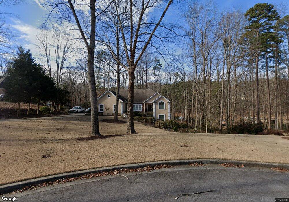
2642 Ridgehurst Dr Buford, GA 30518
Estimated Value: $616,000 - $838,000
5
Beds
3
Baths
2,336
Sq Ft
$298/Sq Ft
Est. Value
About This Home
This home is located at 2642 Ridgehurst Dr, Buford, GA 30518 and is currently estimated at $695,748, approximately $297 per square foot. 2642 Ridgehurst Dr is a home located in Hall County with nearby schools including Friendship Elementary School, C.W. Davis Middle School, and Flowery Branch High School.
Ownership History
Date
Name
Owned For
Owner Type
Purchase Details
Closed on
Oct 15, 2010
Sold by
Stricklin Kenneth S
Bought by
Wright Carl D and Wright Lori L
Current Estimated Value
Home Financials for this Owner
Home Financials are based on the most recent Mortgage that was taken out on this home.
Original Mortgage
$150,000
Outstanding Balance
$98,409
Interest Rate
4.39%
Mortgage Type
New Conventional
Estimated Equity
$597,339
Purchase Details
Closed on
Apr 28, 2005
Sold by
Kubiak Clare Heather
Bought by
Stricklin Kenneth R S
Home Financials for this Owner
Home Financials are based on the most recent Mortgage that was taken out on this home.
Original Mortgage
$548,000
Interest Rate
5.99%
Mortgage Type
New Conventional
Purchase Details
Closed on
Feb 21, 1994
Sold by
Kubiak John Chester
Bought by
Kubiak Clare Heather
Purchase Details
Closed on
Feb 1, 1994
Create a Home Valuation Report for This Property
The Home Valuation Report is an in-depth analysis detailing your home's value as well as a comparison with similar homes in the area
Home Values in the Area
Average Home Value in this Area
Purchase History
| Date | Buyer | Sale Price | Title Company |
|---|---|---|---|
| Wright Carl D | $340,000 | -- | |
| Stricklin Kenneth R S | $685,000 | -- | |
| Kubiak Clare Heather | -- | -- | |
| -- | $140,000 | -- |
Source: Public Records
Mortgage History
| Date | Status | Borrower | Loan Amount |
|---|---|---|---|
| Open | Wright Carl D | $150,000 | |
| Previous Owner | Stricklin Kenneth R S | $548,000 |
Source: Public Records
Tax History Compared to Growth
Tax History
| Year | Tax Paid | Tax Assessment Tax Assessment Total Assessment is a certain percentage of the fair market value that is determined by local assessors to be the total taxable value of land and additions on the property. | Land | Improvement |
|---|---|---|---|---|
| 2025 | $1,761 | $253,880 | $71,400 | $182,480 |
| 2024 | $2,124 | $247,920 | $70,760 | $177,160 |
| 2023 | $1,680 | $207,040 | $70,760 | $136,280 |
| 2022 | $1,757 | $186,920 | $70,760 | $116,160 |
| 2021 | $1,833 | $185,280 | $70,760 | $114,520 |
| 2020 | $4,974 | $181,040 | $70,760 | $110,280 |
| 2019 | $4,890 | $176,600 | $70,760 | $105,840 |
| 2018 | $4,744 | $165,640 | $64,920 | $100,720 |
| 2017 | $4,537 | $159,960 | $64,920 | $95,040 |
| 2016 | $4,430 | $159,960 | $64,920 | $95,040 |
| 2015 | $4,519 | $159,960 | $64,920 | $95,040 |
| 2014 | $4,519 | $159,960 | $64,920 | $95,040 |
Source: Public Records
Map
Nearby Homes
- 5775 Lakeshore Dr
- 5904 Basswood Cove
- 6030 Chimney Springs Rd
- 5697 Frontier Walk Ln
- 2482 Windchase Ct
- 2416 Sterling Manor Dr
- 5832 Bay View Dr
- 2610 Buford Dam Rd
- 6708 Bass Cir
- 5995 Lake Windsor Pkwy Unit 1
- 5862 Bay View Dr
- 6386 Tuggle Dr
- 5885 Bay View Dr
- 5571 Shadburn Ferry Rd
- 5926 Mount Water Trail
- 5574 Lanier Islands Pkwy
- 6558 Lanier Islands Pkwy
- 6228 Lanier Harbor Landing
- 6265 Lake Windsor Pkwy
- 5537 N Richland Creek Rd
- 2638 Ridgehurst Dr
- 2646 Ridgehurst Dr
- 2634 Ridgehurst Dr Unit 37
- 2634 Ridgehurst Dr
- 2639 Ridgehurst Dr
- 2630 Ridgehurst Dr
- 2635 Ridgehurst Dr
- 2645 Ridgehurst Dr
- 2626 Ridgehurst Dr
- 2706 Windrush Dr
- 2723 Brookhaven Ln
- 2629 Ridgehurst Dr
- 2622 Ridgehurst Dr
- 2727 Brookhaven Ln
- 2719 Brookhaven Ln
- 2618 Ridgehurst Dr
- 2705 Windrush Dr
- 2603 Wendover Ct
- 2716 Windrush Dr
- 2731 Brookhaven Ln