2643 Laurel Park Rd Clarksburg, WV 26301
Estimated payment $350/month
Highlights
- No HOA
- Home fronts a stream
- Level Lot
- Neighborhood Views
- Partially Fenced Property
About This Lot
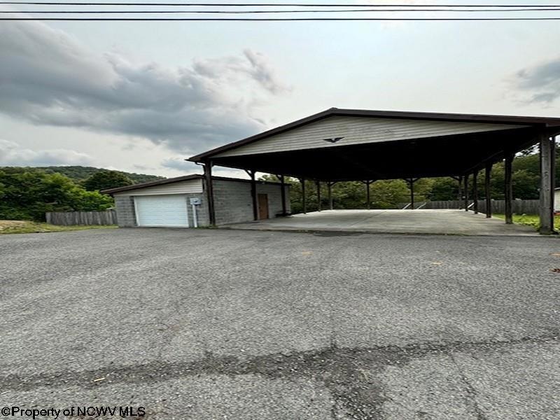
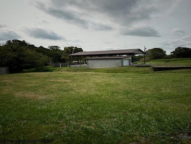
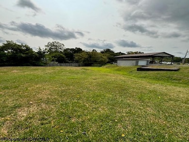
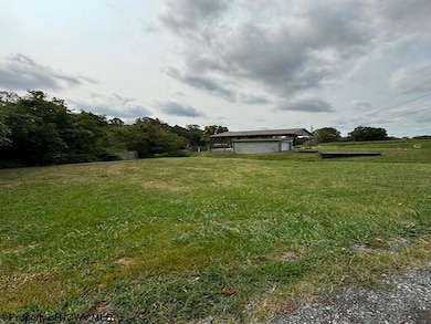
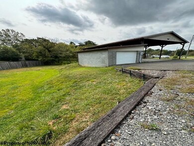
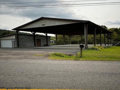
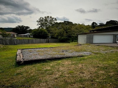
A third of an acre with city utilities available. Great for a new residence or part time parking spot for your RV when visiting West Virginia. 12 X 24 garage that has bathroom and laundry facilities. 30 X 50 concreted pavilion with 2 RV Hookups. 200 Amp service with underground electric to the pole. Possible VRBO for campers or other RVer's. So many possibilities.
Property Details
Property Type
- Land
Est. Annual Taxes
- $213
Lot Details
- 0.33 Acre Lot
- Home fronts a stream
- Partially Fenced Property
- Level Lot
- 2 Lots in the community
- Property is zoned General Residential, General Residential
Schools
- West Milford Elementary School
- South Harrison Middle School
- South Harrison High School
Additional Features
- Neighborhood Views
- Underground Utilities
Community Details
- No Home Owners Association
Listing and Financial Details
- Assessor Parcel Number 41.1
Map
Home Values in the Area
Average Home Value in this Area
Tax History
| Year | Tax Paid | Tax Assessment Tax Assessment Total Assessment is a certain percentage of the fair market value that is determined by local assessors to be the total taxable value of land and additions on the property. | Land | Improvement |
|---|---|---|---|---|
| 2025 | $206 | $17,700 | $7,980 | $9,720 |
| 2024 | $206 | $18,120 | $7,980 | $10,140 |
| 2023 | $208 | $17,280 | $7,980 | $9,300 |
| 2022 | $202 | $17,160 | $7,980 | $9,180 |
| 2021 | $204 | $17,520 | $7,980 | $9,540 |
| 2020 | $201 | $17,400 | $7,980 | $9,420 |
| 2019 | $200 | $17,340 | $7,980 | $9,360 |
| 2018 | $214 | $18,600 | $7,980 | $10,620 |
| 2017 | $203 | $17,760 | $7,320 | $10,440 |
| 2016 | $186 | $16,500 | $6,300 | $10,200 |
| 2015 | $147 | $12,900 | $4,680 | $8,220 |
| 2014 | $145 | $12,780 | $4,680 | $8,100 |
Property History
| Date | Event | Price | List to Sale | Price per Sq Ft |
|---|---|---|---|---|
| 09/05/2025 09/05/25 | For Sale | $63,000 | -- | -- |
Source: North Central West Virginia REIN
MLS Number: 10161443
APN: 20-386A-00410001
Disclaimer: Certain information contained herein is derived from information provided by parties other than Homes.com. All information provided is deemed reliable, but is not guaranteed to be accurate and should be independently verified.
![]() Data provided by North Central WV Real Estate Information Network, Inc.
Data provided by North Central WV Real Estate Information Network, Inc.
IDX information is provided exclusively for consumers’ personal non-commercial use and may not be used for any purpose other than to identify prospective properties consumers may be interested in purchasing.
- 5178 Maple St
- TBA Maple Ave
- 46 Forest Hills Dr
- 106 Mary Ann St
- 4184 Mount Clare Rd
- 163 Hutchinson Hollow Rd
- 534 Morning Dove Dr
- 1100 Country Club Rd
- 32 Saint James Dr
- 280 Brighton Circle Rd
- 17 Hampton Dr
- TBD Saint James Dr
- 482 County Route 25 27
- TBD Doll Run Rd
- 82 Robinwood Dr
- TBD Deer Haven Dr
- TBD Hidden Valley Rd
- 2189 Chub Run Rd
- TBD Owagner Ln
- 8756 Good Hope Pike
- 8193 Cost Ave
- 417 Indiana Ave
- 620 W Pike St
- 437 Smithfield St
- 700 Lodgeville Rd
- 1011 Woodland Dr
- 33 Millbrook Rd
- 119 Hill St
- 50 Dover Ct
- 117 Sassafras Way
- 3618 Shinnston Pike
- 70 Dover Ct Unit 70 Dover Court
- 45 Dover Ct
- 45 Dover Ct
- 50 Stone Ln
- 54 Barrington Ct
- 54 Barrington Ct Unit 54 Barrington Ct #103
- 33 Lincoln Dr
- 102 Bloomfield Ln
- 102 Bloomfield Dr
