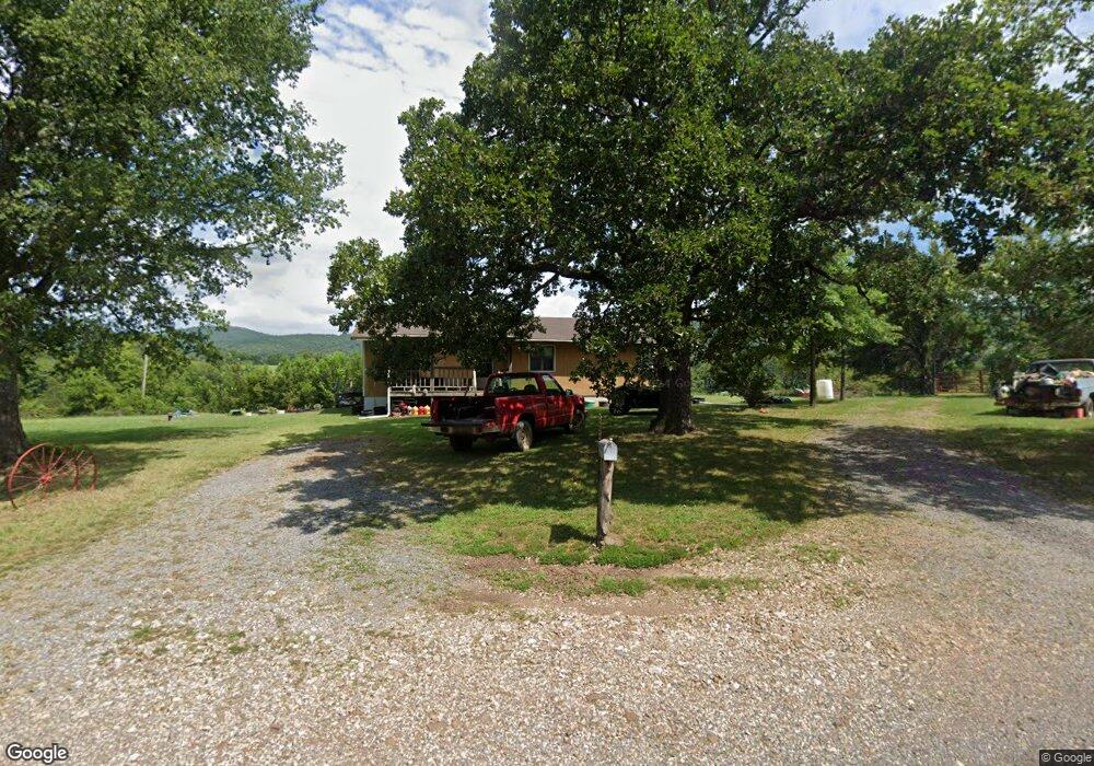
2644 Marsena Rd Marshall, AR 72650
Estimated Value: $196,000 - $318,000
Studio
2
Baths
1,456
Sq Ft
$171/Sq Ft
Est. Value
About This Home
This home is located at 2644 Marsena Rd, Marshall, AR 72650 and is currently estimated at $249,489, approximately $171 per square foot. 2644 Marsena Rd is a home located in Searcy County with nearby schools including Marshall Elementary School, Leslie Elementary School, and Marshall High School.
Ownership History
Date
Name
Owned For
Owner Type
Purchase Details
Closed on
Nov 18, 2025
Sold by
Mcdaniel Charles and Mcdaniel Patricia
Bought by
Bobby Wayne Sanders Irrevocable Trust and Mcdaniel
Current Estimated Value
Purchase Details
Closed on
Oct 27, 2000
Bought by
Sanders Catherine Mcdaniel Famil and Sanders Trust
Purchase Details
Closed on
Oct 16, 2000
Bought by
Mcdaniel Herbert & Sanders Trust
Purchase Details
Closed on
Sep 20, 2000
Bought by
Mcdaniel and Mcdaniel Mcdaniel
Purchase Details
Closed on
Apr 14, 1999
Bought by
Mcdaniel H & Sanders Trust Blair and Estate Johnnie C
Purchase Details
Closed on
Mar 1, 1999
Bought by
Mcdaniel H & Sanders Trust Blair and Estate Johnnie C
Purchase Details
Closed on
Jan 7, 1999
Bought by
Mcdaniel H & Sanders Trust Blair and Estate Johnnie C
Purchase Details
Closed on
Sep 28, 1998
Bought by
Mcdaniel Taft Estate and Mcdaniel Blair,
Purchase Details
Closed on
Sep 8, 1998
Bought by
Mcdaniel Taft Estate and Mcdaniel Blair,
Purchase Details
Closed on
Sep 2, 1998
Bought by
Mcdaniel Taft Estate and Mcdaniel Blair,
Create a Home Valuation Report for This Property
The Home Valuation Report is an in-depth analysis detailing your home's value as well as a comparison with similar homes in the area
Purchase History
| Date | Buyer | Sale Price | Title Company |
|---|---|---|---|
| Bobby Wayne Sanders Irrevocable Trust | -- | None Listed On Document | |
| Mcdaniel Charles | -- | None Listed On Document | |
| Sanders Bobby | -- | None Listed On Document | |
| Sanders Catherine Mcdaniel Famil | -- | -- | |
| Mcdaniel Herbert & Sanders Trust | -- | -- | |
| Mcdaniel Herbert & Sanders Trust | $53,000 | -- | |
| Mcdaniel | -- | -- | |
| Mcdaniel H & Sanders Trust Blair | -- | -- | |
| Mcdaniel H & Sanders Trust Blair | -- | -- | |
| Mcdaniel H & Sanders Trust Blair | -- | -- | |
| Mcdaniel H & Sanders Trust Blair | -- | -- | |
| Mcdaniel Taft Estate | -- | -- | |
| Mcdaniel Taft Estate | -- | -- | |
| Mcdaniel Taft Estate | -- | -- |
Source: Public Records
Tax History
| Year | Tax Paid | Tax Assessment Tax Assessment Total Assessment is a certain percentage of the fair market value that is determined by local assessors to be the total taxable value of land and additions on the property. | Land | Improvement |
|---|---|---|---|---|
| 2025 | $173 | $18,380 | $3,380 | $15,000 |
| 2024 | $173 | $18,380 | $3,380 | $15,000 |
| 2023 | $248 | $18,380 | $3,380 | $15,000 |
| 2022 | $298 | $18,380 | $3,380 | $15,000 |
| 2021 | $291 | $13,950 | $2,990 | $10,960 |
| 2020 | $291 | $13,950 | $2,990 | $10,960 |
| 2019 | $309 | $13,950 | $2,990 | $10,960 |
| 2018 | $334 | $13,950 | $2,990 | $10,960 |
| 2017 | $313 | $13,750 | $2,790 | $10,960 |
| 2016 | $289 | $13,750 | $2,790 | $10,960 |
| 2014 | $244 | $13,930 | $2,790 | $11,140 |
Source: Public Records
Map
Nearby Homes
- 0 Lick Fork Rd Unit 25036132
- 0 Lick Fork Rd Unit LotWP001 24664164
- 0 Marsena Rd Unit 26004499
- 0 Marsena Rd Unit 26004502
- 0 Marsena Rd Unit West
- 0 Marsena Rd Unit East
- 000 W Crow Dr Hills
- 0 Punkin Flat Rd Unit 25022106
- 0 Punkin Flat Rd Unit 23772165
- 1141 Wafted Lane Tract 3
- 1141
- 1141 Wafted Lane Tract 4
- 1141 Wafted Lane Tract 1
- 278 Quadrant Dr
- 7811 Victory Ln
- 2462 Hilltop Rd
- 17640 S Highway 27
- 150 Jack Frost Dr
- 40.12 Acres Landlock Rd
- TBD Lick Fork Rd
Your Personal Tour Guide
Ask me questions while you tour the home.