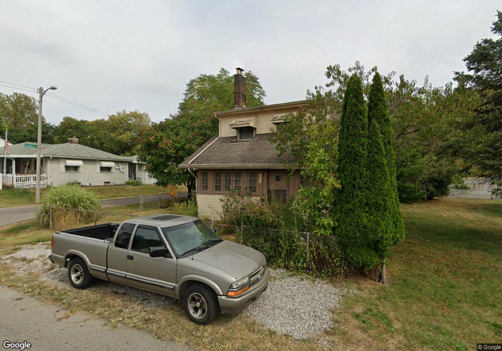
2644 Thorndale Ave Columbus, OH 43207
Obetz-Lockbourne NeighborhoodEstimated Value: $208,579 - $225,000
3
Beds
2
Baths
1,401
Sq Ft
$153/Sq Ft
Est. Value
About This Home
This home is located at 2644 Thorndale Ave, Columbus, OH 43207 and is currently estimated at $214,895, approximately $153 per square foot. 2644 Thorndale Ave is a home located in Franklin County with nearby schools including Parsons Elementary School, Buckeye Middle School, and Marion-Franklin High School.
Ownership History
Date
Name
Owned For
Owner Type
Purchase Details
Closed on
Mar 18, 2015
Sold by
Dale Dennis Arthur D and Dale Dennis
Bought by
Ocwen Loan Servicing Llc
Current Estimated Value
Purchase Details
Closed on
May 10, 2010
Sold by
World Alliance Financial Corp
Bought by
Repicz Rosa
Purchase Details
Closed on
Jul 30, 2009
Sold by
Morrison Heather J and Peralta Pedro Moreno
Bought by
Worl Alliance Financial Corp
Purchase Details
Closed on
Jan 18, 2007
Sold by
Dodd Norman R
Bought by
Dodd Norman R and Morrison Heather J
Purchase Details
Closed on
Jul 24, 1978
Bought by
Dodd May E
Create a Home Valuation Report for This Property
The Home Valuation Report is an in-depth analysis detailing your home's value as well as a comparison with similar homes in the area
Home Values in the Area
Average Home Value in this Area
Purchase History
| Date | Buyer | Sale Price | Title Company |
|---|---|---|---|
| Ocwen Loan Servicing Llc | $38,100 | None Available | |
| Repicz Rosa | $24,000 | Fati | |
| Worl Alliance Financial Corp | -- | None Available | |
| Dodd Norman R | -- | Attorney | |
| Dodd Norman R | -- | Attorney | |
| Dodd May E | -- | -- |
Source: Public Records
Tax History Compared to Growth
Tax History
| Year | Tax Paid | Tax Assessment Tax Assessment Total Assessment is a certain percentage of the fair market value that is determined by local assessors to be the total taxable value of land and additions on the property. | Land | Improvement |
|---|---|---|---|---|
| 2024 | $2,894 | $63,150 | $13,550 | $49,600 |
| 2023 | $2,858 | $63,140 | $13,545 | $49,595 |
| 2022 | $1,844 | $34,690 | $7,250 | $27,440 |
| 2021 | $1,847 | $34,690 | $7,250 | $27,440 |
| 2020 | $1,850 | $34,690 | $7,250 | $27,440 |
| 2019 | $1,883 | $30,280 | $6,300 | $23,980 |
| 2018 | $940 | $30,280 | $6,300 | $23,980 |
| 2017 | $1,882 | $30,280 | $6,300 | $23,980 |
| 2016 | $1,439 | $21,180 | $4,340 | $16,840 |
| 2015 | $655 | $21,180 | $4,340 | $16,840 |
| 2014 | $1,313 | $21,180 | $4,340 | $16,840 |
| 2013 | -- | $19,425 | $4,585 | $14,840 |
Source: Public Records
Map
Nearby Homes
- 19 E Castle Rd
- 84 Betz Rd
- 82 Delray Rd
- 115 W Castle Rd
- 2808 Dolby Dr
- 202 Calahan Rd
- 300 Loxley Dr
- 2769 Shelly Dr
- 2763 Parsons Ave
- 0 Parsons Ave
- 162 Phelps Rd
- 2901 Parsons Ave
- 228 Currier Dr
- 3161 Lewis Rd
- 574 Koebel Ave
- 611 Lock Ave
- 1633-1635 E Greenway Ave
- 546 Stambaugh Ave
- 256 Rumsey Rd Unit 258
- 259 Hinkle Ave
- 2650 Thorndale Ave
- 2630 Thorndale Ave
- 77 Landers Ave
- 2628 Thorndale Ave
- 2658 Thorndale Ave
- 79 Landers Ave
- 80 Landers Ave
- 2639 Thorndale Ave
- 0 Thorndale Ave
- 82 Landers Ave
- 2672 Thorndale Ave
- 83 Landers Ave
- 72 Kail Ave
- 72 Kail Ave
- 2663 Thorndale Ave
- 2623 Thorndale Ave
- 92 Landers Ave
- 2669 Thorndale Ave
- 2600 Thorndale Ave
- 91 Landers Ave