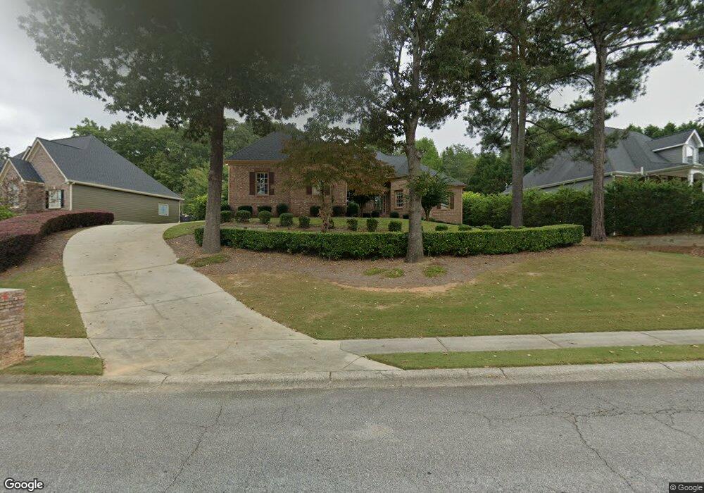
2644 White Rock Dr Unit 11 Buford, GA 30519
Estimated Value: $577,910 - $623,000
4
Beds
3
Baths
2,940
Sq Ft
$205/Sq Ft
Est. Value
About This Home
This home is located at 2644 White Rock Dr Unit 11, Buford, GA 30519 and is currently estimated at $602,228, approximately $204 per square foot. 2644 White Rock Dr Unit 11 is a home located in Hall County with nearby schools including Friendship Elementary School, Cherokee Bluff Middle School, and Cherokee Bluff High School.
Ownership History
Date
Name
Owned For
Owner Type
Purchase Details
Closed on
Aug 7, 2008
Sold by
Mallin Rhonda L
Bought by
Rhonda Lee Mallin Aka Rhonda Lee Doss As
Current Estimated Value
Purchase Details
Closed on
Jul 17, 2007
Sold by
Mallin John R and Mallin Rhonda L
Bought by
Doss Rhonda L and Mallin Rhonda L
Purchase Details
Closed on
Aug 31, 2001
Sold by
Chateau Corners Development Corp
Bought by
R G Cloer Enterprises Inc
Create a Home Valuation Report for This Property
The Home Valuation Report is an in-depth analysis detailing your home's value as well as a comparison with similar homes in the area
Home Values in the Area
Average Home Value in this Area
Purchase History
| Date | Buyer | Sale Price | Title Company |
|---|---|---|---|
| Rhonda Lee Mallin Aka Rhonda Lee Doss As | -- | -- | |
| Doss Rhonda L | $338,000 | -- | |
| R G Cloer Enterprises Inc | $94,800 | -- |
Source: Public Records
Tax History Compared to Growth
Tax History
| Year | Tax Paid | Tax Assessment Tax Assessment Total Assessment is a certain percentage of the fair market value that is determined by local assessors to be the total taxable value of land and additions on the property. | Land | Improvement |
|---|---|---|---|---|
| 2024 | $1,796 | $209,600 | $33,600 | $176,000 |
| 2023 | $1,630 | $202,040 | $33,440 | $168,600 |
| 2022 | $3,311 | $144,240 | $22,840 | $121,400 |
| 2021 | $3,288 | $140,680 | $22,840 | $117,840 |
| 2020 | $3,270 | $136,640 | $13,000 | $123,640 |
| 2019 | $3,175 | $131,960 | $13,000 | $118,960 |
| 2018 | $2,660 | $128,720 | $13,000 | $115,720 |
| 2017 | $2,894 | $119,360 | $13,000 | $106,360 |
| 2016 | $3,074 | $109,880 | $13,000 | $96,880 |
| 2015 | $2,600 | $91,853 | $13,000 | $78,853 |
| 2014 | $2,600 | $91,853 | $13,000 | $78,853 |
Source: Public Records
Map
Nearby Homes
- 2342 Sparta Way
- 3088 Lantana Way
- 3138 Lantana Way
- 3134 Perimeter Cir
- 2732 Thompson Mill Rd
- 4732 Moon Chase Dr
- 2638 Democracy Dr Unit 1
- 2424 Pinnae Place
- 4728 Moon Hollow Ct
- 2264 Oak Falls Ln
- 5730 Nantucket Row
- 5378 Thompson Mill Rd
- 4693 Devencrest Ln
- 2228 Mayors Way
- 2808 Turnwater St
- Sierra Plan at Sherwood Square
- Sawnee Plan at Sherwood Square
- 2941 Climbing Rose St
- 4642 Devencrest Ln Unit 1
- 2650 White Rock Dr
- 2638 White Rock Dr
- 2632 White Rock Dr
- 0 White Rock Dr Unit 8451449
- 0 White Rock Dr Unit 8142703
- 0 White Rock Dr Unit 8692190
- 0 White Rock Dr Unit 8974496
- 0 White Rock Dr Unit 9017603
- 0 White Rock Dr Unit 8763666
- 0 White Rock Dr Unit 3127118
- 0 White Rock Dr Unit 3158754
- 0 White Rock Dr Unit 3260338
- 0 White Rock Dr Unit 7248312
- 0 White Rock Dr Unit 7255404
- 0 White Rock Dr Unit 7283197
- 0 White Rock Dr Unit 7286145
- 0 White Rock Dr Unit 7333171
- 0 White Rock Dr Unit 7362574
- 0 White Rock Dr Unit 7406876
- 2702 Clearwater Springs Dr