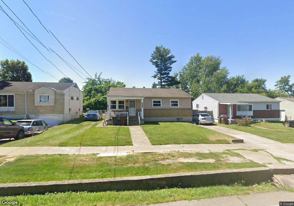
2645 Banning Rd Cincinnati, OH 45239
Estimated Value: $180,000 - $195,237
3
Beds
1
Bath
1,308
Sq Ft
$145/Sq Ft
Est. Value
About This Home
This home is located at 2645 Banning Rd, Cincinnati, OH 45239 and is currently estimated at $189,309, approximately $144 per square foot. 2645 Banning Rd is a home located in Hamilton County with nearby schools including White Oak Middle School, Colerain High School, and Cincinnati Achievement Academy.
Ownership History
Date
Name
Owned For
Owner Type
Purchase Details
Closed on
Apr 18, 2002
Sold by
Bergen Karen E and Bergen Karen E
Bought by
Hines Tammy M
Current Estimated Value
Home Financials for this Owner
Home Financials are based on the most recent Mortgage that was taken out on this home.
Original Mortgage
$89,195
Outstanding Balance
$37,819
Interest Rate
7.13%
Mortgage Type
FHA
Estimated Equity
$151,490
Purchase Details
Closed on
Jan 24, 1994
Sold by
Self Charles M and Self Mary A
Bought by
Bergen Karen E
Home Financials for this Owner
Home Financials are based on the most recent Mortgage that was taken out on this home.
Original Mortgage
$52,000
Interest Rate
7.26%
Create a Home Valuation Report for This Property
The Home Valuation Report is an in-depth analysis detailing your home's value as well as a comparison with similar homes in the area
Home Values in the Area
Average Home Value in this Area
Purchase History
| Date | Buyer | Sale Price | Title Company |
|---|---|---|---|
| Hines Tammy M | $89,900 | -- | |
| Bergen Karen E | -- | -- |
Source: Public Records
Mortgage History
| Date | Status | Borrower | Loan Amount |
|---|---|---|---|
| Open | Hines Tammy M | $89,195 | |
| Previous Owner | Bergen Karen E | $52,000 |
Source: Public Records
Tax History Compared to Growth
Tax History
| Year | Tax Paid | Tax Assessment Tax Assessment Total Assessment is a certain percentage of the fair market value that is determined by local assessors to be the total taxable value of land and additions on the property. | Land | Improvement |
|---|---|---|---|---|
| 2024 | $2,163 | $40,408 | $7,875 | $32,533 |
| 2023 | $2,174 | $40,408 | $7,875 | $32,533 |
| 2022 | $1,555 | $23,545 | $6,164 | $17,381 |
| 2021 | $1,543 | $23,545 | $6,164 | $17,381 |
| 2020 | $1,557 | $23,545 | $6,164 | $17,381 |
| 2019 | $1,361 | $19,219 | $5,222 | $13,997 |
| 2018 | $1,221 | $19,219 | $5,222 | $13,997 |
| 2017 | $1,156 | $19,219 | $5,222 | $13,997 |
| 2016 | $1,466 | $24,084 | $7,172 | $16,912 |
| 2015 | $1,480 | $24,084 | $7,172 | $16,912 |
| 2014 | $1,483 | $24,084 | $7,172 | $16,912 |
| 2013 | $1,533 | $26,177 | $7,795 | $18,382 |
Source: Public Records
Map
Nearby Homes
- 6851 Rutherford Ct
- 2481 Crosley Meadow
- 2412 Amelia Ct
- 2424 Banning Rd
- 2538 Byrneside Dr
- 2598 Byrneside Dr
- 2536 Flanigan Ct
- 2390 Golf Dr
- 2347 Golf Dr
- 3041 Preserve Ln
- 2342 Banning Rd
- 2503 Flanigan Ct
- 5851 Monfort Hills Ave
- 2268 Deblin Dr
- 5970 Colerain Ave
- 5960 Colerain Ave
- 3171 Preserve Ln
- 5845 Shadymist Ln
- 2477 Kipling Ave
- 2603 Kipling Ave
- 2655 Banning Rd
- 2637 Banning Rd
- 2663 Banning Rd
- 7051 Memory Ln
- 7091 Memory Ln
- 2644 Sandhurst Dr
- 2652 Sandhurst Dr
- 2636 Sandhurst Dr
- 2673 Banning Rd
- 2660 Sandhurst Dr
- 7011 Memory Ln
- 7101 Memory Ln
- 2656 Banning Rd
- 2668 Sandhurst Dr
- 2644 Banning Rd
- 2660 Banning Rd
- 2681 Banning Rd
- 2668 Banning Rd
- 2676 Sandhurst Dr
- 7117 Memory Ln