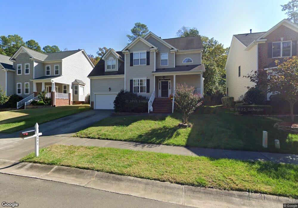
2647 Oleander Dr Durham, NC 27703
South Durham NeighborhoodEstimated Value: $460,000 - $526,000
4
Beds
3
Baths
2,275
Sq Ft
$219/Sq Ft
Est. Value
About This Home
This home is located at 2647 Oleander Dr, Durham, NC 27703 and is currently estimated at $498,950, approximately $219 per square foot. 2647 Oleander Dr is a home located in Durham County with nearby schools including Bethesda Elementary School, John W Neal Middle School, and Southern School of Energy & Sustainability.
Ownership History
Date
Name
Owned For
Owner Type
Purchase Details
Closed on
Aug 18, 2025
Sold by
Yablunosky Matthew Stephen and Yablunosky Lori Lynn
Bought by
Yablunosky Living Trust and Yablunosky
Current Estimated Value
Purchase Details
Closed on
Jun 3, 2004
Sold by
Centex Homes
Bought by
Yablunosky Matthew Stephen and Yablunosky Lori Lynn
Home Financials for this Owner
Home Financials are based on the most recent Mortgage that was taken out on this home.
Original Mortgage
$210,600
Interest Rate
3.75%
Mortgage Type
Purchase Money Mortgage
Create a Home Valuation Report for This Property
The Home Valuation Report is an in-depth analysis detailing your home's value as well as a comparison with similar homes in the area
Home Values in the Area
Average Home Value in this Area
Purchase History
| Date | Buyer | Sale Price | Title Company |
|---|---|---|---|
| Yablunosky Living Trust | -- | None Listed On Document | |
| Yablunosky Matthew Stephen | $235,000 | -- |
Source: Public Records
Mortgage History
| Date | Status | Borrower | Loan Amount |
|---|---|---|---|
| Previous Owner | Yablunosky Matthew Stephen | $210,600 |
Source: Public Records
Tax History
| Year | Tax Paid | Tax Assessment Tax Assessment Total Assessment is a certain percentage of the fair market value that is determined by local assessors to be the total taxable value of land and additions on the property. | Land | Improvement |
|---|---|---|---|---|
| 2025 | $5,305 | $535,134 | $135,450 | $399,684 |
| 2024 | $3,813 | $273,333 | $57,960 | $215,373 |
| 2023 | $3,580 | $273,333 | $57,960 | $215,373 |
| 2022 | $3,498 | $273,333 | $57,960 | $215,373 |
| 2021 | $3,482 | $273,333 | $57,960 | $215,373 |
| 2020 | $3,400 | $273,333 | $57,960 | $215,373 |
| 2019 | $3,400 | $273,333 | $57,960 | $215,373 |
| 2018 | $3,388 | $249,783 | $45,080 | $204,703 |
| 2017 | $3,363 | $249,783 | $45,080 | $204,703 |
| 2016 | $3,250 | $249,783 | $45,080 | $204,703 |
| 2015 | $3,783 | $273,301 | $51,843 | $221,458 |
| 2014 | $3,783 | $273,301 | $51,843 | $221,458 |
Source: Public Records
Map
Nearby Homes
- 2701 Skybrook Ln
- 3503 Long Ridge Rd
- 1016 Hollis Cir
- 3712 Appling Way
- 12 Sameer Ct
- 4512 Brimmer St
- 2214 Tw Alexander Dr
- 5024 Dragonfly Dr
- 2709 Hamilton Green Dr
- 334 Westgrove Ct
- 107 Vickery Hill Ct
- 19 Gandhi Dr
- 5226 Malik Dr
- 1200 Bluewater Way
- 2216 Jollay St
- 111 Lang St
- 5216 Dilbagh Dr
- 231 Westgrove Ct
- 458 Brier Summit Place
- 1018 Flyfish Ave
- 2645 Oleander Dr
- 2643 Oleander Dr
- 4915 Lumley Rd
- 4921 Lumley Rd
- 2641 Oleander Dr
- 2644 Oleander Dr
- 2642 Oleander Dr
- 3305 Forest Grove Ct
- 3307 Forest Grove Ct
- 2640 Oleander Dr
- 3303 Forest Grove Ct
- 3309 Forest Grove Ct
- 3305 Appling Way
- 3311 Forest Grove Ct
- 2637 Oleander Dr
- 2629 Bonnie Brae Rd
- 3306 Forest Grove Ct
- 3401 Forest Grove Ct
- 3308 Forest Grove Ct
- 2625 Bonnie Brae Rd
Your Personal Tour Guide
Ask me questions while you tour the home.