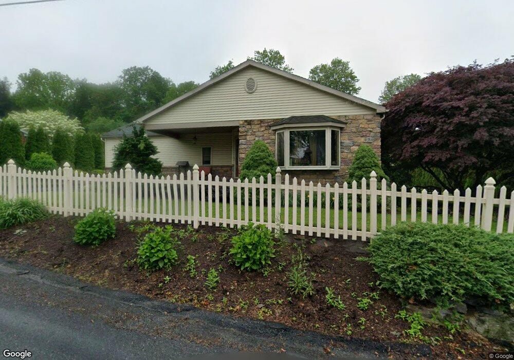
2648 Grove St Slatington, PA 18080
Washington Township NeighborhoodEstimated Value: $291,415 - $310,000
2
Beds
1
Bath
1,429
Sq Ft
$212/Sq Ft
Est. Value
About This Home
This home is located at 2648 Grove St, Slatington, PA 18080 and is currently estimated at $303,604, approximately $212 per square foot. 2648 Grove St is a home located in Lehigh County with nearby schools including Deep Creek Central Elementary School, Grassfield Elementary School, and Peters Elementary School.
Ownership History
Date
Name
Owned For
Owner Type
Purchase Details
Closed on
Jun 10, 2005
Sold by
Shupp Todd E and Shupp Cathy M
Bought by
Shupp Todd E and Shupp Charlene M
Current Estimated Value
Home Financials for this Owner
Home Financials are based on the most recent Mortgage that was taken out on this home.
Original Mortgage
$60,000
Interest Rate
5.79%
Mortgage Type
Stand Alone Refi Refinance Of Original Loan
Purchase Details
Closed on
Feb 24, 1967
Bought by
Shupp Thomas E and Shupp Betty A
Create a Home Valuation Report for This Property
The Home Valuation Report is an in-depth analysis detailing your home's value as well as a comparison with similar homes in the area
Home Values in the Area
Average Home Value in this Area
Purchase History
| Date | Buyer | Sale Price | Title Company |
|---|---|---|---|
| Shupp Todd E | -- | -- | |
| Shupp Thomas E | $10,500 | -- |
Source: Public Records
Mortgage History
| Date | Status | Borrower | Loan Amount |
|---|---|---|---|
| Closed | Shupp Todd E | $60,000 |
Source: Public Records
Tax History Compared to Growth
Tax History
| Year | Tax Paid | Tax Assessment Tax Assessment Total Assessment is a certain percentage of the fair market value that is determined by local assessors to be the total taxable value of land and additions on the property. | Land | Improvement |
|---|---|---|---|---|
| 2025 | $4,377 | $148,600 | $35,400 | $113,200 |
| 2024 | $4,301 | $148,600 | $35,400 | $113,200 |
| 2023 | $4,183 | $148,600 | $35,400 | $113,200 |
| 2022 | $4,108 | $148,600 | $113,200 | $35,400 |
| 2021 | $4,038 | $148,600 | $35,400 | $113,200 |
| 2020 | $3,952 | $148,600 | $35,400 | $113,200 |
| 2019 | $3,849 | $148,600 | $35,400 | $113,200 |
| 2018 | $3,757 | $148,600 | $35,400 | $113,200 |
| 2017 | $3,746 | $148,600 | $35,400 | $113,200 |
| 2016 | -- | $148,600 | $35,400 | $113,200 |
| 2015 | -- | $148,600 | $35,400 | $113,200 |
| 2014 | -- | $148,600 | $35,400 | $113,200 |
Source: Public Records
Map
Nearby Homes