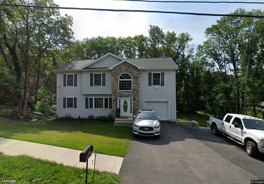
265 E Broad St East Stroudsburg, PA 18301
Estimated Value: $445,844 - $550,000
4
Beds
3
Baths
2,278
Sq Ft
$214/Sq Ft
Est. Value
About This Home
This home is located at 265 E Broad St, East Stroudsburg, PA 18301 and is currently estimated at $486,711, approximately $213 per square foot. 265 E Broad St is a home located in Monroe County with nearby schools including J.M. Hill Elementary School, J.T. Lambert Intermediate School, and East Stroudsburg Senior High School South.
Ownership History
Date
Name
Owned For
Owner Type
Purchase Details
Closed on
Jun 3, 2016
Sold by
D E & S Properties Llc
Bought by
Forbes Keiron and Forbes Freda
Current Estimated Value
Home Financials for this Owner
Home Financials are based on the most recent Mortgage that was taken out on this home.
Original Mortgage
$260,798
Outstanding Balance
$209,572
Interest Rate
3.87%
Mortgage Type
FHA
Estimated Equity
$277,139
Purchase Details
Closed on
Jul 27, 2015
Sold by
Katz Gregory
Bought by
D E & S Properties Inc
Purchase Details
Closed on
Mar 17, 2011
Sold by
Katz David
Bought by
Katz Gregory
Create a Home Valuation Report for This Property
The Home Valuation Report is an in-depth analysis detailing your home's value as well as a comparison with similar homes in the area
Home Values in the Area
Average Home Value in this Area
Purchase History
| Date | Buyer | Sale Price | Title Company |
|---|---|---|---|
| Forbes Keiron | $266,300 | None Available | |
| D E & S Properties Inc | $21,000 | None Available | |
| Katz Gregory | -- | None Available | |
| Schroeder Philip E | -- | None Available | |
| Katz David | -- | None Available |
Source: Public Records
Mortgage History
| Date | Status | Borrower | Loan Amount |
|---|---|---|---|
| Open | Forbes Keiron | $260,798 |
Source: Public Records
Tax History Compared to Growth
Tax History
| Year | Tax Paid | Tax Assessment Tax Assessment Total Assessment is a certain percentage of the fair market value that is determined by local assessors to be the total taxable value of land and additions on the property. | Land | Improvement |
|---|---|---|---|---|
| 2025 | $3,553 | $260,690 | $31,640 | $229,050 |
| 2024 | $2,695 | $260,690 | $31,640 | $229,050 |
| 2023 | $10,261 | $260,690 | $31,640 | $229,050 |
| 2022 | $10,203 | $260,690 | $31,640 | $229,050 |
| 2021 | $9,880 | $260,690 | $31,640 | $229,050 |
| 2020 | $9,581 | $260,690 | $31,640 | $229,050 |
| 2019 | $8,697 | $38,530 | $5,050 | $33,480 |
| 2018 | $8,697 | $38,530 | $5,050 | $33,480 |
| 2017 | $1,132 | $38,530 | $5,050 | $33,480 |
| 2016 | $229 | $5,050 | $5,050 | $0 |
| 2015 | $913 | $5,050 | $5,050 | $0 |
| 2014 | $913 | $5,050 | $5,050 | $0 |
Source: Public Records
Map
Nearby Homes
- 255 E Broad St
- 5614 Franklin Hill Rd
- 248 E Broad St
- 236 Secor St
- 121 Tree Ln
- 6255 Franklin Hill Rd
- 137 Independence Rd
- 211 E Broad St
- 19 Smith St
- 182 State St
- 8 Delilah Rd 8 Rd
- 0 Clubhouse 14 Dr Unit PM-132587
- 204 Analomink St
- 204 Lackawanna Ave
- 155 Kimberleigh Ct
- 52 S Green St
- 197 Meyers St
- 592 N Courtland St
- 125 Stoneleigh Dr
- 198 Grove St
