Estimated Value: $899,000 - $954,252
4
Beds
4
Baths
2,241
Sq Ft
$416/Sq Ft
Est. Value
About This Home
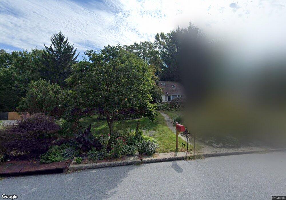
This home is located at 265 Friendship Dr, Paoli, PA 19301 and is currently estimated at $933,063, approximately $416 per square foot. 265 Friendship Dr is a home located in Chester County with nearby schools including Hillside Elementary School, Valley Forge Middle School, and Conestoga Senior High School.
Ownership History
Date
Name
Owned For
Owner Type
Purchase Details
Closed on
May 18, 2001
Sold by
Price Arthur J and Price Nelson A
Bought by
Labess Paul and Labess Leslie
Current Estimated Value
Home Financials for this Owner
Home Financials are based on the most recent Mortgage that was taken out on this home.
Original Mortgage
$274,400
Outstanding Balance
$102,612
Interest Rate
7.05%
Estimated Equity
$830,451
Purchase Details
Closed on
Jan 23, 1996
Sold by
Price Arthur J and Price Joyce E
Bought by
Price Arthur J and Price Joyce E
Create a Home Valuation Report for This Property
The Home Valuation Report is an in-depth analysis detailing your home's value as well as a comparison with similar homes in the area
Home Values in the Area
Average Home Value in this Area
Purchase History
| Date | Buyer | Sale Price | Title Company |
|---|---|---|---|
| Labess Paul | $343,000 | -- | |
| Price Arthur J | -- | Title Insurance Company |
Source: Public Records
Mortgage History
| Date | Status | Borrower | Loan Amount |
|---|---|---|---|
| Open | Labess Paul | $274,400 |
Source: Public Records
Tax History Compared to Growth
Tax History
| Year | Tax Paid | Tax Assessment Tax Assessment Total Assessment is a certain percentage of the fair market value that is determined by local assessors to be the total taxable value of land and additions on the property. | Land | Improvement |
|---|---|---|---|---|
| 2025 | $9,305 | $264,180 | $97,980 | $166,200 |
| 2024 | $9,305 | $264,180 | $97,980 | $166,200 |
| 2023 | $8,741 | $264,180 | $97,980 | $166,200 |
| 2022 | $8,515 | $264,180 | $97,980 | $166,200 |
| 2021 | $8,353 | $264,180 | $97,980 | $166,200 |
| 2020 | $8,123 | $264,180 | $97,980 | $166,200 |
| 2019 | $7,866 | $264,180 | $97,980 | $166,200 |
| 2018 | $7,711 | $264,180 | $97,980 | $166,200 |
| 2017 | $7,527 | $264,180 | $97,980 | $166,200 |
| 2016 | -- | $264,180 | $97,980 | $166,200 |
| 2015 | -- | $264,180 | $97,980 | $166,200 |
| 2014 | -- | $264,180 | $97,980 | $166,200 |
Source: Public Records
Map
Nearby Homes
- 109 Vincent Rd
- 5 Kent Ln
- 106 N Valley Rd
- 1242 Old Lancaster Rd
- 521 Foxwood Ln
- 2102 Quail Ridge Dr
- 1 Whitworth Ave
- 1441 Berwyn Paoli Rd
- 1304 Weatherstone Dr Unit 1304
- 202 Shoreline Dr
- 1602 Weatherstone Dr Unit 1602
- 1705 Weatherstone Dr
- 1250 Swedesford Rd
- 29 Manor Rd
- 21 Manor Rd
- 211 Wooded Way
- 104 Lynbrook Rd
- 32 Manchester Ct
- 114 Manor Rd
- 896 Conestoga Rd
- 253 Friendship Dr
- 275 Friendship Dr
- 243 Friendship Dr
- 266 Friendship Dr
- 246 Friendship Dr
- 278 Friendship Dr
- 291 Friendship Dr
- 292 Friendship Dr
- 233 Friendship Dr
- 317 Hilltop Rd
- 283 Friendship Dr
- 133 Agnew Ln
- 302 Friendship Dr
- 303 Friendship Dr
- 135 Agnew Ln
- 135 Agnew Ln
- 327 Hilltop Rd
- 131 Agnew Ln
- 306 Friendship Dr
- 326 Hilltop Rd