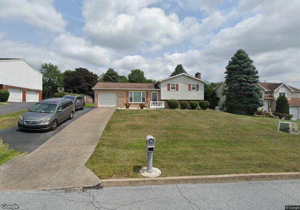
265 Kempton Ave Harrisburg, PA 17111
Estimated Value: $278,000 - $349,000
4
Beds
3
Baths
1,706
Sq Ft
$181/Sq Ft
Est. Value
About This Home
This home is located at 265 Kempton Ave, Harrisburg, PA 17111 and is currently estimated at $308,908, approximately $181 per square foot. 265 Kempton Ave is a home located in Dauphin County with nearby schools including Lawnton Elementary School, Swatara Middle School, and Central Dauphin East Senior High School.
Ownership History
Date
Name
Owned For
Owner Type
Purchase Details
Closed on
Apr 25, 2011
Sold by
Malatesta Kim M
Bought by
Warner Linwood L
Current Estimated Value
Home Financials for this Owner
Home Financials are based on the most recent Mortgage that was taken out on this home.
Original Mortgage
$175,437
Outstanding Balance
$124,917
Interest Rate
5.5%
Mortgage Type
FHA
Estimated Equity
$183,991
Create a Home Valuation Report for This Property
The Home Valuation Report is an in-depth analysis detailing your home's value as well as a comparison with similar homes in the area
Home Values in the Area
Average Home Value in this Area
Purchase History
| Date | Buyer | Sale Price | Title Company |
|---|---|---|---|
| Warner Linwood L | $180,000 | -- |
Source: Public Records
Mortgage History
| Date | Status | Borrower | Loan Amount |
|---|---|---|---|
| Open | Warner Linwood L | $175,437 |
Source: Public Records
Tax History Compared to Growth
Tax History
| Year | Tax Paid | Tax Assessment Tax Assessment Total Assessment is a certain percentage of the fair market value that is determined by local assessors to be the total taxable value of land and additions on the property. | Land | Improvement |
|---|---|---|---|---|
| 2025 | $3,034 | $101,700 | $16,000 | $85,700 |
| 2024 | $2,882 | $101,700 | $16,000 | $85,700 |
| 2023 | $2,882 | $101,700 | $16,000 | $85,700 |
| 2022 | $2,882 | $101,700 | $16,000 | $85,700 |
| 2021 | $2,820 | $101,700 | $16,000 | $85,700 |
| 2020 | $2,791 | $101,700 | $16,000 | $85,700 |
| 2019 | $2,803 | $101,700 | $16,000 | $85,700 |
| 2018 | $2,757 | $101,700 | $16,000 | $85,700 |
| 2017 | $2,665 | $101,700 | $16,000 | $85,700 |
| 2016 | $0 | $101,700 | $16,000 | $85,700 |
| 2015 | -- | $101,700 | $16,000 | $85,700 |
| 2014 | -- | $101,700 | $16,000 | $85,700 |
Source: Public Records
Map
Nearby Homes
- 314 Lincoln Ave
- 344 Eddington Ave
- 191 Chartwood Dr
- 69 Delmont Ave
- 0 N 50th St
- 730 Harvest Dr
- 4800 E Circle Dr
- 4917 Lancaster St
- 4818 Derry St
- 6321 Huntingdon St
- 6341 Somerset St
- 4610 Derry St
- 130 Leonard Ln
- 6100 Hocker Dr
- 6436 Ann St
- 1099 Dowhower Rd
- 5691 Chambers Hill Rd
- 6520 Derry St
- 11 S 43rd St
- 6150 Chambers Hill Rd
- 257 Kempton Ave
- 277 Kempton Ave
- 245 Kempton Ave
- 5621 Fordham Ave
- 5611 Fordham Ave
- 5601 Fordham Ave
- 256 Kempton Ave
- 268 Kempton Ave
- 244 Kempton Ave
- 237 Kempton Ave
- 5631 Fordham Ave
- 5581 Fordham Ave
- 232 Kempton Ave
- 5641 Fordham Ave
- 5641 Fordham Ave
- 235 Stafford Ave
- 225 Kempton Ave
- 249 Stafford Ave
- 5620 Fordham Ave
- 221 Stafford Ave