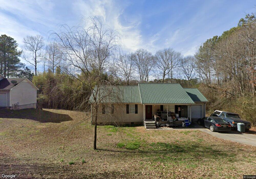
265 Lavista Dr SW Calhoun, GA 30701
Estimated Value: $196,621 - $263,000
3
Beds
2
Baths
1,100
Sq Ft
$209/Sq Ft
Est. Value
About This Home
This home is located at 265 Lavista Dr SW, Calhoun, GA 30701 and is currently estimated at $229,405, approximately $208 per square foot. 265 Lavista Dr SW is a home located in Gordon County with nearby schools including Swain Elementary School, Ashworth Middle School, and Gordon Central High School.
Ownership History
Date
Name
Owned For
Owner Type
Purchase Details
Closed on
Apr 27, 2015
Sold by
Roberson Rebecca D
Bought by
Roberson Michael S
Current Estimated Value
Purchase Details
Closed on
Apr 27, 2004
Sold by
Roberson Michael S
Bought by
Roberson Michael S and Roberson Rebecca D
Purchase Details
Closed on
Nov 1, 2001
Sold by
G Bonner Construction Co
Bought by
Bonner & Woods Properties
Purchase Details
Closed on
May 11, 2000
Bought by
G Bonner Construction Co
Purchase Details
Closed on
Dec 7, 1999
Bought by
Mcdaniel Flipper
Purchase Details
Closed on
Dec 23, 1998
Bought by
Hall John Wayne and Hall Shelba S
Create a Home Valuation Report for This Property
The Home Valuation Report is an in-depth analysis detailing your home's value as well as a comparison with similar homes in the area
Home Values in the Area
Average Home Value in this Area
Purchase History
| Date | Buyer | Sale Price | Title Company |
|---|---|---|---|
| Roberson Michael S | -- | -- | |
| Roberson Michael S | -- | -- | |
| Roberson Michael S | $83,100 | -- | |
| Bonner & Woods Properties | $75,900 | -- | |
| G Bonner Construction Co | -- | -- | |
| Mcdaniel Flipper | -- | -- | |
| Hall John Wayne | -- | -- |
Source: Public Records
Tax History Compared to Growth
Tax History
| Year | Tax Paid | Tax Assessment Tax Assessment Total Assessment is a certain percentage of the fair market value that is determined by local assessors to be the total taxable value of land and additions on the property. | Land | Improvement |
|---|---|---|---|---|
| 2024 | $1,316 | $53,816 | $3,360 | $50,456 |
| 2023 | $1,229 | $50,388 | $3,360 | $47,028 |
| 2022 | $1,217 | $47,040 | $3,360 | $43,680 |
| 2021 | $1,016 | $38,264 | $3,360 | $34,904 |
| 2020 | $1,051 | $38,676 | $3,360 | $35,316 |
| 2019 | $1,045 | $38,276 | $3,360 | $34,916 |
| 2018 | $965 | $35,520 | $3,360 | $32,160 |
| 2017 | $939 | $33,680 | $3,360 | $30,320 |
| 2016 | $941 | $33,680 | $3,360 | $30,320 |
| 2015 | $932 | $33,080 | $3,360 | $29,720 |
| 2014 | $858 | $31,467 | $3,360 | $28,107 |
Source: Public Records
Map
Nearby Homes
- 176 Village Way SW
- The Braselton II Plan at Fair Oak
- The Reynolds Plan at Fair Oak
- The Buford II Plan at Fair Oak
- The Lawson Plan at Fair Oak
- The Caldwell Plan at Fair Oak
- The Benson II Plan at Fair Oak
- The Greenbrier II Plan at Fair Oak
- 130 Brookstone Dr SW
- 413 Beamer Rd SW
- 137 Regency Row SW
- 210 Madison Dr SW
- 121 Foxhall Dr SW
- 0 Highway 53 Spur SW Unit 7529096
- 215 Wilson St
- 227 Mcconnell Rd
- 100 Neal St
- 0 Reeves Station Rd SW Unit 10548197
- 0 Reeves Station Rd SW Unit 7601645
- 404 Mcginnis Cir
- 267 Lavista Dr SW
- 190 Overland Dr SW
- 190 Overland Dr SW
- 277 Lavista Dr SW
- 262 Lavista Dr SW
- 272 Lavista Dr SW
- 180 Overland Dr SW
- 227 Lavista Dr SW
- 287 Lavista Dr SW
- 190 Dakota Ln SW
- 286 Lavista Dr SW
- 226 Lavista Dr SW
- 172 Overland Dr SW
- 470 Lakecrest Cir SW
- 464 Lakecrest Cir SW
- 113 Westview Dr SW
- 434 Lakecrest Cir SW
- 207 Patriots Row SW
- 478 Lakecrest Cir SW
- 131 Westview Dr SW