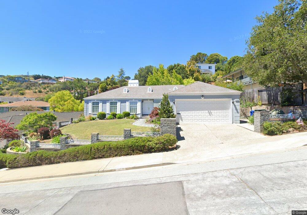
265 Loyola Dr Millbrae, CA 94030
Mills Estates NeighborhoodEstimated Value: $2,498,682 - $2,981,000
3
Beds
2
Baths
2,130
Sq Ft
$1,272/Sq Ft
Est. Value
About This Home
This home is located at 265 Loyola Dr, Millbrae, CA 94030 and is currently estimated at $2,708,421, approximately $1,271 per square foot. 265 Loyola Dr is a home located in San Mateo County with nearby schools including Spring Valley Elementary School, Taylor Middle School, and Mills High School.
Ownership History
Date
Name
Owned For
Owner Type
Purchase Details
Closed on
Feb 4, 2004
Sold by
Sandrini Louis M and Sandrini Sherron Dee
Bought by
Sandrini Louis M and Sandrini Sherron Dee
Current Estimated Value
Home Financials for this Owner
Home Financials are based on the most recent Mortgage that was taken out on this home.
Original Mortgage
$223,000
Outstanding Balance
$104,514
Interest Rate
5.82%
Mortgage Type
New Conventional
Estimated Equity
$2,603,907
Purchase Details
Closed on
Nov 22, 2002
Sold by
Sandrini Louis M and Sandrini Sherron Dee
Bought by
Sandrini Louis M and Sandrini Sherron Dee
Home Financials for this Owner
Home Financials are based on the most recent Mortgage that was taken out on this home.
Original Mortgage
$227,000
Interest Rate
6.28%
Purchase Details
Closed on
May 8, 1995
Sold by
Sandrini Louis M and Sandrini Sherron Dee
Bought by
Sandrini Louis M and Sandrini Sherron Dee
Create a Home Valuation Report for This Property
The Home Valuation Report is an in-depth analysis detailing your home's value as well as a comparison with similar homes in the area
Home Values in the Area
Average Home Value in this Area
Purchase History
| Date | Buyer | Sale Price | Title Company |
|---|---|---|---|
| Sandrini Louis M | -- | Ticor Title | |
| Sandrini Louis M | -- | Ticor Title | |
| Sandrini Louis M | -- | -- | |
| Sandrini Louis M | -- | Old Republic Title Company | |
| Sandrini Louis M | -- | -- |
Source: Public Records
Mortgage History
| Date | Status | Borrower | Loan Amount |
|---|---|---|---|
| Open | Sandrini Louis M | $223,000 | |
| Previous Owner | Sandrini Louis M | $227,000 |
Source: Public Records
Tax History
| Year | Tax Paid | Tax Assessment Tax Assessment Total Assessment is a certain percentage of the fair market value that is determined by local assessors to be the total taxable value of land and additions on the property. | Land | Improvement |
|---|---|---|---|---|
| 2025 | $7,942 | $599,188 | $243,727 | $355,461 |
| 2023 | $7,942 | $575,923 | $234,264 | $341,659 |
| 2022 | $6,422 | $564,631 | $229,671 | $334,960 |
| 2021 | $6,349 | $553,561 | $225,168 | $328,393 |
| 2020 | $6,246 | $547,886 | $222,860 | $325,026 |
| 2019 | $6,098 | $537,144 | $218,491 | $318,653 |
| 2018 | $6,076 | $526,612 | $214,207 | $312,405 |
| 2017 | $5,891 | $516,287 | $210,007 | $306,280 |
| 2016 | $5,809 | $506,165 | $205,890 | $300,275 |
| 2015 | $5,769 | $498,563 | $202,798 | $295,765 |
| 2014 | $5,638 | $488,798 | $198,826 | $289,972 |
Source: Public Records
Map
Nearby Homes
- 1340 Manzanita Dr
- 8 Millbrae Cir
- 909 Hillcrest Blvd
- 1550 Frontera Way Unit 109
- 1550 Frontera Way Unit 319
- 320 Vallejo Dr Unit 30
- 320 Vallejo Dr Unit 22
- 340 Vallejo Dr Unit 71
- 15 Mullins Ct
- 3051 Atwater Dr
- 39 Colorados Dr
- 274 La Cruz Ave
- 1683 Escalante Way
- 88 S Broadway Unit 2405
- 460 Hazel Ave
- 1656 Lassen Way
- 2 Corte Camellia
- 842 Clearfield Dr
- 480 Anita Dr
- 1125 Dufferin Ave
Your Personal Tour Guide
Ask me questions while you tour the home.