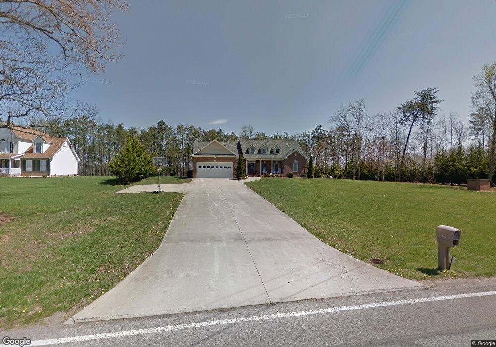
265 Matthews Rd Pilot Mountain, NC 27041
Estimated Value: $396,000 - $477,000
3
Beds
3
Baths
3,075
Sq Ft
$145/Sq Ft
Est. Value
About This Home
This home is located at 265 Matthews Rd, Pilot Mountain, NC 27041 and is currently estimated at $446,461, approximately $145 per square foot. 265 Matthews Rd is a home located in Surry County with nearby schools including Pilot Mountain Elementary School, Pilot Mountain Middle School, and East Surry High School.
Ownership History
Date
Name
Owned For
Owner Type
Purchase Details
Closed on
Jan 9, 2012
Sold by
Mcbride Donald Gray and Mcbride Judy Arrington
Bought by
Lowe Samuel Alan and Lowe Amy Paulette
Current Estimated Value
Home Financials for this Owner
Home Financials are based on the most recent Mortgage that was taken out on this home.
Original Mortgage
$261,250
Outstanding Balance
$179,227
Interest Rate
4.07%
Mortgage Type
New Conventional
Estimated Equity
$267,234
Purchase Details
Closed on
Nov 30, 2005
Sold by
Slater Charles R and Slater Sharon W
Bought by
Mcbride Donald Gray and Mcbride Arrington
Home Financials for this Owner
Home Financials are based on the most recent Mortgage that was taken out on this home.
Original Mortgage
$200,000
Interest Rate
6.23%
Mortgage Type
New Conventional
Purchase Details
Closed on
Nov 1, 2004
Purchase Details
Closed on
Aug 1, 2002
Create a Home Valuation Report for This Property
The Home Valuation Report is an in-depth analysis detailing your home's value as well as a comparison with similar homes in the area
Purchase History
| Date | Buyer | Sale Price | Title Company |
|---|---|---|---|
| Lowe Samuel Alan | $275,000 | None Available | |
| Mcbride Donald Gray | $260,000 | None Available | |
| -- | $15,500 | -- | |
| -- | $249,000 | -- |
Source: Public Records
Mortgage History
| Date | Status | Borrower | Loan Amount |
|---|---|---|---|
| Open | Lowe Samuel Alan | $261,250 | |
| Previous Owner | Mcbride Donald Gray | $200,000 |
Source: Public Records
Tax History
| Year | Tax Paid | Tax Assessment Tax Assessment Total Assessment is a certain percentage of the fair market value that is determined by local assessors to be the total taxable value of land and additions on the property. | Land | Improvement |
|---|---|---|---|---|
| 2025 | $1,946 | $346,490 | $14,000 | $332,490 |
| 2024 | $1,672 | $275,320 | $14,000 | $261,320 |
| 2023 | $1,641 | $275,320 | $14,000 | $261,320 |
| 2022 | $1,641 | $275,320 | $14,000 | $261,320 |
| 2021 | $1,672 | $275,320 | $14,000 | $261,320 |
| 2020 | $1,654 | $258,710 | $14,000 | $244,710 |
| 2019 | $1,651 | $258,710 | $14,000 | $244,710 |
| 2018 | $1,621 | $258,710 | $0 | $0 |
| 2017 | $1,648 | $258,710 | $0 | $0 |
| 2016 | $1,648 | $258,710 | $0 | $0 |
| 2013 | -- | $263,200 | $0 | $0 |
Source: Public Records
Map
Nearby Homes
- 3002 Alleghany Ln
- 6190 Alleghany Ln
- 1207 Alleghany Ln
- 9076 Alleghany Ln
- 3234 Alleghany Ln
- 300 Tom Hunter Rd
- 2725 Wilkes Ln
- 0 Wilkes Ln
- 2837 Wilkes Ln
- 2602 Wilkes Ln
- 204 Freeman Ridge Trail
- 00 Simmons Rd
- 2109 Cook School Rd
- 00 Carson Rd Unit 1.75
- 310 Jessup Grove Church Rd
- 100-186 Jessup Grove Church Rd Unit 3.9 +/- AC tract
- 812 W Main St
- 1096-1238 Cook School Rd Unit 97+/- AC Tract
- TBD Marbury Trail
- 950 Dodson Mill Rd
- 261 Matthews Rd
- 266 Matthews Rd
- 251 Matthews Rd
- 250 Matthews Rd
- 299 Matthews Rd
- Tract C Matthews Rd
- 227 Matthews Rd
- 329 Matthews Rd
- 335 Matthews Rd
- 353 Matthews Rd
- 117 Turney Farm Ln
- 144 Turney Farm Ln
- 379 Matthews Rd
- 173 Matthews Rd
- 303 Matthews Rd
- 176 Spruce Pine Ln
- 2925 Cook School Rd
- 0 Cook School
- 433 Matthews Rd
- 405 Matthews Rd
Your Personal Tour Guide
Ask me questions while you tour the home.