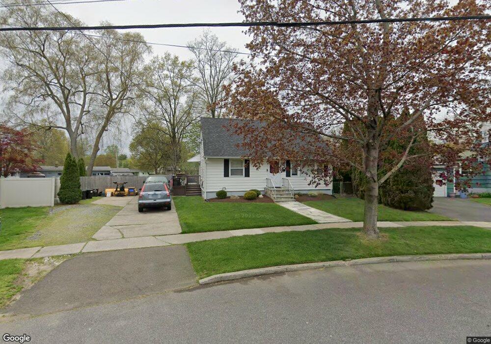
265 Meadowbrook Rd Stratford, CT 06614
Estimated Value: $394,000 - $444,000
4
Beds
1
Bath
1,183
Sq Ft
$349/Sq Ft
Est. Value
About This Home
This home is located at 265 Meadowbrook Rd, Stratford, CT 06614 and is currently estimated at $413,312, approximately $349 per square foot. 265 Meadowbrook Rd is a home located in Fairfield County with nearby schools including Second Hill Lane Elementary School, Harry B. Flood Middle School, and Bunnell High School.
Ownership History
Date
Name
Owned For
Owner Type
Purchase Details
Closed on
Aug 19, 1997
Sold by
Sansonetti John and Sansonetti Grace
Bought by
Arpie Brian and Arpie Margarita
Current Estimated Value
Home Financials for this Owner
Home Financials are based on the most recent Mortgage that was taken out on this home.
Original Mortgage
$106,300
Outstanding Balance
$15,961
Interest Rate
7.56%
Mortgage Type
Unknown
Estimated Equity
$397,351
Purchase Details
Closed on
Sep 18, 1990
Sold by
Gabany Florence
Bought by
Sansonetti John
Home Financials for this Owner
Home Financials are based on the most recent Mortgage that was taken out on this home.
Original Mortgage
$129,200
Interest Rate
9.76%
Create a Home Valuation Report for This Property
The Home Valuation Report is an in-depth analysis detailing your home's value as well as a comparison with similar homes in the area
Home Values in the Area
Average Home Value in this Area
Purchase History
| Date | Buyer | Sale Price | Title Company |
|---|---|---|---|
| Arpie Brian | $130,000 | -- | |
| Sansonetti John | $152,000 | -- |
Source: Public Records
Mortgage History
| Date | Status | Borrower | Loan Amount |
|---|---|---|---|
| Open | Sansonetti John | $106,300 | |
| Previous Owner | Sansonetti John | $123,000 | |
| Previous Owner | Sansonetti John | $126,000 | |
| Previous Owner | Sansonetti John | $129,200 |
Source: Public Records
Tax History
| Year | Tax Paid | Tax Assessment Tax Assessment Total Assessment is a certain percentage of the fair market value that is determined by local assessors to be the total taxable value of land and additions on the property. | Land | Improvement |
|---|---|---|---|---|
| 2025 | $5,563 | $138,390 | $79,940 | $58,450 |
| 2024 | $5,563 | $138,390 | $79,940 | $58,450 |
| 2023 | $5,563 | $138,390 | $79,940 | $58,450 |
| 2022 | $5,461 | $138,390 | $79,940 | $58,450 |
| 2021 | $5,462 | $138,390 | $79,940 | $58,450 |
| 2020 | $5,486 | $138,390 | $79,940 | $58,450 |
| 2019 | $6,014 | $150,850 | $86,170 | $64,680 |
| 2018 | $6,019 | $150,850 | $86,170 | $64,680 |
| 2017 | $6,029 | $150,850 | $86,170 | $64,680 |
| 2016 | $5,882 | $150,850 | $86,170 | $64,680 |
| 2015 | $5,578 | $150,850 | $86,170 | $64,680 |
| 2014 | $5,914 | $165,970 | $96,740 | $69,230 |
Source: Public Records
Map
Nearby Homes
- 2803 Broadbridge Ave
- 2672 Broadbridge Ave
- 1285 Success Ave
- 270 Andrew St
- 72 Broadmere Rd
- 193 Greenfield Ave
- 58 Auburn St
- 1679 Nichols Ave
- 484 Reitter St W
- 22 Sikorsky Place
- 56 Stonybrook Rd
- 15 Ferndale Place
- 460 Stonybrook Rd Unit LOT A and C
- 460 Stonybrook Rd
- 168 Sunnybank Ave
- 333 Stonybrook Rd
- 39 Woodcrest Ave
- 545 Barnum Terrace Extension
- 165 Douglas St
- 235 Henry Ave Unit 12G
- 255 Meadowbrook Rd
- 310 Albright Ave
- 275 Meadowbrook Rd
- 320 Albright Ave
- 270 Meadowbrook Rd
- 245 Meadowbrook Rd
- 285 Meadowbrook Rd
- 285 Marina Dr
- 245 Marina Dr
- 10 Unity Dr
- 300 Albright Ave
- 290 Meadowbrook Rd
- 295 Meadowbrook Rd
- 225 Meadowbrook Rd
- 280 Albright Ave
- 30 Unity Dr
- 225 Marina Dr
- 290 Marina Dr
- 300 Meadowbrook Rd
- 315 Albright Ave
Your Personal Tour Guide
Ask me questions while you tour the home.