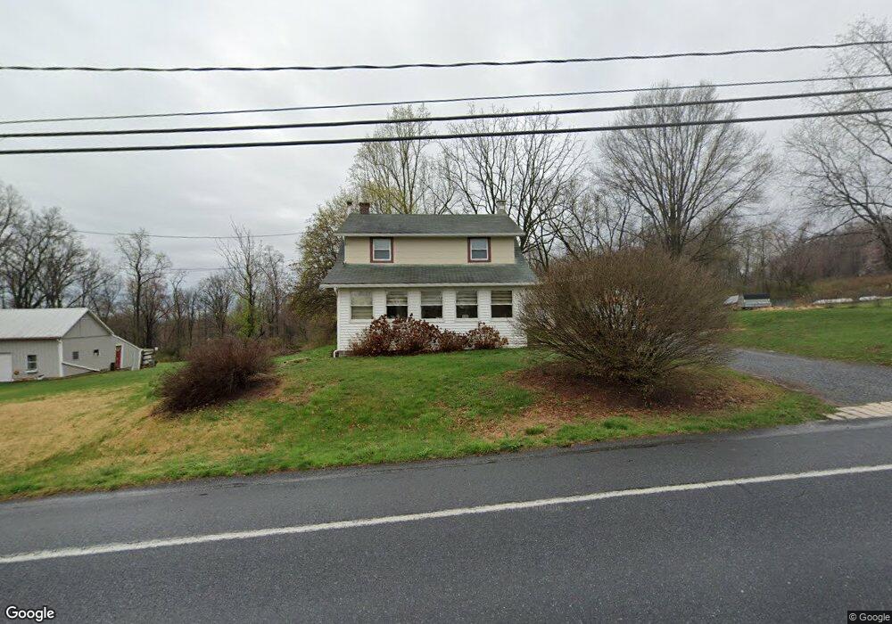
265 N King St Denver, PA 17517
Estimated Value: $255,000 - $350,000
2
Beds
1
Bath
1,407
Sq Ft
$214/Sq Ft
Est. Value
About This Home
This home is located at 265 N King St, Denver, PA 17517 and is currently estimated at $300,625, approximately $213 per square foot. 265 N King St is a home located in Lancaster County with nearby schools including Cocalico Senior High School, Reamstown Mennonite School, and Springville Mennonite School.
Ownership History
Date
Name
Owned For
Owner Type
Purchase Details
Closed on
Jun 28, 2018
Sold by
Nolt Lamar H and Nolt Lois E
Bought by
Curd Clay and Curd Jane Marie
Current Estimated Value
Home Financials for this Owner
Home Financials are based on the most recent Mortgage that was taken out on this home.
Original Mortgage
$167,089
Outstanding Balance
$145,128
Interest Rate
4.6%
Mortgage Type
Purchase Money Mortgage
Estimated Equity
$155,497
Purchase Details
Closed on
Aug 14, 2006
Sold by
Martin Edna Mae and Martin Henry L
Bought by
Nolt Lamar H and Nolt Lois E
Create a Home Valuation Report for This Property
The Home Valuation Report is an in-depth analysis detailing your home's value as well as a comparison with similar homes in the area
Home Values in the Area
Average Home Value in this Area
Purchase History
| Date | Buyer | Sale Price | Title Company |
|---|---|---|---|
| Curd Clay | $162,000 | Homesale Settlement Services | |
| Nolt Lamar H | $113,000 | None Available |
Source: Public Records
Mortgage History
| Date | Status | Borrower | Loan Amount |
|---|---|---|---|
| Open | Curd Clay | $167,089 |
Source: Public Records
Tax History Compared to Growth
Tax History
| Year | Tax Paid | Tax Assessment Tax Assessment Total Assessment is a certain percentage of the fair market value that is determined by local assessors to be the total taxable value of land and additions on the property. | Land | Improvement |
|---|---|---|---|---|
| 2025 | $3,768 | $150,600 | $71,200 | $79,400 |
| 2024 | $3,768 | $150,600 | $71,200 | $79,400 |
| 2023 | $3,681 | $150,600 | $71,200 | $79,400 |
| 2022 | $3,584 | $150,600 | $71,200 | $79,400 |
| 2021 | $3,584 | $150,600 | $71,200 | $79,400 |
| 2020 | $3,584 | $150,600 | $71,200 | $79,400 |
| 2019 | $3,541 | $150,600 | $71,200 | $79,400 |
| 2018 | $4,200 | $150,600 | $71,200 | $79,400 |
| 2017 | $3,215 | $111,900 | $29,100 | $82,800 |
| 2016 | $3,215 | $111,900 | $29,100 | $82,800 |
| 2015 | $661 | $111,900 | $29,100 | $82,800 |
| 2014 | $2,498 | $111,900 | $29,100 | $82,800 |
Source: Public Records
Map
Nearby Homes
- 505 Hertzog Valley Rd
- 135 Fraelich Rd
- 595 Netzley Dr
- 350 Indian Run Rd
- 500 Mount Airy Rd Unit 16
- 720 S Cocalico Rd
- 475 Horseshoe Trail Rd
- 755 Poplar St
- 324 Hawthorne Dr
- 2 Garvin Rd
- 12 Lancaster Ave
- 154 Larch Ln
- 218 Fausnacht Dr
- 9 Hawthorne Dr
- 128 N 4th St
- 170 W Girl Scout Rd
- 45 S Peartown Rd
- 60 W Church Rd
- 210 Stevens Rd
- 754 W Route 897
- 255 N King St
- 260 N King St
- 235 N King St
- 300A N King St
- 300 N King St
- 295 N King St
- 230 N King St
- 225a N King St Unit A
- 225a N King St
- 225A N King St
- 225 N King St Unit A
- 225 N King St
- 320 N King St
- 345 Hartings Park Rd
- 315 N King St
- 220 N King St
- 1645 S Cocalico Rd
- 1640 S Cocalico Rd
- 210 N King St
- 320 Hartings Park Rd