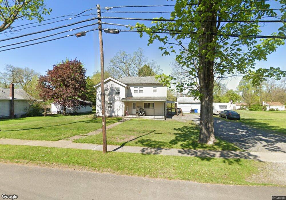
265 Park Ave Cortland, OH 44410
Estimated Value: $155,807 - $210,000
4
Beds
2
Baths
2,110
Sq Ft
$82/Sq Ft
Est. Value
About This Home
This home is located at 265 Park Ave, Cortland, OH 44410 and is currently estimated at $172,452, approximately $81 per square foot. 265 Park Ave is a home located in Trumbull County with nearby schools including Lakeview Elementary School, Lakeview Middle School, and Lakeview High School.
Ownership History
Date
Name
Owned For
Owner Type
Purchase Details
Closed on
Apr 13, 2022
Sold by
Northern Buckeye Investments Ltd
Bought by
Kesling Bryan J
Current Estimated Value
Home Financials for this Owner
Home Financials are based on the most recent Mortgage that was taken out on this home.
Original Mortgage
$127,153
Outstanding Balance
$120,485
Interest Rate
5.13%
Mortgage Type
FHA
Estimated Equity
$51,967
Purchase Details
Closed on
Oct 20, 2004
Sold by
Oconnor Annette D and Oconnor David W
Bought by
Northern Buckeye Investments Ltd
Home Financials for this Owner
Home Financials are based on the most recent Mortgage that was taken out on this home.
Original Mortgage
$74,000
Interest Rate
5.93%
Mortgage Type
New Conventional
Purchase Details
Closed on
Aug 23, 1994
Sold by
Reed Ernest
Bought by
Snyder Joyce E
Purchase Details
Closed on
Jan 1, 1990
Bought by
Earnest Mcclellan
Create a Home Valuation Report for This Property
The Home Valuation Report is an in-depth analysis detailing your home's value as well as a comparison with similar homes in the area
Home Values in the Area
Average Home Value in this Area
Purchase History
| Date | Buyer | Sale Price | Title Company |
|---|---|---|---|
| Kesling Bryan J | $129,500 | Title Professionals Group | |
| Northern Buckeye Investments Ltd | $92,500 | -- | |
| Snyder Joyce E | $51,000 | -- | |
| Earnest Mcclellan | -- | -- |
Source: Public Records
Mortgage History
| Date | Status | Borrower | Loan Amount |
|---|---|---|---|
| Open | Kesling Bryan J | $127,153 | |
| Previous Owner | Northern Buckeye Investments Ltd | $74,000 |
Source: Public Records
Tax History Compared to Growth
Tax History
| Year | Tax Paid | Tax Assessment Tax Assessment Total Assessment is a certain percentage of the fair market value that is determined by local assessors to be the total taxable value of land and additions on the property. | Land | Improvement |
|---|---|---|---|---|
| 2024 | $2,205 | $40,990 | $7,350 | $33,640 |
| 2023 | $2,205 | $40,990 | $7,350 | $33,640 |
| 2022 | $1,487 | $23,170 | $7,350 | $15,820 |
| 2021 | $1,492 | $23,170 | $7,350 | $15,820 |
| 2020 | $1,500 | $23,170 | $7,350 | $15,820 |
| 2019 | $1,363 | $20,550 | $7,350 | $13,200 |
| 2018 | $1,369 | $20,550 | $7,350 | $13,200 |
| 2017 | $1,368 | $20,550 | $7,350 | $13,200 |
| 2016 | $1,488 | $21,600 | $7,390 | $14,210 |
| 2015 | $1,483 | $21,600 | $7,390 | $14,210 |
| 2014 | $1,308 | $21,600 | $7,390 | $14,210 |
| 2013 | $1,332 | $21,600 | $7,390 | $14,210 |
Source: Public Records
Map
Nearby Homes
- 0 N High St
- 101 Elizabeth Ct
- 163 N Mecca St Unit 167
- 20 Harneds Landing Unit 20
- 167 S Mecca St
- 155 Heritage Ln
- 400 Tournament Trail Unit 400
- 151 Cedar Cir
- 278 Rosewae Ave
- 525 Sycamore Trail
- 507 Tournament Trail
- 404 Cherry Hill Ln
- 124 Saint Andrews
- 428 Cherry Hill Ln
- 160 Saint Andrews
- 408 S Colonial Dr
- 211 Natale Dr
- 121 Fairway Dr
- 4869 Phillips Rice Rd
- 105 Diamond Way Unit 105