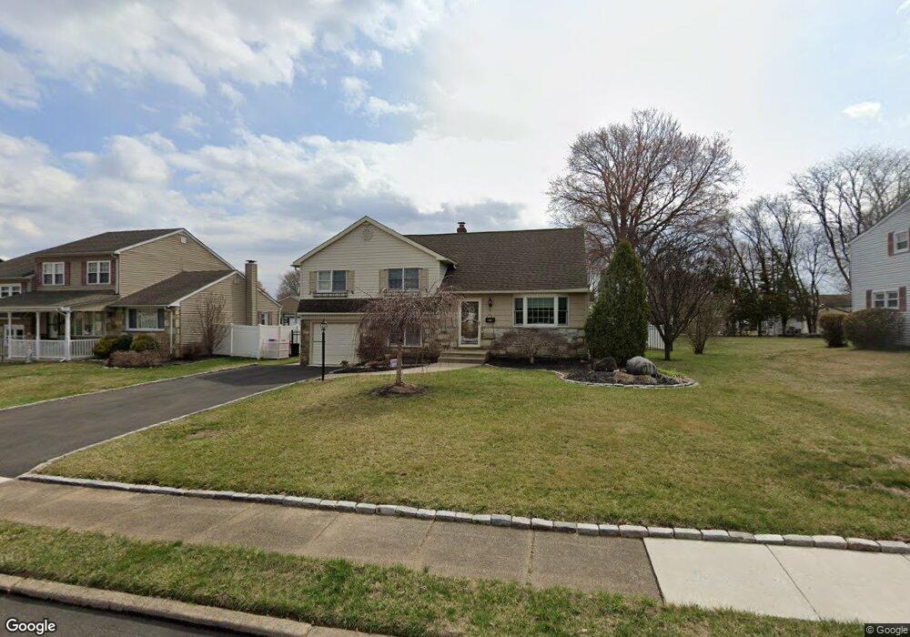
265 Poplar Rd Warminster, PA 18974
Estimated Value: $432,692 - $567,000
Studio
3
Baths
1,790
Sq Ft
$282/Sq Ft
Est. Value
About This Home
This home is located at 265 Poplar Rd, Warminster, PA 18974 and is currently estimated at $503,923, approximately $281 per square foot. 265 Poplar Rd is a home located in Bucks County with nearby schools including Willow Dale Elementary School, Log College Middle School, and William Tennent High School.
Ownership History
Date
Name
Owned For
Owner Type
Purchase Details
Closed on
Jul 2, 2013
Sold by
Price Jeffrey M and Dorozinsky Catherine
Bought by
Price Jeffrey M and Price Catharine
Current Estimated Value
Home Financials for this Owner
Home Financials are based on the most recent Mortgage that was taken out on this home.
Original Mortgage
$172,500
Outstanding Balance
$123,665
Interest Rate
3.59%
Mortgage Type
New Conventional
Estimated Equity
$380,258
Purchase Details
Closed on
Apr 23, 1999
Sold by
Hufnell Thomas E and Hufnell Judith R
Bought by
Price Jeffrey M and Dorozinsky Catharine
Home Financials for this Owner
Home Financials are based on the most recent Mortgage that was taken out on this home.
Original Mortgage
$170,900
Interest Rate
6.85%
Create a Home Valuation Report for This Property
The Home Valuation Report is an in-depth analysis detailing your home's value as well as a comparison with similar homes in the area
Home Values in the Area
Average Home Value in this Area
Purchase History
| Date | Buyer | Sale Price | Title Company |
|---|---|---|---|
| Price Jeffrey M | -- | None Available | |
| Price Jeffrey M | $179,900 | -- |
Source: Public Records
Mortgage History
| Date | Status | Borrower | Loan Amount |
|---|---|---|---|
| Open | Price Jeffrey M | $172,500 | |
| Closed | Price Jeffrey M | $170,900 |
Source: Public Records
Tax History
| Year | Tax Paid | Tax Assessment Tax Assessment Total Assessment is a certain percentage of the fair market value that is determined by local assessors to be the total taxable value of land and additions on the property. | Land | Improvement |
|---|---|---|---|---|
| 2025 | $5,319 | $25,200 | $5,640 | $19,560 |
| 2024 | $5,319 | $25,200 | $5,640 | $19,560 |
| 2023 | $5,155 | $25,200 | $5,640 | $19,560 |
| 2022 | $5,045 | $25,200 | $5,640 | $19,560 |
| 2021 | $4,927 | $25,200 | $5,640 | $19,560 |
| 2020 | $4,858 | $25,200 | $5,640 | $19,560 |
| 2019 | $4,600 | $25,200 | $5,640 | $19,560 |
| 2018 | $4,490 | $25,200 | $5,640 | $19,560 |
| 2017 | $4,359 | $25,200 | $5,640 | $19,560 |
| 2016 | $4,359 | $25,200 | $5,640 | $19,560 |
| 2015 | $4,279 | $25,200 | $5,640 | $19,560 |
| 2014 | $4,279 | $25,200 | $5,640 | $19,560 |
Source: Public Records
Map
Nearby Homes
- 240 Clearfield Cir
- 158 Wiltshire Ln
- 173 Villa Dr Unit 100
- 194 Gibson Ave
- 1246 Victoria Rd
- 189 Villa Dr Unit 108
- 64 Villa Dr Unit 206
- 60 Caledonia Dr
- 209 Fairway Dr Unit 118
- 1171 W County Line Rd
- L:26 Street Rd
- 746 Spruce Rd
- 146 Fairway Dr Unit 134
- 532 Sherwood Ln
- 1454 Kingsley Dr
- 0 York Rd
- 1413 Foster Rd
- Lot 15 Kennedy Way
- 537 Sherwood Ln
- 602 America Dr Unit FARADAY MODEL HOME
Your Personal Tour Guide
Ask me questions while you tour the home.