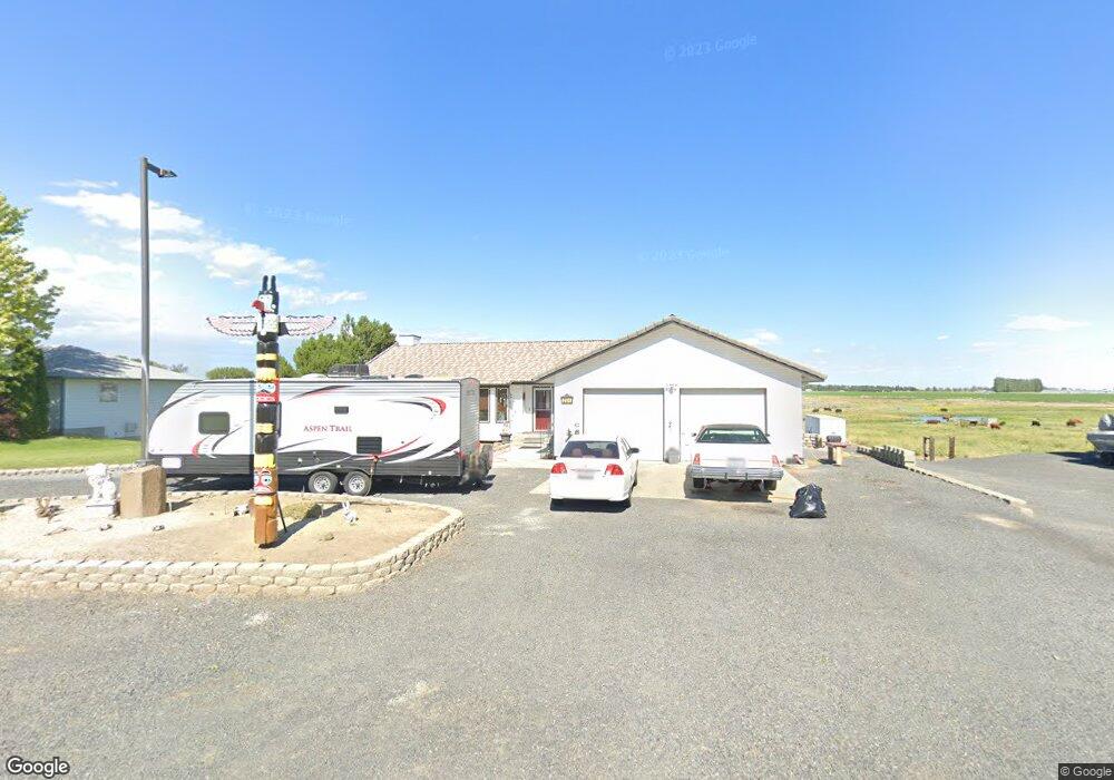
265 Road K.7 SE Moses Lake, WA 98837
Estimated Value: $499,688 - $626,000
5
Beds
2
Baths
2,006
Sq Ft
$284/Sq Ft
Est. Value
About This Home
This home is located at 265 Road K.7 SE, Moses Lake, WA 98837 and is currently estimated at $570,172, approximately $284 per square foot. 265 Road K.7 SE is a home located in Grant County with nearby schools including Sage Point Elementary School, Columbia Middle School, and Moses Lake High School.
Ownership History
Date
Name
Owned For
Owner Type
Purchase Details
Closed on
Jul 27, 2005
Sold by
Beneficial Mortgage Corp
Bought by
Grant Sam and Grant Catherine
Current Estimated Value
Home Financials for this Owner
Home Financials are based on the most recent Mortgage that was taken out on this home.
Original Mortgage
$147,920
Outstanding Balance
$77,204
Interest Rate
5.56%
Mortgage Type
Fannie Mae Freddie Mac
Estimated Equity
$492,968
Purchase Details
Closed on
Jan 28, 2005
Sold by
Lee Bruce Terry L and Lee Bruce Ronda
Bought by
Beneficial Mortgage Corp
Create a Home Valuation Report for This Property
The Home Valuation Report is an in-depth analysis detailing your home's value as well as a comparison with similar homes in the area
Home Values in the Area
Average Home Value in this Area
Purchase History
| Date | Buyer | Sale Price | Title Company |
|---|---|---|---|
| Grant Sam | $184,900 | Grant County Title | |
| Beneficial Mortgage Corp | $161,920 | Grant County Title |
Source: Public Records
Mortgage History
| Date | Status | Borrower | Loan Amount |
|---|---|---|---|
| Open | Grant Sam | $147,920 |
Source: Public Records
Tax History Compared to Growth
Tax History
| Year | Tax Paid | Tax Assessment Tax Assessment Total Assessment is a certain percentage of the fair market value that is determined by local assessors to be the total taxable value of land and additions on the property. | Land | Improvement |
|---|---|---|---|---|
| 2024 | $4,525 | $413,013 | $50,550 | $362,463 |
| 2023 | $4,221 | $331,425 | $35,415 | $296,010 |
| 2022 | $3,866 | $331,425 | $35,415 | $296,010 |
| 2021 | $3,867 | $331,425 | $35,415 | $296,010 |
| 2020 | $3,643 | $323,280 | $35,415 | $287,865 |
| 2019 | $3,765 | $289,090 | $50,200 | $238,890 |
| 2018 | $4,408 | $288,765 | $50,200 | $238,565 |
| 2017 | $3,918 | $257,035 | $50,200 | $206,835 |
| 2016 | $3,291 | $223,015 | $50,200 | $172,815 |
| 2013 | -- | $231,150 | $50,200 | $180,950 |
Source: Public Records
Map
Nearby Homes
- 12214 Heritage Ln SE
- 74 Judy Rd
- 0 E Yonezawa Blvd
- 0 NNA Yonezawa Blvd
- 2117 Dilley Ave
- 2020 Perch Ave
- 2001 Perch Ave
- 2000 Perch Ave
- 1909 Dilley Ave
- 1720 E Pirate Ln
- 510 Trout Ave
- 320 E Inglewood Dr
- 1311 S Vandal Ct
- 500 E Linden Ave
- 9460 Albert Way SE
- 253 Karl Rd NE
- 527 Road I 6 NE
- 1412 E Hunter Place
- 216 E Tanglewood Dr
- 9307 Albert Way SE
- 239 Road K.7 SE
- 11733 Baseline 2 SE
- 11733 Baseline.2 Rd SE
- 295 Road K.7 SE
- 295 Road K.7 SE
- 205 Road K.7 SE
- 11696 Baseline.2 Rd SE
- 11733 Baseline.1 Rd SE
- 11695 Baseline.1 Rd SE
- 11732 Baseline.1 Rd SE
- 88 Road K.7 SE
- 12029 Heritage Ln SE
- 12007 Heritage Ln SE
- 11735 Baseline Rd E
- 11970 Heritage Ln SE
- 12016 Heritage Ln SE
- 12037 Heritage Ln SE
- 11953 Baseline Rd E
- 12011 Baseline Rd E
- 12109 Heritage Ln SE