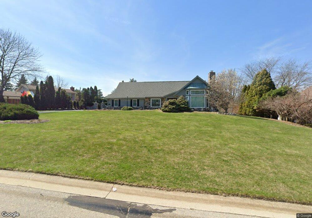
265 Sheffield Dr Brookfield, WI 53005
Estimated Value: $682,000 - $862,000
3
Beds
3
Baths
2,304
Sq Ft
$331/Sq Ft
Est. Value
About This Home
This home is located at 265 Sheffield Dr, Brookfield, WI 53005 and is currently estimated at $762,606, approximately $330 per square foot. 265 Sheffield Dr is a home located in Waukesha County with nearby schools including Swanson Elementary School, Wisconsin Hills Middle School, and Brookfield Central High School.
Ownership History
Date
Name
Owned For
Owner Type
Purchase Details
Closed on
Jan 11, 2024
Sold by
Dunlavy-Tachon Mary Lynn
Bought by
Mary Lynn Dunlavy-Tachon Revocable Living Tru and Dunlavy-Tachon
Current Estimated Value
Purchase Details
Closed on
Jan 10, 2024
Sold by
Restated Dennis P Dwyer Revocable Living and Dunlavy-Tachon Mary Lynn
Bought by
Dunlavy-Tachon Mary Lynn
Purchase Details
Closed on
Sep 10, 2021
Sold by
Dwyer Dennis P
Bought by
Dwyer Trust
Create a Home Valuation Report for This Property
The Home Valuation Report is an in-depth analysis detailing your home's value as well as a comparison with similar homes in the area
Home Values in the Area
Average Home Value in this Area
Purchase History
We collect this data history from publicly available records. To have your information removed, we recommend requesting removal directly through your county’s website.
| Date | Buyer | Sale Price | Title Company |
|---|---|---|---|
| Mary Lynn Dunlavy-Tachon Revocable Living Tru | -- | None Listed On Document | |
| Mary Lynn Dunlavy-Tachon Revocable Living Tru | -- | None Listed On Document | |
| Dunlavy-Tachon Mary Lynn | -- | None Listed On Document | |
| Dunlavy-Tachon Mary Lynn | -- | None Listed On Document | |
| Dwyer Trust | -- | None Available |
Source: Public Records
Tax History
| Year | Tax Paid | Tax Assessment Tax Assessment Total Assessment is a certain percentage of the fair market value that is determined by local assessors to be the total taxable value of land and additions on the property. | Land | Improvement |
|---|---|---|---|---|
| 2024 | $7,143 | $633,300 | $145,000 | $488,300 |
| 2023 | $7,154 | $633,300 | $145,000 | $488,300 |
| 2022 | $7,415 | $513,200 | $140,000 | $373,200 |
| 2021 | $7,858 | $513,200 | $140,000 | $373,200 |
| 2020 | $8,173 | $513,200 | $140,000 | $373,200 |
| 2019 | $7,860 | $513,200 | $140,000 | $373,200 |
| 2018 | $7,001 | $446,200 | $140,000 | $306,200 |
| 2017 | $7,984 | $446,200 | $140,000 | $306,200 |
| 2016 | $7,093 | $446,200 | $140,000 | $306,200 |
| 2015 | $7,050 | $446,200 | $140,000 | $306,200 |
| 2014 | $7,313 | $446,200 | $140,000 | $306,200 |
| 2013 | $7,313 | $446,200 | $140,000 | $306,200 |
Source: Public Records
Map
Nearby Homes
- 150 Bunker Hill Dr
- 530 Park Cir
- 295 N Elm Grove Rd Unit A
- 13350 W Bluemound Rd Unit 2
- 575 Kenmar Rd
- 825 Kurtis Dr
- 840 Kurtis Dr
- 738 Elm Grove Rd Unit 738
- 14745 Watertown Plank Rd
- 215 Leanore Ln
- 305 Leanore Ln
- 14745 Timberidge Trail
- 13050 W Bluemound Rd Unit 307
- 12990 W Bluemound Rd Unit 103
- 13060 W Bluemound Rd Unit 201
- 13060 W Bluemound Rd Unit 101
- 805 Lone Tree Rd
- 825 Lone Tree Rd
- 1065 Lower Ridgeway
- 13335 Watertown Plank Rd Unit 105
- 190 Bunker Hill Dr
- 230 Bunker Hill Dr
- 280 Sheffield Dr
- 175 Bunker Hill Dr
- 205 Bunker Hill Dr
- 110 Bunker Hill Dr
- 135 Bunker Hill Dr
- 225 Bunker Hill Dr
- 320 Sheffield Dr
- 260 Bunker Hill Dr
- 150 Stockton Ct
- 335 Sheffield Dr
- 180 Stockton Ct
- 255 Bunker Hill Dr
- 120 Stockton Ct
- 300 Bunker Hill Dr
- 350 Sheffield Dr
- 14045 Golf Pkwy
- 365 Sheffield Dr
- 275 Bunker Hill Dr
Your Personal Tour Guide
Ask me questions while you tour the home.