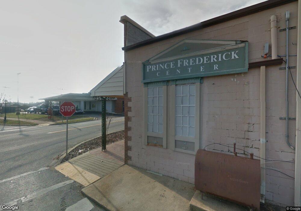
265 Solomons Island Rd S Prince Frederick, MD 20678
Estimated Value: $5,108,044
--
Bed
--
Bath
1,740
Sq Ft
$2,936/Sq Ft
Est. Value
About This Home
This home is located at 265 Solomons Island Rd S, Prince Frederick, MD 20678 and is currently estimated at $5,108,044, approximately $2,935 per square foot. 265 Solomons Island Rd S is a home located in Calvert County with nearby schools including Barstow Elementary School, Calvert Middle School, and Calvert High School.
Ownership History
Date
Name
Owned For
Owner Type
Purchase Details
Closed on
Oct 19, 2007
Sold by
R T E Enterprises Llc
Bought by
Kody Holdings Prince Frederick Llc
Current Estimated Value
Purchase Details
Closed on
Oct 15, 2007
Sold by
R T E Enterprises Llc
Bought by
Kody Holdings Prince Frederick Llc
Purchase Details
Closed on
Apr 29, 2005
Sold by
Prince Frederick Motor Co Inc
Bought by
R T E Enterprises Llc
Purchase Details
Closed on
Apr 28, 2005
Sold by
Prince Frederick Motor Co Inc
Bought by
R T E Enterprises Llc
Create a Home Valuation Report for This Property
The Home Valuation Report is an in-depth analysis detailing your home's value as well as a comparison with similar homes in the area
Home Values in the Area
Average Home Value in this Area
Purchase History
| Date | Buyer | Sale Price | Title Company |
|---|---|---|---|
| Kody Holdings Prince Frederick Llc | $3,750,000 | -- | |
| Kody Holdings Prince Frederick Llc | $3,750,000 | -- | |
| R T E Enterprises Llc | $3,672,850 | -- | |
| R T E Enterprises Llc | $3,672,850 | -- |
Source: Public Records
Tax History Compared to Growth
Tax History
| Year | Tax Paid | Tax Assessment Tax Assessment Total Assessment is a certain percentage of the fair market value that is determined by local assessors to be the total taxable value of land and additions on the property. | Land | Improvement |
|---|---|---|---|---|
| 2025 | $14,877 | $1,392,933 | $0 | $0 |
| 2024 | $14,877 | $1,358,700 | $563,800 | $794,900 |
| 2023 | $14,331 | $1,358,700 | $563,800 | $794,900 |
| 2022 | $14,328 | $1,358,700 | $563,800 | $794,900 |
| 2021 | $21,330 | $2,076,000 | $563,800 | $1,512,200 |
| 2020 | $21,330 | $2,023,500 | $0 | $0 |
| 2019 | $20,878 | $1,971,000 | $0 | $0 |
| 2018 | $20,314 | $1,918,500 | $563,800 | $1,354,700 |
| 2017 | $20,115 | $1,873,067 | $0 | $0 |
| 2016 | -- | $1,827,633 | $0 | $0 |
| 2015 | $15,718 | $1,782,200 | $0 | $0 |
| 2014 | $15,718 | $1,705,233 | $0 | $0 |
Source: Public Records
Map
Nearby Homes
- 447 Dark Star Way
- 365 Equestrian Way
- 103 Westlake Blvd
- 360 Whirlaway Dr
- 512 Falcon Place
- 125 Polo Way
- 49 Thoroughbred Dr
- 667 Hawk Hill Dr
- 85 Mason Rd
- 240 Mason Rd
- 0 Armory Rd
- 380 Mason Rd
- 579 English Oak Ln
- The Benedict A Plan at Patuxent Commons
- The Benedict B2 Plan at Patuxent Commons
- The Benedict C Plan at Patuxent Commons
- 185 Radio Dr
- 592 Burr Oak Ct
- 84 Potomac Ct
- 362 Cambridge Place
- 255 Solomons Island Rd S
- 315 Solomons Island Rd S
- 69 Sherry Ln
- 65 Sherry Ln
- 75 Sherry Ln
- 220 Solomons Island Rd S
- 3 Sherry Ln
- 246 Rimfire Way
- 252 Rimfire Way
- 275 Merrimac Ct
- 338 Majestic Ln
- 240 Rimfire Way
- 258 Rimfire Way
- 289 Merrimac Ct
- 345 Majestic Ln
- 344 Majestic Ln
- 300 Whirlaway Dr
- 60 Sherry Ln
- 355 Merrimac Ct
- 15 Duke St