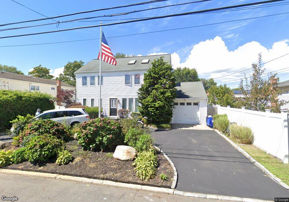
265 Tremont Rd Unit 1st Fl Lindenhurst, NY 11757
Estimated Value: $610,564 - $694,000
2
Beds
1
Bath
1,692
Sq Ft
$392/Sq Ft
Est. Value
About This Home
This home is located at 265 Tremont Rd Unit 1st Fl, Lindenhurst, NY 11757 and is currently estimated at $662,641, approximately $391 per square foot. 265 Tremont Rd Unit 1st Fl is a home located in Suffolk County with nearby schools including William Rall School, Lindenhurst Middle School, and Lindenhurst Senior High School.
Ownership History
Date
Name
Owned For
Owner Type
Purchase Details
Closed on
Oct 30, 2016
Sold by
Collins Bryan
Bought by
Orzechowski Nobert and Gardocki Wojeiech C
Current Estimated Value
Purchase Details
Closed on
Oct 23, 2012
Sold by
Broszeit Eleanor and Broszeit Eleanor Squicciarini
Bought by
Collins Bryan
Home Financials for this Owner
Home Financials are based on the most recent Mortgage that was taken out on this home.
Original Mortgage
$216,000
Interest Rate
3.39%
Mortgage Type
New Conventional
Purchase Details
Closed on
Jul 2, 1982
Sold by
Town Of Babylon
Bought by
Broszeit Eleanor Squicciarini
Create a Home Valuation Report for This Property
The Home Valuation Report is an in-depth analysis detailing your home's value as well as a comparison with similar homes in the area
Home Values in the Area
Average Home Value in this Area
Purchase History
| Date | Buyer | Sale Price | Title Company |
|---|---|---|---|
| Orzechowski Nobert | $360,000 | -- | |
| Collins Bryan | $270,000 | United Hudson Title | |
| Broszeit Eleanor Squicciarini | -- | -- |
Source: Public Records
Mortgage History
| Date | Status | Borrower | Loan Amount |
|---|---|---|---|
| Previous Owner | Collins Bryan | $216,000 |
Source: Public Records
Tax History Compared to Growth
Tax History
| Year | Tax Paid | Tax Assessment Tax Assessment Total Assessment is a certain percentage of the fair market value that is determined by local assessors to be the total taxable value of land and additions on the property. | Land | Improvement |
|---|---|---|---|---|
| 2024 | $13,472 | $3,320 | $270 | $3,050 |
| 2023 | $13,472 | $3,320 | $270 | $3,050 |
| 2022 | $9,950 | $3,320 | $270 | $3,050 |
| 2021 | $9,950 | $3,320 | $270 | $3,050 |
| 2020 | $11,681 | $3,320 | $270 | $3,050 |
| 2019 | $11,681 | $0 | $0 | $0 |
| 2018 | $9,878 | $3,320 | $270 | $3,050 |
| 2017 | $9,878 | $3,320 | $270 | $3,050 |
| 2016 | $9,914 | $3,320 | $270 | $3,050 |
| 2015 | -- | $3,320 | $270 | $3,050 |
| 2014 | -- | $3,790 | $270 | $3,520 |
Source: Public Records
Map
Nearby Homes
- 456 Heathcote Rd
- 16 Burton Place
- 430 Heathcote Rd
- 45 Feustal St
- 1029 N Niagara Ave
- 0 Tenety Ave Unit 3461459
- 165 Tremont Rd
- 61 Kellum St Unit A and B
- 61 Kellum St Unit 61A
- 156 Farmers Ave
- 83 Justice St
- 108 Justice St
- 957 N Fulton Ave
- 702 6th St
- 940 N Erie Ave
- 48 Farmers Ave
- 10 Winchester Dr
- 583 Straight Path
- 436 Herzel Blvd
- 45 Farber Dr