
Seller's Agent in 2025
Rebecca Kallhoff
RE/MAX
(480) 275-9566
9 in this area
72 Total Sales
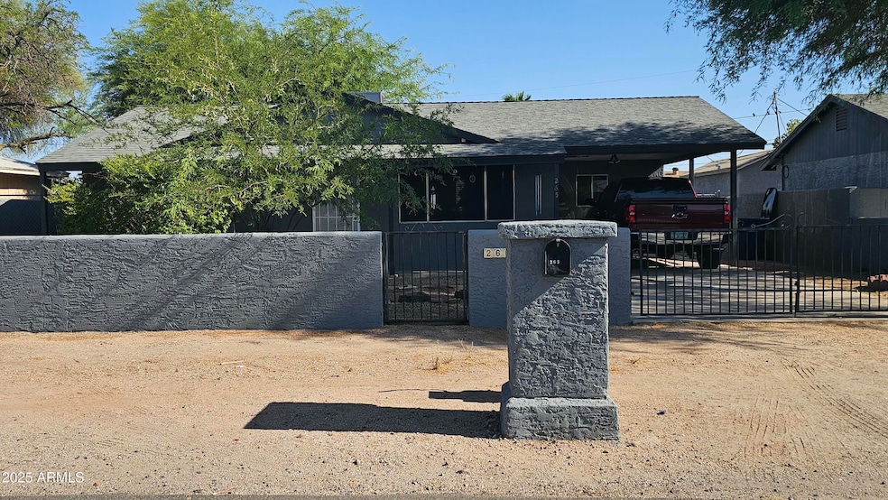
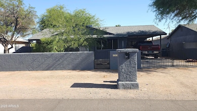
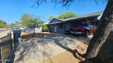
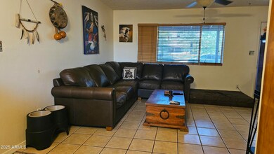
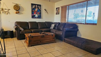
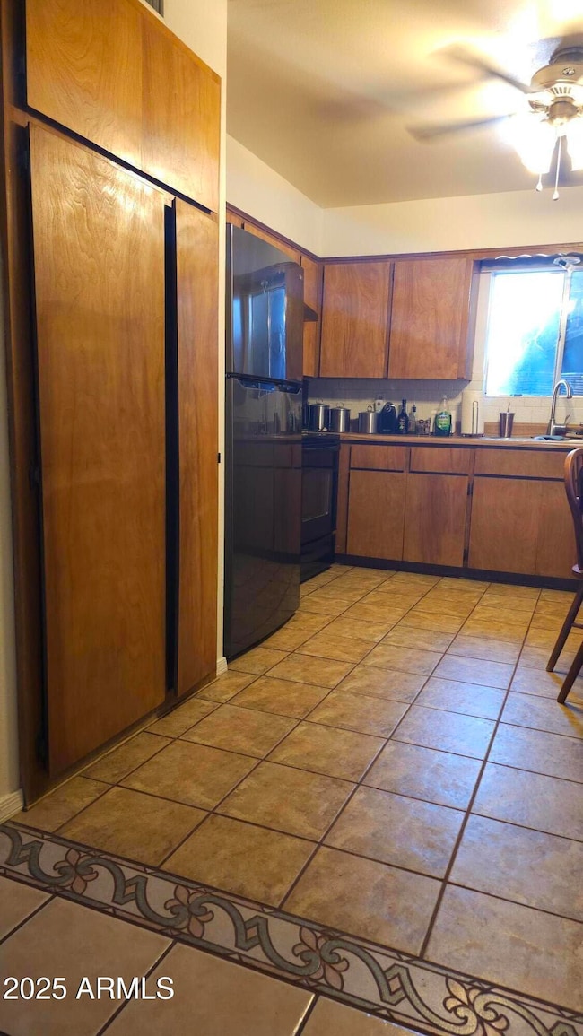
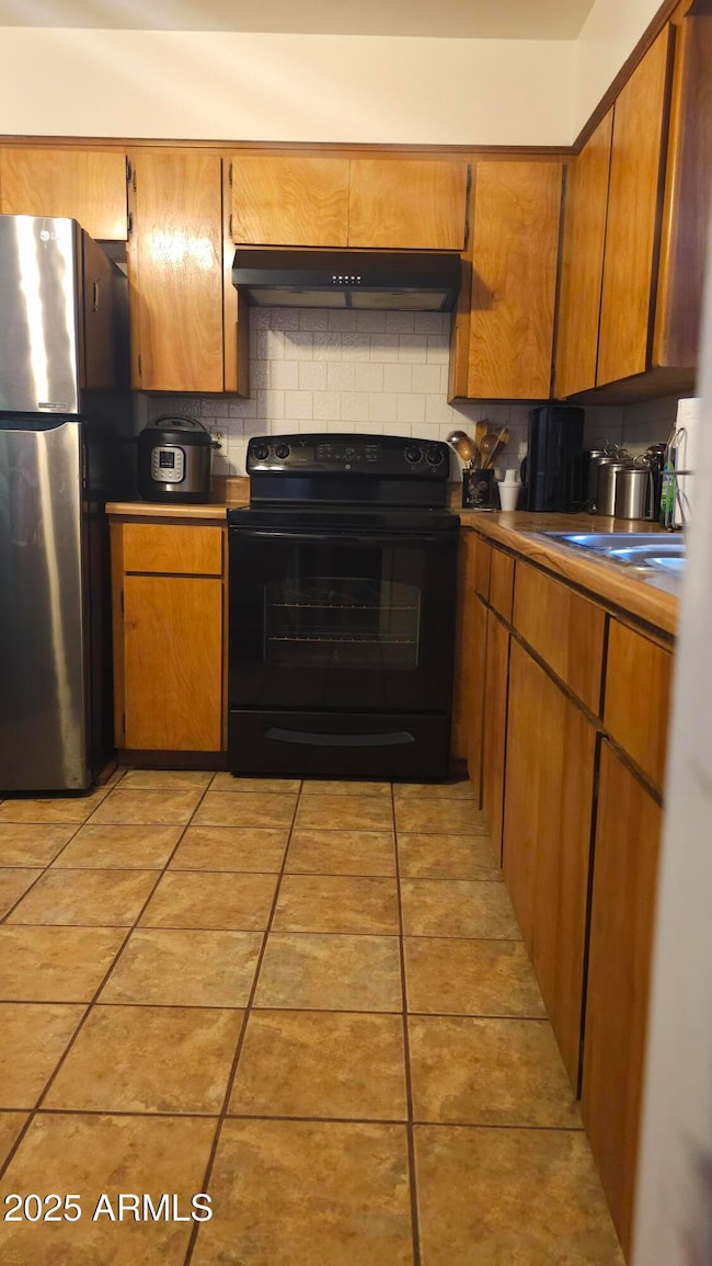
Welcome to this delightful 2-bedroom, 1-bath home that blends comfort and style in every detail. Featuring beautiful tile flooring throughout, this home is both low-maintenance & elegant. Enjoy year-round comfort with a brand-new AC installed in 2024 & a newer roof with a 35-year warranty, providing peace of mind for years to come. The Arizona room offers a versatile space to relax, work, or entertain—& it's has AC for added comfort. Step outside to a generous backyard enclosed by a fully block-fenced yard, stuccoed and freshly painted for a clean, modern finish. Additional highlights include two storage sheds that stay with the property and fresh exterior paint that enhances curb appeal. This move-in ready home is perfect for anyone seeking charm.
Last Agent to Sell the Property
RE/MAX Alliance Group License #SA558499000 Listed on: 06/19/2025
| Date | Type | Sale Price | Title Company |
|---|---|---|---|
| Warranty Deed | $300,000 | Homelight Settlement | |
| Interfamily Deed Transfer | -- | Driggs Title Agency Inc | |
| Warranty Deed | $50,300 | United Title Agency | |
| Quit Claim Deed | -- | -- | |
| Quit Claim Deed | -- | United Title Agency |
| Date | Status | Loan Amount | Loan Type |
|---|---|---|---|
| Open | $10,500 | New Conventional | |
| Open | $294,566 | FHA | |
| Previous Owner | $72,000 | New Conventional | |
| Previous Owner | $48,824 | FHA |
| Date | Event | Price | List to Sale | Price per Sq Ft |
|---|---|---|---|---|
| 10/30/2025 10/30/25 | Sold | $300,000 | 0.0% | $332 / Sq Ft |
| 07/29/2025 07/29/25 | Price Changed | $300,000 | -3.2% | $332 / Sq Ft |
| 06/19/2025 06/19/25 | For Sale | $310,000 | -- | $343 / Sq Ft |
| Year | Tax Paid | Tax Assessment Tax Assessment Total Assessment is a certain percentage of the fair market value that is determined by local assessors to be the total taxable value of land and additions on the property. | Land | Improvement |
|---|---|---|---|---|
| 2025 | $795 | $14,873 | -- | -- |
| 2024 | $764 | $20,609 | -- | -- |
| 2023 | $783 | $15,471 | $0 | $0 |
| 2022 | $750 | $11,237 | $4,192 | $7,045 |
| 2021 | $764 | $10,379 | $0 | $0 |
| 2020 | $745 | $9,794 | $0 | $0 |
| 2019 | $714 | $9,401 | $0 | $0 |
| 2018 | $700 | $5,692 | $0 | $0 |
| 2017 | $681 | $5,036 | $0 | $0 |
| 2016 | $664 | $4,972 | $1,100 | $3,872 |
| 2014 | $657 | $3,843 | $1,100 | $2,743 |
Seller's Agent in 2025
Rebecca Kallhoff
RE/MAX
(480) 275-9566
9 in this area
72 Total Sales
Buyer's Agent in 2025
Brandon Howe
Howe Realty
(602) 909-6513
5 in this area
1,529 Total Sales
Buyer Co-Listing Agent in 2025
Riky Serrano
Howe Realty
(623) 633-6887
1 in this area
61 Total Sales
Source: Arizona Regional Multiple Listing Service (ARMLS)
MLS Number: 6882743
APN: 102-09-120
Disclaimer: Certain information contained herein is derived from information provided by parties other than Homes.com. All information provided is deemed reliable, but is not guaranteed to be accurate and should be independently verified.
![]() All information should be verified by the recipient and none is guaranteed as accurate by ARMLS
All information should be verified by the recipient and none is guaranteed as accurate by ARMLS
Listing Information presented by local MLS brokerage: Ten-X, local REALTOR®- Arlene Richardson - (888)-952-6393
Ask me questions while you tour the home.