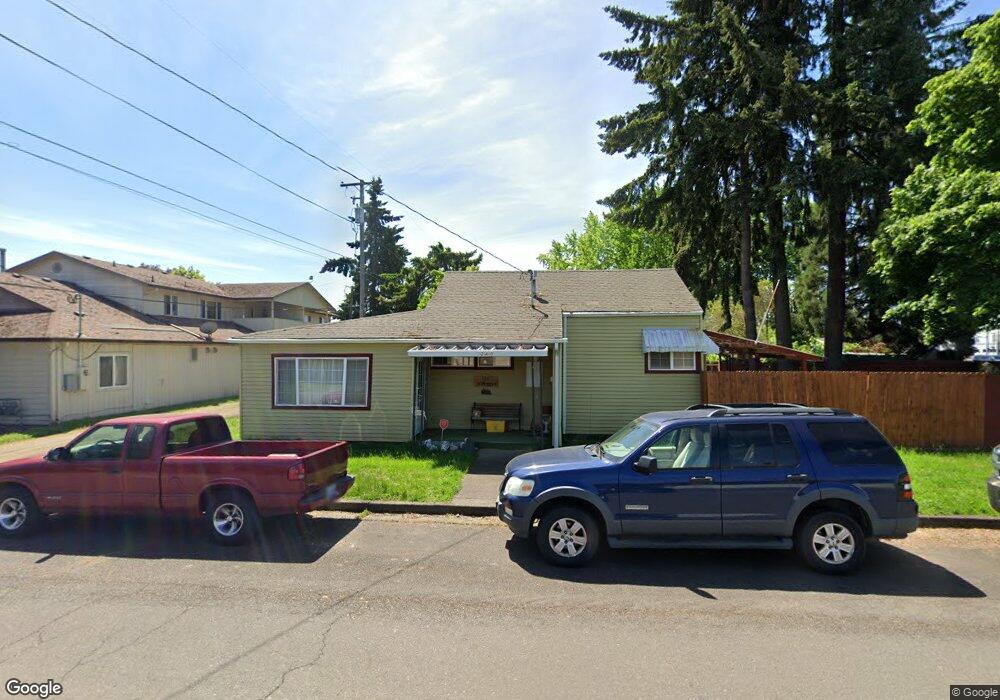
265 W 3rd Ave Junction City, OR 97448
Estimated Value: $350,959 - $390,000
2
Beds
1
Bath
1,320
Sq Ft
$277/Sq Ft
Est. Value
About This Home
This home is located at 265 W 3rd Ave, Junction City, OR 97448 and is currently estimated at $366,240, approximately $277 per square foot. 265 W 3rd Ave is a home located in Lane County with nearby schools including Junction City High School.
Ownership History
Date
Name
Owned For
Owner Type
Purchase Details
Closed on
Nov 23, 2005
Sold by
Freese Gary A
Bought by
Jackson James W and Jackson Patricia
Current Estimated Value
Home Financials for this Owner
Home Financials are based on the most recent Mortgage that was taken out on this home.
Original Mortgage
$32,600
Outstanding Balance
$18,001
Interest Rate
6.07%
Mortgage Type
Stand Alone Second
Estimated Equity
$348,239
Create a Home Valuation Report for This Property
The Home Valuation Report is an in-depth analysis detailing your home's value as well as a comparison with similar homes in the area
Home Values in the Area
Average Home Value in this Area
Purchase History
| Date | Buyer | Sale Price | Title Company |
|---|---|---|---|
| Jackson James W | $163,000 | Fidelity National Title Insu |
Source: Public Records
Mortgage History
| Date | Status | Borrower | Loan Amount |
|---|---|---|---|
| Open | Jackson James W | $32,600 | |
| Open | Jackson James W | $130,400 |
Source: Public Records
Tax History Compared to Growth
Tax History
| Year | Tax Paid | Tax Assessment Tax Assessment Total Assessment is a certain percentage of the fair market value that is determined by local assessors to be the total taxable value of land and additions on the property. | Land | Improvement |
|---|---|---|---|---|
| 2024 | $2,410 | $143,552 | -- | -- |
| 2023 | $2,410 | $139,371 | $0 | $0 |
| 2022 | $2,248 | $135,312 | $0 | $0 |
| 2021 | $2,203 | $131,371 | $0 | $0 |
| 2020 | $2,133 | $127,545 | $0 | $0 |
| 2019 | $2,058 | $123,831 | $0 | $0 |
| 2018 | $1,999 | $116,723 | $0 | $0 |
| 2017 | $1,928 | $116,723 | $0 | $0 |
| 2016 | $1,875 | $113,323 | $0 | $0 |
| 2015 | $1,657 | $110,022 | $0 | $0 |
| 2014 | $1,664 | $106,817 | $0 | $0 |
Source: Public Records
Map
Nearby Homes
- 351 Juniper St
- 617 Juniper St
- 271 Alder St
- 93982 Prairie (Off Street) Rd
- 805 Deal St
- 930 Holly St
- 0 Holly St
- 1085 W 1st Ave Unit 8
- 954 Elm St
- 810 Birch St
- 188 Sumac Ct
- 1021 Deal St
- 346 E 10th Place
- 1010 Birch Place
- 1090 Nyssa St
- 1225 W 10th Ave Unit 26
- 1225 W 10th Ave Unit 28
- 1225 W 10th Ave Unit 50
- 1225 W 10th Ave Unit 53
- 1066 SW Coral St
- 246 Holly St
- 310 Holly St
- 283 Greenwood St
- 275 Greenwood St
- 330 Holly St
- 321 Greenwood St
- 245 Greenwood St
- 331 Greenwood St
- 272 W 2nd Ave
- 221 Greenwood St
- 355 W 3rd Ave
- 175 W 3rd Ave
- 289 W 4th Ave
- 240 Greenwood St
- 320 Greenwood St
- 330 Greenwood St
- 2394 W 8th Ave
- 2459 W 10th Ave
- 2469 W 10th Ave
- 170 W 2nd Ave