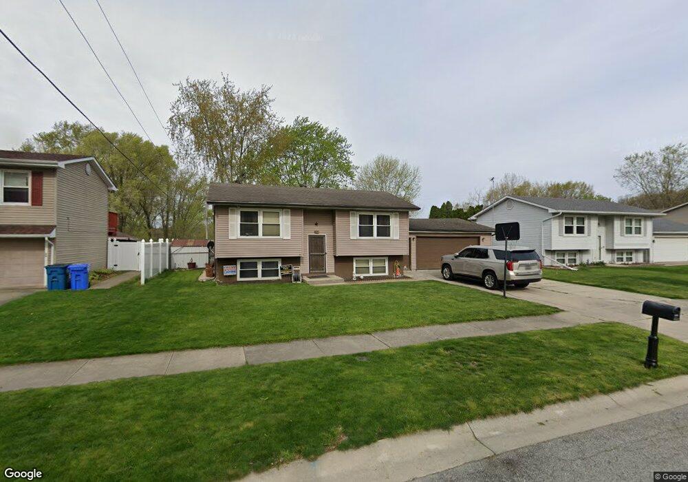
265 Walnut Ln Crown Point, IN 46307
Estimated Value: $265,000 - $313,000
2
Beds
1
Bath
1,706
Sq Ft
$168/Sq Ft
Est. Value
About This Home
This home is located at 265 Walnut Ln, Crown Point, IN 46307 and is currently estimated at $286,210, approximately $167 per square foot. 265 Walnut Ln is a home located in Lake County with nearby schools including Lake Street Elementary School, Robert Taft Middle School, and Crown Point High School.
Ownership History
Date
Name
Owned For
Owner Type
Purchase Details
Closed on
Oct 14, 2009
Sold by
Dapkus Steven and Estate Of Andrew Dapkus
Bought by
Powers Lorianna M
Current Estimated Value
Home Financials for this Owner
Home Financials are based on the most recent Mortgage that was taken out on this home.
Original Mortgage
$126,172
Outstanding Balance
$81,338
Interest Rate
5.07%
Mortgage Type
FHA
Estimated Equity
$204,872
Create a Home Valuation Report for This Property
The Home Valuation Report is an in-depth analysis detailing your home's value as well as a comparison with similar homes in the area
Home Values in the Area
Average Home Value in this Area
Purchase History
| Date | Buyer | Sale Price | Title Company |
|---|---|---|---|
| Powers Lorianna M | -- | Community Title Community |
Source: Public Records
Mortgage History
| Date | Status | Borrower | Loan Amount |
|---|---|---|---|
| Open | Powers Lorianna M | $126,172 |
Source: Public Records
Tax History
| Year | Tax Paid | Tax Assessment Tax Assessment Total Assessment is a certain percentage of the fair market value that is determined by local assessors to be the total taxable value of land and additions on the property. | Land | Improvement |
|---|---|---|---|---|
| 2025 | $1,865 | $215,000 | $34,100 | $180,900 |
| 2024 | $4,887 | $192,600 | $34,100 | $158,500 |
| 2023 | $1,855 | $177,800 | $34,100 | $143,700 |
| 2022 | $1,855 | $170,300 | $34,100 | $136,200 |
| 2021 | $1,847 | $172,000 | $26,600 | $145,400 |
| 2020 | $1,796 | $165,600 | $26,600 | $139,000 |
| 2019 | $1,764 | $159,100 | $26,600 | $132,500 |
| 2018 | $1,791 | $153,600 | $26,600 | $127,000 |
| 2017 | $1,692 | $146,100 | $26,600 | $119,500 |
| 2016 | $1,839 | $152,700 | $26,600 | $126,100 |
| 2014 | $1,586 | $145,500 | $26,500 | $119,000 |
| 2013 | $1,438 | $137,600 | $26,600 | $111,000 |
Source: Public Records
Map
Nearby Homes
- 460 O'Hagan Dr
- 138 S Chase Dr
- 114 S Chase Dr
- 629 W South St
- 619 W North St
- 412 W South St
- 437 Fairview Ave
- 600 W North St
- 817 Mary Ellen Dr
- 0 W Joliet St
- 301 Hoffman St
- 10813 Lane St
- 7770 W 106th Ln
- 306 Holton Ridge
- 767 Kenmare Pkwy
- 771 Kenmare Pkwy
- 772 Kenmare Pkwy
- 10607 Lane St
- 123 Elmwood Place
- 511 N West St
Your Personal Tour Guide
Ask me questions while you tour the home.