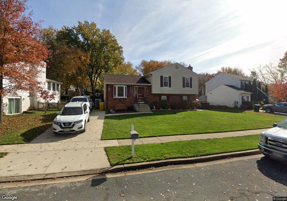
265 Way Cross Way Arnold, MD 21012
Estimated Value: $588,304 - $687,000
--
Bed
3
Baths
1,952
Sq Ft
$323/Sq Ft
Est. Value
About This Home
This home is located at 265 Way Cross Way, Arnold, MD 21012 and is currently estimated at $630,076, approximately $322 per square foot. 265 Way Cross Way is a home located in Anne Arundel County with nearby schools including Arnold Elementary School, Severn River Middle School, and Broadneck High School.
Ownership History
Date
Name
Owned For
Owner Type
Purchase Details
Closed on
Apr 29, 2024
Sold by
Hott Michael W and Hott Marian J
Bought by
Gunning John M and Taylor Megan L
Current Estimated Value
Home Financials for this Owner
Home Financials are based on the most recent Mortgage that was taken out on this home.
Original Mortgage
$525,150
Outstanding Balance
$517,772
Interest Rate
6.87%
Mortgage Type
New Conventional
Estimated Equity
$112,304
Purchase Details
Closed on
Feb 29, 1984
Bought by
Hott Michael W and Hott Marian J
Home Financials for this Owner
Home Financials are based on the most recent Mortgage that was taken out on this home.
Original Mortgage
$72,650
Interest Rate
13.25%
Create a Home Valuation Report for This Property
The Home Valuation Report is an in-depth analysis detailing your home's value as well as a comparison with similar homes in the area
Home Values in the Area
Average Home Value in this Area
Purchase History
| Date | Buyer | Sale Price | Title Company |
|---|---|---|---|
| Gunning John M | $589,000 | Community Title Network | |
| Gunning John M | $589,000 | Community Title Network | |
| Hott Michael W | $97,300 | -- |
Source: Public Records
Mortgage History
| Date | Status | Borrower | Loan Amount |
|---|---|---|---|
| Open | Gunning John M | $525,150 | |
| Closed | Gunning John M | $525,150 | |
| Previous Owner | Hott Michael W | $72,650 |
Source: Public Records
Tax History Compared to Growth
Tax History
| Year | Tax Paid | Tax Assessment Tax Assessment Total Assessment is a certain percentage of the fair market value that is determined by local assessors to be the total taxable value of land and additions on the property. | Land | Improvement |
|---|---|---|---|---|
| 2025 | $4,956 | $452,267 | -- | -- |
| 2024 | $4,956 | $406,700 | $257,200 | $149,500 |
| 2023 | $3,421 | $402,367 | $0 | $0 |
| 2022 | $3,206 | $398,033 | $0 | $0 |
| 2021 | $3,043 | $393,700 | $242,200 | $151,500 |
| 2020 | $3,043 | $369,133 | $0 | $0 |
| 2019 | $5,947 | $344,567 | $0 | $0 |
| 2018 | $3,245 | $320,000 | $179,100 | $140,900 |
| 2017 | $2,793 | $320,000 | $0 | $0 |
| 2016 | -- | $320,000 | $0 | $0 |
| 2015 | -- | $324,300 | $0 | $0 |
| 2014 | -- | $324,300 | $0 | $0 |
Source: Public Records
Map
Nearby Homes
- 1078 Brightleaf Ct
- 1215 Driftwood Ct
- 303 Ternwing Dr
- 249 Overleaf Dr
- Severn Plan at Ford's Grant
- Newport Plan at Ford's Grant
- Magothy Plan at Ford's Grant
- 0 Moore Rd
- 1232 Taylor Ave
- 276 Overleaf Dr
- 00 Mazie
- 0000 Mazie
- 516 Norton Ln
- 317 Long Meadow Way
- 832 Clifton Ave
- 1256 Crowell Ct
- 1277 Ritchie Hwy Unit 195
- 1199 Asquithpines Place
- 131 Admirals Ridge Dr
- 817 Barrett Ave
- 265 Waycross Way
- 267 Way Cross Way
- 263 Way Cross Way
- 266 Foxfire Ct
- 269 Way Cross Way
- 432 Haven Holme Ct
- 260 Way Cross Way
- 268 Foxfire Ct
- 262 Way Cross Way
- 264 Way Cross Way
- 258 Way Cross Way
- 268 Way Cross Way
- 255 Way Cross Way
- 434 Haven Holme Ct
- 255 Waycross Way
- 256 Way Cross Way
- 271 Way Cross Way
- 267 Foxfire Ct
- 269 Foxfire Ct
- 270 Way Cross Way