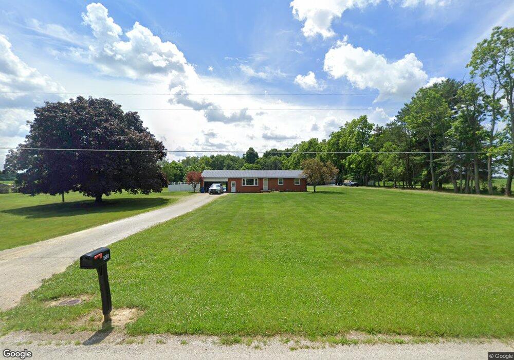
2650 Peterson Rd Mansfield, OH 44903
Estimated Value: $252,000 - $277,000
3
Beds
1
Bath
1,144
Sq Ft
$231/Sq Ft
Est. Value
About This Home
This home is located at 2650 Peterson Rd, Mansfield, OH 44903 and is currently estimated at $263,824, approximately $230 per square foot. 2650 Peterson Rd is a home located in Richland County with nearby schools including Madison High School, St. Mary Catholic School, and Temple-Christian School.
Ownership History
Date
Name
Owned For
Owner Type
Purchase Details
Closed on
Jul 7, 2015
Sold by
Eddleblute Rodney D and Eddleblute Elizabeth J
Bought by
Eddleblute Ryan R and Eddleblute Rodney D
Current Estimated Value
Purchase Details
Closed on
Aug 25, 2006
Sold by
Cassidy Michael Sid and Cassidy Susan L
Bought by
Eddleblute Rodney D and Eddleblute Elizabeth J
Home Financials for this Owner
Home Financials are based on the most recent Mortgage that was taken out on this home.
Original Mortgage
$108,000
Interest Rate
6.44%
Mortgage Type
Purchase Money Mortgage
Create a Home Valuation Report for This Property
The Home Valuation Report is an in-depth analysis detailing your home's value as well as a comparison with similar homes in the area
Home Values in the Area
Average Home Value in this Area
Purchase History
| Date | Buyer | Sale Price | Title Company |
|---|---|---|---|
| Eddleblute Ryan R | -- | Chicago Title | |
| Eddleblute Rodney D | $135,000 | None Available |
Source: Public Records
Mortgage History
| Date | Status | Borrower | Loan Amount |
|---|---|---|---|
| Closed | Eddleblute Rodney D | $108,000 |
Source: Public Records
Tax History Compared to Growth
Tax History
| Year | Tax Paid | Tax Assessment Tax Assessment Total Assessment is a certain percentage of the fair market value that is determined by local assessors to be the total taxable value of land and additions on the property. | Land | Improvement |
|---|---|---|---|---|
| 2024 | $3,259 | $63,190 | $15,790 | $47,400 |
| 2023 | $3,259 | $63,190 | $15,790 | $47,400 |
| 2022 | $2,549 | $45,350 | $12,650 | $32,700 |
| 2021 | $2,496 | $45,350 | $12,650 | $32,700 |
| 2020 | $2,515 | $45,350 | $12,650 | $32,700 |
| 2019 | $2,290 | $38,530 | $10,630 | $27,900 |
| 2018 | $2,271 | $38,530 | $10,630 | $27,900 |
| 2017 | $2,229 | $38,530 | $10,630 | $27,900 |
| 2016 | $2,236 | $37,760 | $10,100 | $27,660 |
| 2015 | $2,236 | $37,760 | $10,100 | $27,660 |
| 2014 | $2,082 | $35,100 | $7,440 | $27,660 |
| 2012 | $2,010 | $36,950 | $7,830 | $29,120 |
Source: Public Records
Map
Nearby Homes
- 2750 Lutz Ave
- 0 Peterson Rd
- 2641 State Route 430
- 609 Mcbride Rd
- 0 McBride Road Parcel # 1 Unit 9066028
- 598 Impala Dr
- 630 Impala Dr
- 0 Satinwood Dr
- 775 Touby Ln
- 2495 Emma Ln
- 640 Running Brook Way
- 2270 Lakecrest Dr Unit 2272
- 76 Ford Rd N
- 76 Ford Rd N Unit 20
- 641 Laver Rd
- 0 Mcelroy Rd
- 0 Mount Zion Rd Unit 9069748
- 304 Esley Ln
- 3290 Shad Dr W
- 0 State Route 39 & I-71 Northeast Quadrant
- 2682 Peterson Rd
- 2610 Peterson Rd
- 2580 Peterson Rd
- 2704 Peterson Rd
- 2697 Peterson Rd
- 2692 Peterson Rd
- 2718 Peterson Rd
- 521 Wolf Rd
- 2715 Peterson Rd
- 2730 Peterson Rd
- 2565 Peterson Rd
- 2744 Peterson Rd
- 2735 Peterson Rd
- 495 Wolf Rd
- 2758 Peterson Rd
- 346 Colonial Dr
- 2751 Peterson Rd
- 2515 Peterson Rd
- 2770 Peterson Rd
- 324 Colonial Dr