Estimated Value: $406,518 - $439,000
4
Beds
3
Baths
2,280
Sq Ft
$184/Sq Ft
Est. Value
About This Home
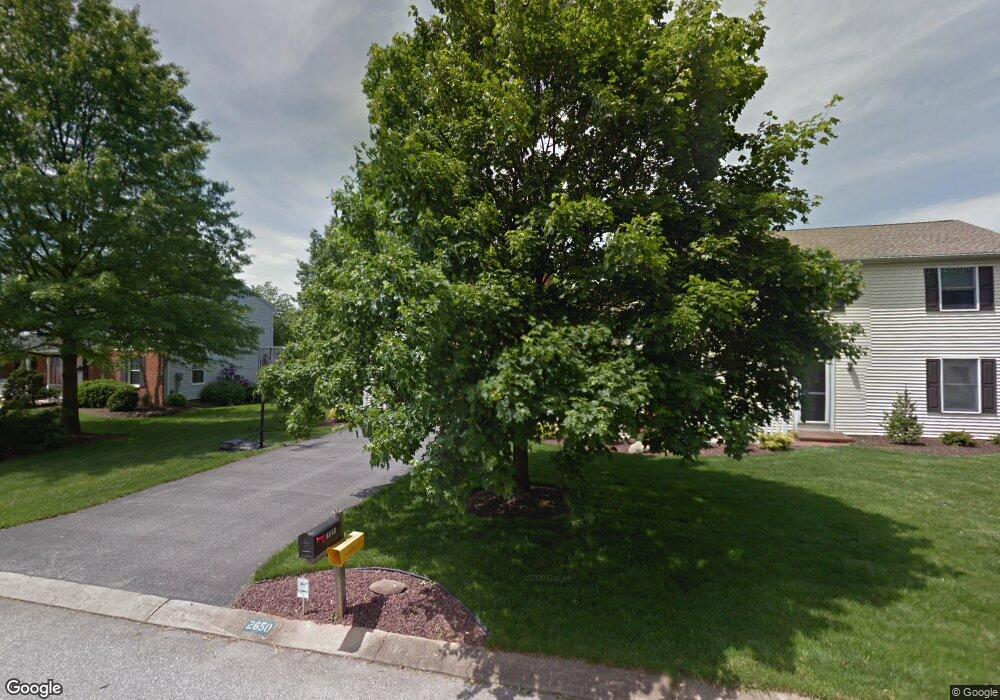
This home is located at 2650 Saint Andrews Way, York, PA 17404 and is currently estimated at $420,380, approximately $184 per square foot. 2650 Saint Andrews Way is a home located in York County with nearby schools including Central York High School, Christian School of York, and York Adventist Christian School.
Ownership History
Date
Name
Owned For
Owner Type
Purchase Details
Closed on
Aug 25, 2000
Sold by
Hill Cheryl A and Kerdock Esq John S
Bought by
Mcquay Mark C and Mcquay Cindy R
Current Estimated Value
Home Financials for this Owner
Home Financials are based on the most recent Mortgage that was taken out on this home.
Original Mortgage
$159,159
Outstanding Balance
$58,254
Interest Rate
8.16%
Mortgage Type
VA
Estimated Equity
$362,126
Purchase Details
Closed on
Mar 12, 1996
Bought by
Hill Cheryl A
Create a Home Valuation Report for This Property
The Home Valuation Report is an in-depth analysis detailing your home's value as well as a comparison with similar homes in the area
Home Values in the Area
Average Home Value in this Area
Purchase History
| Date | Buyer | Sale Price | Title Company |
|---|---|---|---|
| Mcquay Mark C | $154,900 | First American Title Ins Co | |
| Hill Cheryl A | $145,000 | -- |
Source: Public Records
Mortgage History
| Date | Status | Borrower | Loan Amount |
|---|---|---|---|
| Open | Mcquay Mark C | $159,159 |
Source: Public Records
Tax History Compared to Growth
Tax History
| Year | Tax Paid | Tax Assessment Tax Assessment Total Assessment is a certain percentage of the fair market value that is determined by local assessors to be the total taxable value of land and additions on the property. | Land | Improvement |
|---|---|---|---|---|
| 2025 | $6,015 | $196,280 | $64,150 | $132,130 |
| 2024 | $5,843 | $196,280 | $64,150 | $132,130 |
| 2023 | $5,631 | $196,280 | $64,150 | $132,130 |
| 2022 | $5,541 | $196,280 | $64,150 | $132,130 |
| 2021 | $5,345 | $196,280 | $64,150 | $132,130 |
| 2020 | $5,345 | $196,280 | $64,150 | $132,130 |
| 2019 | $5,247 | $196,280 | $64,150 | $132,130 |
| 2018 | $5,133 | $196,280 | $64,150 | $132,130 |
| 2017 | $5,048 | $196,280 | $64,150 | $132,130 |
| 2016 | $0 | $196,280 | $64,150 | $132,130 |
| 2015 | -- | $196,280 | $64,150 | $132,130 |
| 2014 | -- | $196,280 | $64,150 | $132,130 |
Source: Public Records
Map
Nearby Homes
- 1300 Garrison Dr
- 2741 Primrose Ln N
- 1305 Detwiler Dr
- 1425 Brittany Dr
- 1270 Detwiler Dr
- 1375 Detwiler Dr
- 1520 Winsford Ln
- 1160 Detwiler Dr
- 2547 Hepplewhite Dr
- 1055 Wetherburn Dr
- 15 Wetherburn Ct
- 1201 Falls Grove Ln
- 1005 Gleneagles Dr
- 1900-G Greenbriar Rd
- 1900-F Greenbriar Rd
- 1900-E Greenbriar Rd
- 820 Gleneagles Dr
- 0 Stillmeadow Ln
- 2611 Oberlin Dr
- GALEN Plan at Fox Run Heights
- 2660 Saint Andrews Way
- 2640 Saint Andrews Way
- 1345 Garrison Dr
- 2655 Stevenson Dr Unit 357
- 2655 Stevenson Dr
- 2665 Stevenson Dr
- 2590 Lori Dr
- 1400 Garrison Dr
- 2645 Stevenson Dr
- 2630 Saint Andrews Way
- 2631 Saint Andrews Way
- 1350 Garrison Dr
- 2630 St Andrews Way
- 2705 Stevenson Dr
- 1340 Garrison Dr
- 2660 Stevenson Dr
- 2580 Lori Dr
- 2650 Stevenson Dr
- 2620 Saint Andrews Way
- 2670 Stevenson Dr