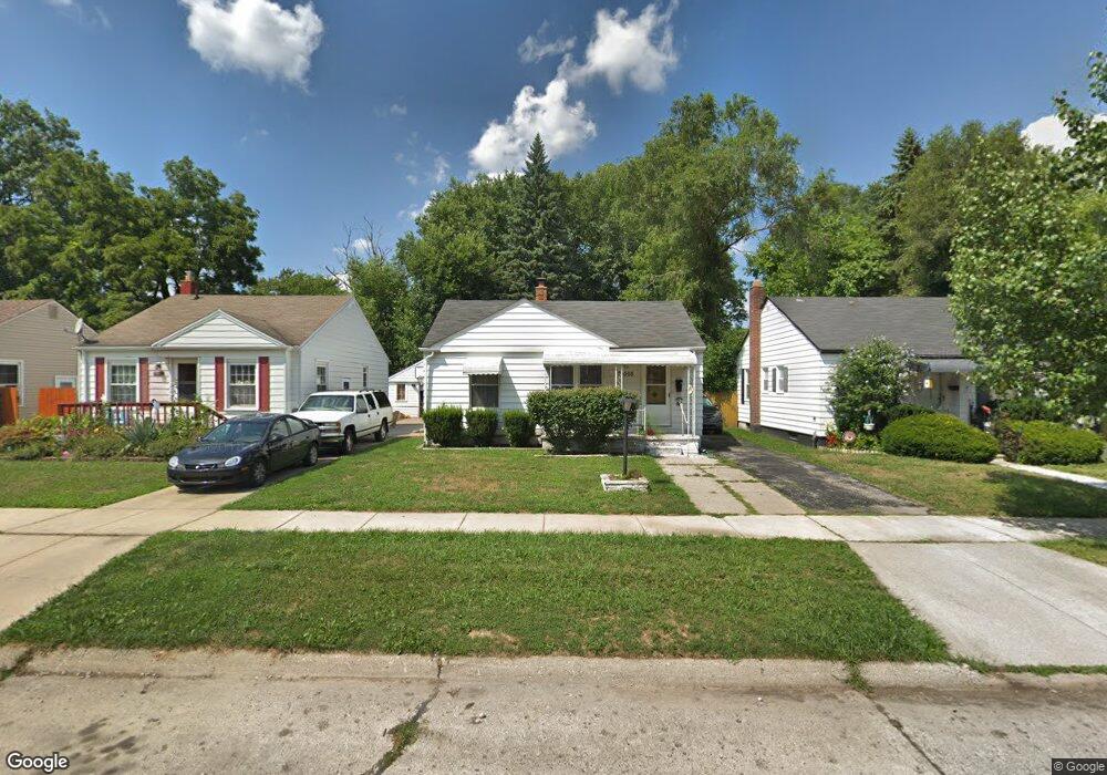
26508 Eton Ave Dearborn Heights, MI 48125
Estimated Value: $126,000 - $135,000
2
Beds
1
Bath
716
Sq Ft
$183/Sq Ft
Est. Value
About This Home
This home is located at 26508 Eton Ave, Dearborn Heights, MI 48125 and is currently estimated at $130,947, approximately $182 per square foot. 26508 Eton Ave is a home located in Wayne County with nearby schools including Quest Charter Academy, West Village Academy, and Peterson-Warren Academy.
Ownership History
Date
Name
Owned For
Owner Type
Purchase Details
Closed on
Feb 16, 2021
Sold by
Marsh Laura B and Emery Laura
Bought by
Emery Michael
Current Estimated Value
Home Financials for this Owner
Home Financials are based on the most recent Mortgage that was taken out on this home.
Original Mortgage
$51,428
Outstanding Balance
$45,997
Interest Rate
2.7%
Mortgage Type
New Conventional
Estimated Equity
$84,950
Purchase Details
Closed on
Jun 18, 2004
Sold by
Gutierrez Fernando and Gutierrez Rudolph
Bought by
Emery Laura
Purchase Details
Closed on
Jun 12, 1997
Sold by
Gutierrez Erelinda
Bought by
Gutierrez Erelinda
Create a Home Valuation Report for This Property
The Home Valuation Report is an in-depth analysis detailing your home's value as well as a comparison with similar homes in the area
Home Values in the Area
Average Home Value in this Area
Purchase History
| Date | Buyer | Sale Price | Title Company |
|---|---|---|---|
| Emery Michael | $57,143 | Title One Inc | |
| Emery Laura | $84,500 | Multiple | |
| Gutierrez Erelinda | -- | Multiple |
Source: Public Records
Mortgage History
| Date | Status | Borrower | Loan Amount |
|---|---|---|---|
| Open | Emery Michael | $51,428 |
Source: Public Records
Tax History Compared to Growth
Tax History
| Year | Tax Paid | Tax Assessment Tax Assessment Total Assessment is a certain percentage of the fair market value that is determined by local assessors to be the total taxable value of land and additions on the property. | Land | Improvement |
|---|---|---|---|---|
| 2025 | $1,004 | $60,500 | $0 | $0 |
| 2024 | $1,004 | $50,100 | $0 | $0 |
| 2023 | $901 | $43,000 | $0 | $0 |
| 2022 | $1,224 | $36,200 | $0 | $0 |
| 2021 | $1,225 | $31,900 | $0 | $0 |
| 2019 | $1,537 | $25,100 | $0 | $0 |
| 2018 | $986 | $23,800 | $0 | $0 |
| 2017 | $614 | $23,200 | $0 | $0 |
| 2016 | $1,062 | $23,500 | $0 | $0 |
| 2015 | $2,190 | $21,900 | $0 | $0 |
| 2013 | $2,360 | $24,600 | $0 | $0 |
| 2010 | -- | $28,100 | $0 | $0 |
Source: Public Records
Map
Nearby Homes
- 4863 Glenis St
- 26225 McDonald St
- 26532 Powers Ave
- 26439 Hopkins St
- 26458 Hopkins St
- 26106 Powers Ave
- 26159 Stanford St
- 4110 John Daly St
- 25895 Annapolis St
- 25965 Currier St
- 26773 Colgate St
- 26202 Colgate St
- 26231 Andover St
- 5526 Sylvia St
- 26860 Andover St
- 27022 Colgate St
- 26916 Andover St
- 25628 Powers Ave
- 5970 John Daly St
- 26653 Ross St
- 26396 Eton Ave
- 26516 Eton Ave
- 26524 Eton Ave
- 26388 Eton Ave
- 26380 Eton Ave
- 26445 McDonald St
- 26532 Eton Ave
- 26455 McDonald St
- 26435 McDonald St
- 26475 McDonald St
- 26465 McDonald St
- 26372 Eton Ave
- 26419 McDonald St
- 26509 Eton Ave
- 26397 Eton Ave
- 26517 Eton Ave
- 26366 Eton Ave
- 26389 Eton Ave
- 26525 Eton Ave
- 26548 Eton Ave