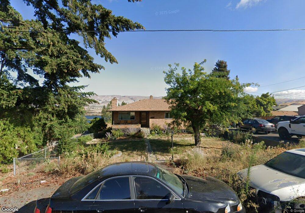
2651 E 10th St the Dalles, OR 97058
Estimated Value: $505,000 - $528,000
4
Beds
3
Baths
2,625
Sq Ft
$197/Sq Ft
Est. Value
About This Home
This home is located at 2651 E 10th St, the Dalles, OR 97058 and is currently estimated at $516,500, approximately $196 per square foot. 2651 E 10th St is a home located in Wasco County with nearby schools including Dry Hollow Elementary School, The Dalles Middle School, and The Dalles High School.
Ownership History
Date
Name
Owned For
Owner Type
Purchase Details
Closed on
Oct 12, 2020
Sold by
Osborne Olga Lillian
Bought by
Mccreery Paul A and Mccreery Shannon Irene
Current Estimated Value
Home Financials for this Owner
Home Financials are based on the most recent Mortgage that was taken out on this home.
Original Mortgage
$224,000
Outstanding Balance
$198,333
Interest Rate
2.9%
Mortgage Type
New Conventional
Estimated Equity
$318,167
Purchase Details
Closed on
Mar 13, 2014
Sold by
Dennee John E and Dennee Helen G
Bought by
Osborne Robert Thomas and Osborne Olga Lillian
Home Financials for this Owner
Home Financials are based on the most recent Mortgage that was taken out on this home.
Original Mortgage
$228,305
Interest Rate
4.29%
Mortgage Type
VA
Create a Home Valuation Report for This Property
The Home Valuation Report is an in-depth analysis detailing your home's value as well as a comparison with similar homes in the area
Purchase History
| Date | Buyer | Sale Price | Title Company |
|---|---|---|---|
| Mccreery Paul A | $354,000 | Amerititle | |
| Osborne Robert Thomas | $223,500 | None Available |
Source: Public Records
Mortgage History
| Date | Status | Borrower | Loan Amount |
|---|---|---|---|
| Open | Mccreery Paul A | $224,000 | |
| Previous Owner | Osborne Robert Thomas | $228,305 |
Source: Public Records
Tax History
| Year | Tax Paid | Tax Assessment Tax Assessment Total Assessment is a certain percentage of the fair market value that is determined by local assessors to be the total taxable value of land and additions on the property. | Land | Improvement |
|---|---|---|---|---|
| 2025 | $5,127 | $285,351 | -- | -- |
| 2024 | $4,987 | $277,040 | -- | -- |
| 2023 | $4,841 | $268,971 | $0 | $0 |
| 2022 | $4,734 | $121,525 | $0 | $0 |
| 2021 | $4,589 | $117,985 | $0 | $0 |
| 2020 | $4,475 | $114,549 | $0 | $0 |
| 2019 | $4,726 | $111,213 | $0 | $0 |
| 2018 | $4,594 | $232,017 | $0 | $0 |
| 2017 | $4,230 | $225,259 | $0 | $0 |
| 2016 | $4,244 | $218,698 | $0 | $0 |
| 2015 | $4,021 | $212,328 | $0 | $0 |
| 2014 | $4,276 | $211,920 | $0 | $0 |
Source: Public Records
Map
Nearby Homes
- 2606 E 10th St
- 2718 E 2nd St
- 2444 E 10th St
- 2410 E 12th St
- 2318 E 13th St
- 3103 Fremont St
- 3113 Fremont St
- 162 Blue Heron Ct
- 112 Southshore Ave
- 192 Honeysuckle Ln
- 110 Southshore Ave
- 125 Southshore Ln
- 1704 Oakwood Dr
- 1700 Lone Pine Blvd
- 500 E Knoll Ct
- 1903 Golden Way
- 1500 Lone Pine Blvd
- 1400 Lone Pine Blvd
- 240 Lone Pine Ln Unit 2
- 250 Lone Pine Ln Unit 7
- 1006 Morton St
- 2637 E 10th St
- 2717 E 10th St
- 2716 E 9th St
- 2715 E 10th St
- 2648 Old Dufur Rd
- 980 Morton St
- 2636 Old Dufur Rd
- 2719 E 10th St
- 2627 E 10th St
- 2656 Old Dufur Rd
- 1105 Morton St
- 2700 Old Dufur Rd
- 2702 Old Dufur Rd
- 2632 Old Dufur Rd
- 2700/2702 Old Dufur Rd
- 1 E 9th St Unit lot 1
- 2623 E 10th St
- 2710 Old Dufur Rd
Your Personal Tour Guide
Ask me questions while you tour the home.