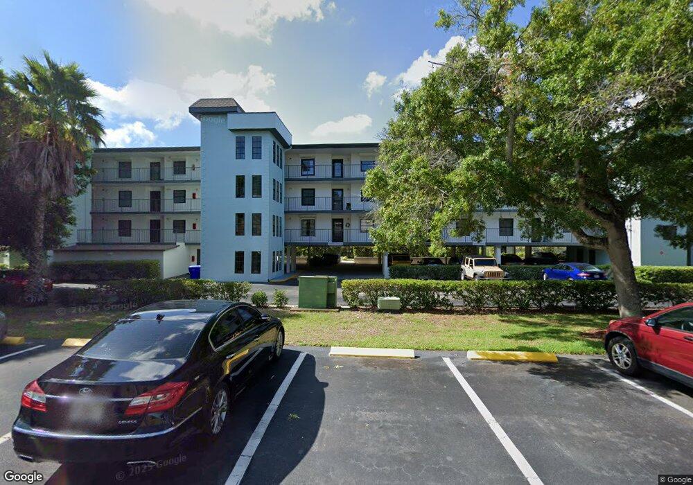
2651 Michael Place Unit 1305 Dunedin, FL 34698
Estimated Value: $251,238 - $352,000
--
Bed
--
Bath
1,230
Sq Ft
$252/Sq Ft
Est. Value
About This Home
This home is located at 2651 Michael Place Unit 1305, Dunedin, FL 34698 and is currently estimated at $309,810, approximately $251 per square foot. 2651 Michael Place Unit 1305 is a home located in Pinellas County with nearby schools including San Jose Elementary School, Palm Harbor Middle School, and Dunedin High School.
Ownership History
Date
Name
Owned For
Owner Type
Purchase Details
Closed on
Jan 26, 2018
Sold by
Gordon Charles R
Bought by
Minton Leslie
Current Estimated Value
Home Financials for this Owner
Home Financials are based on the most recent Mortgage that was taken out on this home.
Original Mortgage
$140,000
Outstanding Balance
$117,560
Interest Rate
3.93%
Mortgage Type
New Conventional
Estimated Equity
$192,250
Purchase Details
Closed on
Apr 6, 2007
Sold by
Gordon Charles R and Gordon Alice C
Bought by
Gordon Charles R and Gordon Alice C
Purchase Details
Closed on
Apr 3, 1998
Sold by
Despirt Robert L and Despirt Rebecca A
Bought by
Gordon Charles R and Gordon Alice C
Purchase Details
Closed on
Dec 8, 1995
Sold by
Radojkovich Dusan and Radojkovich Elenora
Bought by
Despirt Robert L and Despirt Rebecca A
Home Financials for this Owner
Home Financials are based on the most recent Mortgage that was taken out on this home.
Original Mortgage
$61,110
Interest Rate
7.4%
Mortgage Type
New Conventional
Create a Home Valuation Report for This Property
The Home Valuation Report is an in-depth analysis detailing your home's value as well as a comparison with similar homes in the area
Home Values in the Area
Average Home Value in this Area
Purchase History
| Date | Buyer | Sale Price | Title Company |
|---|---|---|---|
| Minton Leslie | $175,000 | Compass Land & Title Of Nort | |
| Gordon Charles R | -- | Attorney | |
| Gordon Charles R | $76,000 | -- | |
| Despirt Robert L | $63,000 | -- |
Source: Public Records
Mortgage History
| Date | Status | Borrower | Loan Amount |
|---|---|---|---|
| Open | Minton Leslie | $140,000 | |
| Previous Owner | Despirt Robert L | $61,110 |
Source: Public Records
Tax History Compared to Growth
Tax History
| Year | Tax Paid | Tax Assessment Tax Assessment Total Assessment is a certain percentage of the fair market value that is determined by local assessors to be the total taxable value of land and additions on the property. | Land | Improvement |
|---|---|---|---|---|
| 2025 | $2,158 | $171,864 | -- | -- |
| 2024 | $2,114 | $167,020 | -- | -- |
| 2023 | $2,114 | $162,155 | $0 | $0 |
| 2022 | $2,044 | $157,432 | $0 | $0 |
| 2021 | $2,061 | $152,847 | $0 | $0 |
| 2020 | $2,051 | $150,737 | $0 | $0 |
| 2019 | $2,008 | $147,348 | $0 | $147,348 |
| 2018 | $733 | $84,603 | $0 | $0 |
| 2017 | $716 | $82,863 | $0 | $0 |
| 2016 | $698 | $81,159 | $0 | $0 |
| 2015 | $811 | $80,595 | $0 | $0 |
| 2014 | $790 | $79,955 | $0 | $0 |
Source: Public Records
Map
Nearby Homes
- 464 Paula Dr N Unit 116
- 464 N Paula Dr Unit 207
- 464 N Paula Dr Unit 221
- 464 N Paula Dr Unit 301
- 464 N Paula Dr Unit 106
- 2700 Bayshore Blvd Unit 593
- 2700 Bayshore Blvd Unit 532
- 2700 Bayshore Blvd Unit 11308
- 2700 Bayshore Blvd Unit 6210
- 2700 Bayshore Blvd Unit A505
- 2700 Bayshore Blvd Unit 4106
- 2700 Bayshore Blvd Unit 3211
- 2700 Bayshore Blvd Unit 5108
- 2700 Bayshore Blvd Unit 1305
- 2700 Bayshore Blvd Unit 555
- 2700 Bayshore Blvd Unit 2110
- 2700 Bayshore Blvd Unit 539
- 2700 Bayshore Blvd Unit 11302
- 2700 Bayshore Blvd Unit 1206
- 2700 Bayshore Blvd Unit 5210
- 2651 Michael Place Unit 307
- 2651 Michael Place Unit 305
- 2651 Michael Place Unit 205
- 2651 Michael Place Unit 203
- 2651 Michael Place Unit 306
- 2651 Michael Place Unit 304
- 2651 Michael Place Unit 303
- 2651 Michael Place Unit 302
- 2651 Michael Place Unit 301
- 2651 Michael Place
- 2651 Michael Place Unit 206
- 2651 Michael Place
- 2651 Michael Place Unit 204
- 2651 Michael Place
- 2651 Michael Place Unit 202
- 2651 Michael Place
- 2651 Michael Place Unit 106
- 2651 Michael Place Unit 105
- 2651 Michael Place
- 2651 Michael Place Unit 103