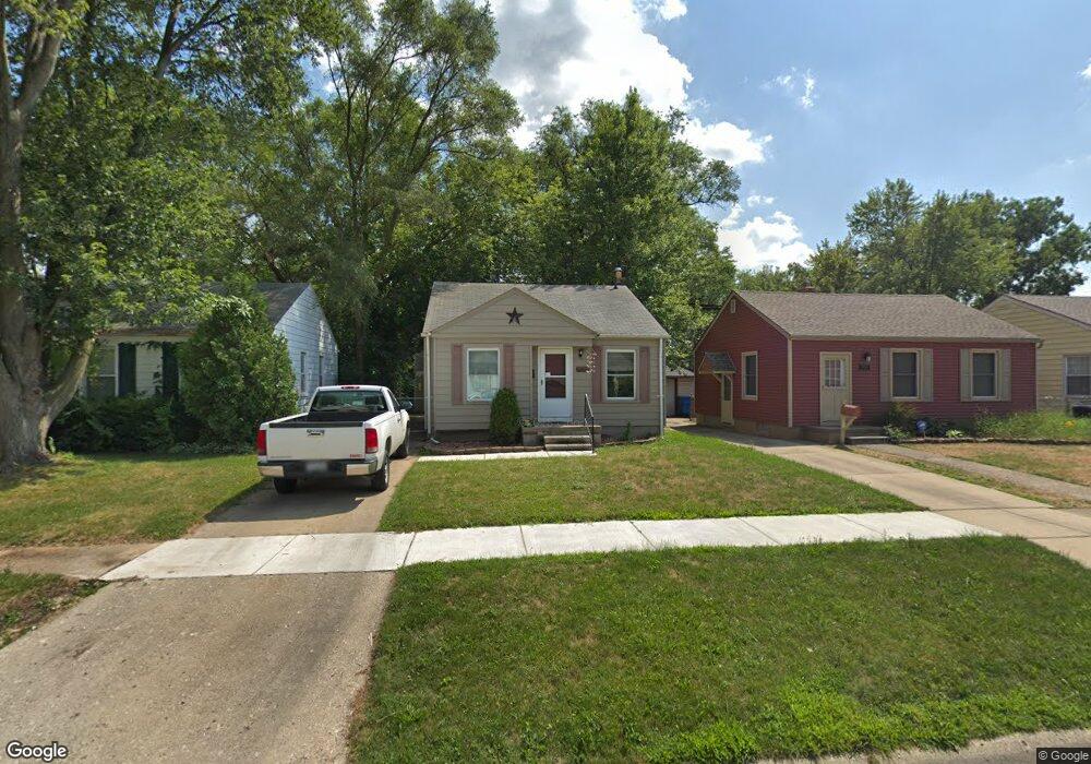
26517 Eton Ave Dearborn Heights, MI 48125
Estimated Value: $120,041 - $136,000
2
Beds
1
Bath
729
Sq Ft
$173/Sq Ft
Est. Value
About This Home
This home is located at 26517 Eton Ave, Dearborn Heights, MI 48125 and is currently estimated at $125,760, approximately $172 per square foot. 26517 Eton Ave is a home located in Wayne County with nearby schools including Quest Charter Academy, West Village Academy, and Peterson-Warren Academy.
Ownership History
Date
Name
Owned For
Owner Type
Purchase Details
Closed on
Dec 28, 2012
Sold by
Brummitt John J and Brummitt Frank Robert
Bought by
Brummitt John J
Current Estimated Value
Home Financials for this Owner
Home Financials are based on the most recent Mortgage that was taken out on this home.
Original Mortgage
$68,862
Outstanding Balance
$50,330
Interest Rate
4.5%
Mortgage Type
FHA
Estimated Equity
$75,430
Purchase Details
Closed on
Sep 8, 2005
Sold by
Tarolli Jeffrey E and Tarolli Karen E
Bought by
Brummitt John J
Create a Home Valuation Report for This Property
The Home Valuation Report is an in-depth analysis detailing your home's value as well as a comparison with similar homes in the area
Home Values in the Area
Average Home Value in this Area
Purchase History
| Date | Buyer | Sale Price | Title Company |
|---|---|---|---|
| Brummitt John J | -- | Stewart Title Guaranty Co | |
| Brummitt John J | $84,000 | Downriver Title Agency |
Source: Public Records
Mortgage History
| Date | Status | Borrower | Loan Amount |
|---|---|---|---|
| Open | Brummitt John J | $68,862 |
Source: Public Records
Tax History Compared to Growth
Tax History
| Year | Tax Paid | Tax Assessment Tax Assessment Total Assessment is a certain percentage of the fair market value that is determined by local assessors to be the total taxable value of land and additions on the property. | Land | Improvement |
|---|---|---|---|---|
| 2025 | $1,160 | $55,900 | $0 | $0 |
| 2024 | $1,160 | $46,400 | $0 | $0 |
| 2023 | $1,054 | $40,100 | $0 | $0 |
| 2022 | $1,551 | $34,000 | $0 | $0 |
| 2021 | $1,539 | $30,200 | $0 | $0 |
| 2019 | $1,425 | $23,900 | $0 | $0 |
| 2018 | $914 | $22,500 | $0 | $0 |
| 2017 | $942 | $21,400 | $0 | $0 |
| 2016 | $1,355 | $21,700 | $0 | $0 |
| 2015 | $2,030 | $20,300 | $0 | $0 |
| 2013 | $2,180 | $23,300 | $0 | $0 |
| 2010 | -- | $26,500 | $0 | $0 |
Source: Public Records
Map
Nearby Homes
- 4863 Glenis St
- 26532 Powers Ave
- 26225 McDonald St
- 26439 Hopkins St
- 26458 Hopkins St
- 26106 Powers Ave
- 5526 Sylvia St
- 26159 Stanford St
- 4110 John Daly St
- 25926 Powers Ave
- 26773 Colgate St
- 25965 Currier St
- 25895 Annapolis St
- 26772 Colgate St
- 26202 Colgate St
- 26231 Andover St
- 5970 John Daly St
- 5993 John Daly St
- 27022 Colgate St
- 26860 Andover St
- 26525 Eton Ave
- 26509 Eton Ave
- 26533 Eton Ave
- 26397 Eton Ave
- 26541 Eton Ave
- 26516 Pennie St
- 26389 Eton Ave
- 26508 Pennie St
- 26396 Pennie St
- 26540 Pennie St
- 26532 Pennie St
- 26381 Eton Ave
- 26549 Eton Ave
- 26388 Pennie St
- 26516 Eton Ave
- 26524 Eton Ave
- 26508 Eton Ave
- 26532 Eton Ave
- 26373 Eton Ave
- 26380 Pennie St