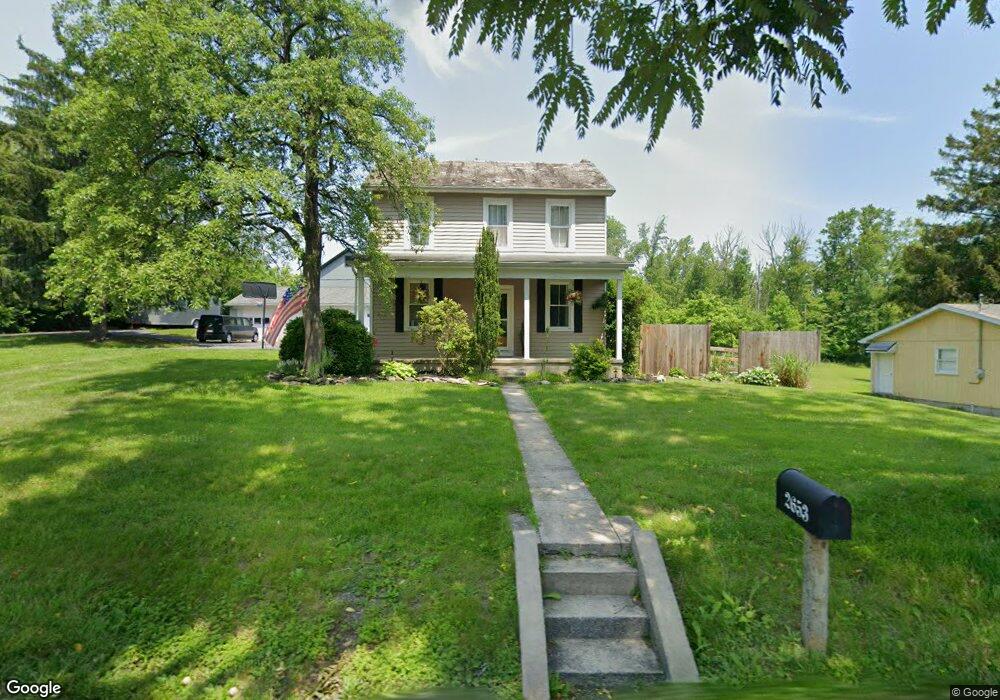
2653 Welshtown Rd Slatington, PA 18080
Washington Township NeighborhoodEstimated Value: $257,702 - $305,000
3
Beds
1
Bath
1,224
Sq Ft
$226/Sq Ft
Est. Value
About This Home
This home is located at 2653 Welshtown Rd, Slatington, PA 18080 and is currently estimated at $276,176, approximately $225 per square foot. 2653 Welshtown Rd is a home located in Lehigh County with nearby schools including Deep Creek Central Elementary School, Grassfield Elementary School, and Slatington Elementary School.
Ownership History
Date
Name
Owned For
Owner Type
Purchase Details
Closed on
Jul 16, 2003
Sold by
Kolnos Sylvia I
Bought by
Kolnos Sylvia I
Current Estimated Value
Purchase Details
Closed on
Mar 18, 1987
Sold by
Lancsek Sylvia
Bought by
Kolnos Sylvia I
Create a Home Valuation Report for This Property
The Home Valuation Report is an in-depth analysis detailing your home's value as well as a comparison with similar homes in the area
Home Values in the Area
Average Home Value in this Area
Purchase History
| Date | Buyer | Sale Price | Title Company |
|---|---|---|---|
| Kolnos Sylvia I | -- | -- | |
| Kolnos Sylvia I | -- | -- |
Source: Public Records
Tax History Compared to Growth
Tax History
| Year | Tax Paid | Tax Assessment Tax Assessment Total Assessment is a certain percentage of the fair market value that is determined by local assessors to be the total taxable value of land and additions on the property. | Land | Improvement |
|---|---|---|---|---|
| 2025 | $3,782 | $128,400 | $62,100 | $66,300 |
| 2024 | $3,717 | $128,400 | $62,100 | $66,300 |
| 2023 | $3,614 | $128,400 | $62,100 | $66,300 |
| 2022 | $3,549 | $128,400 | $66,300 | $62,100 |
| 2021 | $3,489 | $128,400 | $62,100 | $66,300 |
| 2020 | $3,415 | $128,400 | $62,100 | $66,300 |
| 2019 | $3,326 | $128,400 | $62,100 | $66,300 |
| 2018 | $3,246 | $128,400 | $62,100 | $66,300 |
| 2017 | $3,237 | $128,400 | $62,100 | $66,300 |
| 2016 | -- | $128,400 | $62,100 | $66,300 |
| 2015 | -- | $128,400 | $62,100 | $66,300 |
| 2014 | -- | $128,400 | $62,100 | $66,300 |
Source: Public Records
Map
Nearby Homes
- 2657 Welshtown Rd
- 2656 Welshtown Rd
- 2648 Welshtown Rd
- 2662 Welshtown Rd
- 2666 Welshtown Rd
- 2642 Welshtown Rd
- 2649 Welshtown Rd
- 2639 Welshtown Rd
- 2670 Welshtown Rd
- 2675 Welshtown Rd
- 2693 Welshtown Rd
- 2633 Welshtown Rd
- 8104 Skeet Club Rd
- 8104 Skeet Club Rd
- 2712 Welshtown Rd
- 2627 Welshtown Rd
- 2674 Welshtown Rd
- 2718 Welshtown Rd
- 2727 Welshtown Rd
- 2724 Welshtown Rd