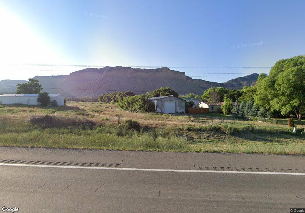
2654 Highway 160-491 Cortez, CO 81321
Estimated Value: $143,415 - $539,000
--
Bed
--
Bath
4,040
Sq Ft
$83/Sq Ft
Est. Value
About This Home
This home is located at 2654 Highway 160-491, Cortez, CO 81321 and is currently estimated at $337,104, approximately $83 per square foot. 2654 Highway 160-491 is a home with nearby schools including Montezuma-Cortez High School.
Ownership History
Date
Name
Owned For
Owner Type
Purchase Details
Closed on
Jan 22, 2015
Sold by
The Dolores State Bank
Bought by
Leonard Ronald F and Martin Virginia
Current Estimated Value
Purchase Details
Closed on
Sep 12, 2013
Sold by
Steelman Lonnie Joe and Steelman Connie Sue
Bought by
Deans Safety Consultants Inc
Purchase Details
Closed on
Jun 20, 2008
Sold by
Worrell Jesse R and Worrell Cynthia L
Bought by
Steelman Lonnie Joe and Steelman Connie Sue
Home Financials for this Owner
Home Financials are based on the most recent Mortgage that was taken out on this home.
Original Mortgage
$60,000
Interest Rate
6.75%
Mortgage Type
Commercial
Create a Home Valuation Report for This Property
The Home Valuation Report is an in-depth analysis detailing your home's value as well as a comparison with similar homes in the area
Home Values in the Area
Average Home Value in this Area
Purchase History
| Date | Buyer | Sale Price | Title Company |
|---|---|---|---|
| Leonard Ronald F | $110,000 | Colorado Land Title Co Llc | |
| Deans Safety Consultants Inc | -- | None Available | |
| Steelman Lonnie Joe | $60,000 | None Available |
Source: Public Records
Mortgage History
| Date | Status | Borrower | Loan Amount |
|---|---|---|---|
| Previous Owner | Steelman Lonnie Joe | $60,000 |
Source: Public Records
Tax History Compared to Growth
Tax History
| Year | Tax Paid | Tax Assessment Tax Assessment Total Assessment is a certain percentage of the fair market value that is determined by local assessors to be the total taxable value of land and additions on the property. | Land | Improvement |
|---|---|---|---|---|
| 2024 | $143 | $2,771 | $755 | $2,016 |
| 2023 | $143 | $7,150 | $1,949 | $5,201 |
| 2022 | $282 | $21,166 | $7,099 | $14,067 |
| 2021 | $287 | $21,166 | $7,099 | $14,067 |
| 2020 | $198 | $15,081 | $7,099 | $7,982 |
| 2019 | $197 | $15,081 | $7,099 | $7,982 |
| 2018 | $222 | $4,040 | $1,760 | $2,280 |
| 2017 | $220 | $4,040 | $1,760 | $2,280 |
| 2016 | $235 | $16,040 | $7,100 | $8,940 |
| 2015 | $232 | $87,380 | $0 | $0 |
| 2014 | $228 | $4,440 | $0 | $0 |
Source: Public Records
Map
Nearby Homes
- 2161 Highway 160 491
- 22088 Road C 1
- 20975 Road b
- 21043 Road C 7
- 5200 Road 21
- 5178 Hwy 160-491
- 21424 Road F
- 6066 Road 21
- 6493 County Road 23 6
- 6597 Road 24
- 22989 Road G 5
- 24293 Road G
- 18261 Road G
- 617 Apple Dr
- 706 Apple Dr
- 623 Detroit Ave
- 915 S Broadway
- 17979 Road G
- 23848 J 3 Rd
- TBD Chisholm Pl & Jarrett Ave
- 2624 Highway 160-491
- 2684 Highway 160-491
- S Hwy 160-491 Unit 2654 S Hwy 160-491
- S Hwy 160-491
- 21837 Road B 7
- 21945 Road B.7
- 21803 Road B.7
- 0 Road B 7
- 2504 Highway 160-491
- TBD Hwy 160-491
- 0 160-491 Unit 760386
- 0 160-491 Unit 747450
- 0 160 491 Unit 2654 Hwy 160/491
- 21933 Road B.7
- 2500 Highway 160-491
- 2494 Highway 160-491
- 3113 Highway 160-491
- 21730 Road c
- 0 Hwy 491 160 Unit 611951
- 3113 Hwy 491 160