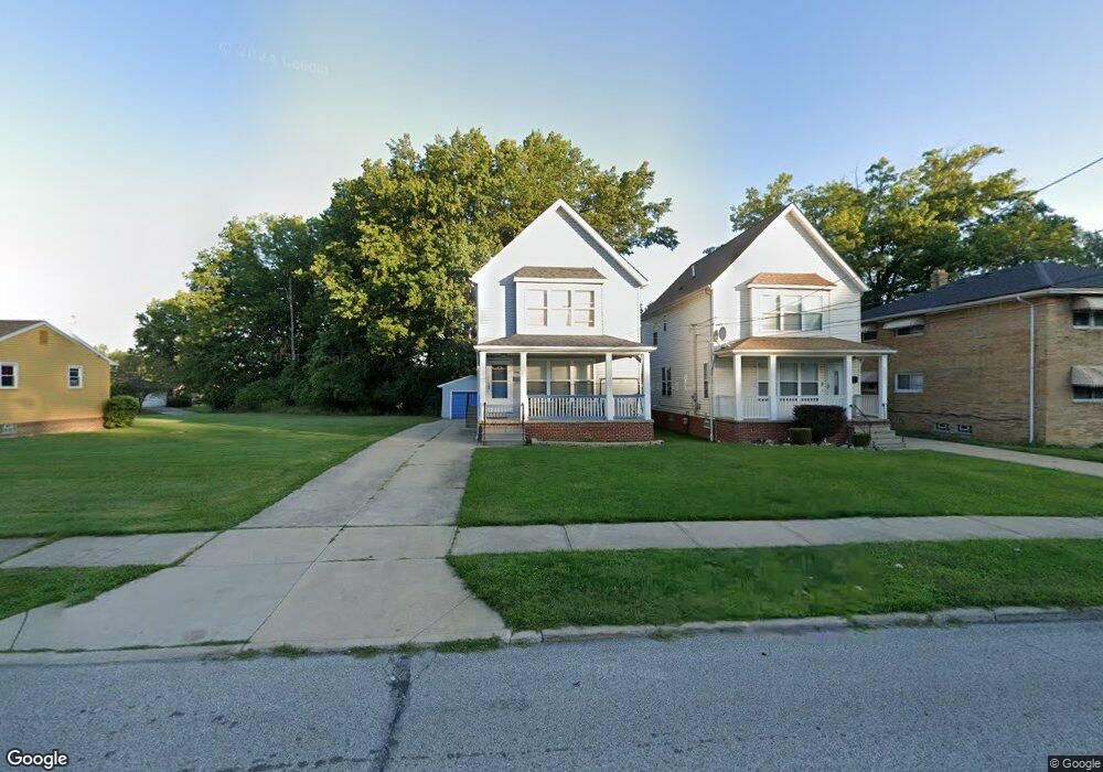
26541 Brush Ave Euclid, OH 44132
Estimated Value: $109,000 - $199,000
3
Beds
2
Baths
1,554
Sq Ft
$101/Sq Ft
Est. Value
About This Home
This home is located at 26541 Brush Ave, Euclid, OH 44132 and is currently estimated at $157,682, approximately $101 per square foot. 26541 Brush Ave is a home located in Cuyahoga County with nearby schools including Bluestone Elementary School, Euclid High School, and All Saints of St. John Vianney School.
Ownership History
Date
Name
Owned For
Owner Type
Purchase Details
Closed on
Aug 17, 2009
Sold by
U S Bank National Association
Bought by
Howard Karl E
Current Estimated Value
Home Financials for this Owner
Home Financials are based on the most recent Mortgage that was taken out on this home.
Original Mortgage
$62,840
Interest Rate
5.19%
Mortgage Type
FHA
Purchase Details
Closed on
Mar 24, 2009
Sold by
Carter Dushen and Morris Felicia
Bought by
Us Bank National Association
Purchase Details
Closed on
Feb 21, 2007
Sold by
Carter Dushen
Bought by
Morris Felicia
Purchase Details
Closed on
Mar 31, 2006
Sold by
Hud
Bought by
Carter Dushen
Home Financials for this Owner
Home Financials are based on the most recent Mortgage that was taken out on this home.
Original Mortgage
$103,500
Interest Rate
9.57%
Mortgage Type
Fannie Mae Freddie Mac
Purchase Details
Closed on
Dec 1, 2005
Sold by
Midfirst Bank
Bought by
Hud
Purchase Details
Closed on
Oct 24, 2005
Sold by
Hud
Bought by
Midfirst Bank
Purchase Details
Closed on
Sep 9, 2005
Sold by
Bryant Charles C and Bryant Traci C
Bought by
Hud
Purchase Details
Closed on
Feb 22, 2001
Sold by
Higey Donald R
Bought by
Mcculler Matthew and Premier Alliance Development Group
Home Financials for this Owner
Home Financials are based on the most recent Mortgage that was taken out on this home.
Original Mortgage
$219,000
Interest Rate
7.18%
Purchase Details
Closed on
May 23, 1997
Sold by
Levin Maxine G
Bought by
Fundamental Investments Inc
Purchase Details
Closed on
Dec 9, 1992
Sold by
Sill Robert L
Bought by
Sill, Alan Robert - Trustee
Purchase Details
Closed on
Apr 26, 1990
Sold by
Levin Robert M
Bought by
Sill Robert L
Purchase Details
Closed on
May 19, 1976
Sold by
Levin Maxine G
Bought by
Levin Robert M
Purchase Details
Closed on
Aug 13, 1975
Sold by
Levin Robert M
Bought by
Levin Maxine G
Purchase Details
Closed on
Jan 1, 1975
Bought by
Levin Robert M
Create a Home Valuation Report for This Property
The Home Valuation Report is an in-depth analysis detailing your home's value as well as a comparison with similar homes in the area
Home Values in the Area
Average Home Value in this Area
Purchase History
| Date | Buyer | Sale Price | Title Company |
|---|---|---|---|
| Howard Karl E | $64,000 | Sovereign Title Agency Llc | |
| Us Bank National Association | $81,770 | None Available | |
| Morris Felicia | $60,000 | None Available | |
| Carter Dushen | $115,000 | Lakeside Title | |
| Hud | -- | Attorney | |
| Midfirst Bank | -- | Attorney | |
| Hud | $110,000 | Attorney | |
| Mcculler Matthew | $14,000 | Mountaineer Title Inc | |
| Fundamental Investments Inc | $17,400 | -- | |
| Sill, Alan Robert - Trustee | -- | -- | |
| Sill Robert L | -- | -- | |
| Levin Robert M | -- | -- | |
| Levin Maxine G | -- | -- | |
| Levin Robert M | -- | -- |
Source: Public Records
Mortgage History
| Date | Status | Borrower | Loan Amount |
|---|---|---|---|
| Previous Owner | Howard Karl E | $62,840 | |
| Previous Owner | Carter Dushen | $103,500 | |
| Previous Owner | Mcculler Matthew | $219,000 |
Source: Public Records
Tax History Compared to Growth
Tax History
| Year | Tax Paid | Tax Assessment Tax Assessment Total Assessment is a certain percentage of the fair market value that is determined by local assessors to be the total taxable value of land and additions on the property. | Land | Improvement |
|---|---|---|---|---|
| 2024 | $4,473 | $66,010 | $6,090 | $59,920 |
| 2023 | $3,163 | $36,720 | $4,940 | $31,780 |
| 2022 | $3,091 | $36,720 | $4,940 | $31,780 |
| 2021 | $3,439 | $36,720 | $4,940 | $31,780 |
| 2020 | $2,887 | $27,830 | $3,750 | $24,080 |
| 2019 | $2,596 | $79,500 | $10,700 | $68,800 |
| 2018 | $2,623 | $27,830 | $3,750 | $24,080 |
| 2017 | $2,890 | $26,010 | $3,080 | $22,930 |
| 2016 | $443 | $3,080 | $3,080 | $0 |
| 2015 | $467 | $3,080 | $3,080 | $0 |
| 2014 | $467 | $3,640 | $3,640 | $0 |
Source: Public Records
Map
Nearby Homes
- 1670 Hillandale Dr
- 1507 E 256th St
- 27601 Mills Ave
- 1555 E 256th St
- 1445 Sulzer Ave
- 1471 Hall Ct
- 1523 Babbitt Rd
- 1530 E 254th St
- 145 Richmond Rd
- 1552 E 254th St
- 1468 E 252nd St
- 1467 E 250th St
- 25151 Euclid Ave
- 1498 E 248th St
- 1354 Craneing Rd
- 24971 Euclid Ave
- 861 E 256th St
- 820 E 250th St
- 825 E 256th St
- 1790 Skyline Dr
- 26551 Brush Ave
- 26601 Brush Ave
- 26601 Brush Ave Unit 1
- 26601 Brush Ave Unit 2
- 26491 Brush Ave
- 26631 Brush Ave
- E 264th St
- 26451 Brush Ave
- 26510 Brush Ave
- 26540 Brush Ave
- 26550 Brush Ave
- 26500 Brush Ave
- 26600 Brush Ave
- 26630 Brush Ave
- 26660 Tungsten Rd Unit 102
- 26650 Brush Ave
- 26700 Brush Ave
- 1396 E 264th St
- 26750 Brush Ave
- 26397 Brush Ave