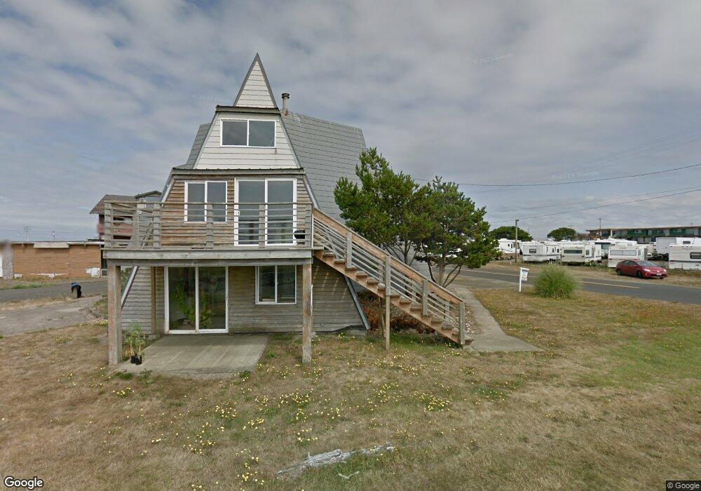
2655 N Harms St Westport, WA 98595
Estimated Value: $461,000 - $561,000
--
Bed
--
Bath
2,197
Sq Ft
$237/Sq Ft
Est. Value
About This Home
This home is located at 2655 N Harms St, Westport, WA 98595 and is currently estimated at $520,837, approximately $237 per square foot. 2655 N Harms St is a home with nearby schools including Ocosta Elementary School and Ocosta Junior/Senior High School.
Ownership History
Date
Name
Owned For
Owner Type
Purchase Details
Closed on
Apr 7, 2014
Sold by
Risher Trevor
Bought by
Melling Kristopher G and Melling Teresa B
Current Estimated Value
Create a Home Valuation Report for This Property
The Home Valuation Report is an in-depth analysis detailing your home's value as well as a comparison with similar homes in the area
Home Values in the Area
Average Home Value in this Area
Purchase History
| Date | Buyer | Sale Price | Title Company |
|---|---|---|---|
| Melling Kristopher G | $135,000 | Coast Title |
Source: Public Records
Tax History Compared to Growth
Tax History
| Year | Tax Paid | Tax Assessment Tax Assessment Total Assessment is a certain percentage of the fair market value that is determined by local assessors to be the total taxable value of land and additions on the property. | Land | Improvement |
|---|---|---|---|---|
| 2025 | $3,719 | $436,876 | $177,784 | $259,092 |
| 2024 | $3,543 | $396,163 | $177,784 | $218,379 |
| 2023 | $3,754 | $396,163 | $177,784 | $218,379 |
| 2022 | $3,258 | $282,896 | $62,370 | $220,526 |
| 2021 | $2,989 | $282,896 | $62,370 | $220,526 |
| 2020 | $2,285 | $237,285 | $59,400 | $177,885 |
| 2019 | $2,102 | $173,804 | $66,825 | $106,979 |
| 2018 | $2,354 | $164,079 | $66,825 | $97,254 |
| 2017 | $1,743 | $164,079 | $66,825 | $97,254 |
| 2016 | $1,766 | $147,870 | $66,825 | $81,045 |
| 2014 | -- | $141,725 | $66,825 | $74,900 |
| 2013 | -- | $221,170 | $66,825 | $154,345 |
Source: Public Records
Map
Nearby Homes
- 612 Dune Crest Loop
- 615 Dune Crest Loop
- 437 Dune Crest Dr
- 0 Sunset Beach Ct Unit NWM2333278
- 0 S Gold St Unit NWM2367586
- 0 Surf St Unit NWM2408053
- 710 S Hancock Ave Unit 216
- 710 S Hancock Ave Unit 419+
- 710 S Hancock Ave Unit 308
- 710 S Hancock Ave Unit 328
- 710 S Hancock Ave Unit 102&3
- 710 S Hancock Ave Unit 301
- 710 S Hancock Ave Unit 111
- 1288 Cohasset Crest N
- 1603 Golden Sands Ln
- 280 S Surf St
- 815 W Lee Ave
- 1600 W Ocean Ave Unit 1019
- 1600 W Ocean Ave Unit 1211
- 1600 W Ocean Ave Unit 925
- 926 Pheasant Run Dr
- 813 Hancock Ave Unit 13
- 623 Dune Crest Loop
- 611 Dune Crest Loop
- 1505 Dune Crest Loop
- 930 Pheasant Run
- 601 Dune Crest Loop
- 912 Pheasant Run
- 0 Pheasant Run Unit 28068953
- 0 Pheasant Run Unit NWM33171115
- 0 Pheasant Run Unit NWM33167045
- 0 Pheasant Run Unit 1625565
- 2 Pheasant Run Dr
- 606 Dune Crest Loop
- 920 Pheasant Run
- 923 Dune Crest Dr
- 921 Pheasant Run Dr
- 922 Pheasant Run
- 922 Pheasant Run Dr
- 916 Pheasant Run Dr