Estimated Value: $175,507 - $232,000
4
Beds
2
Baths
1,920
Sq Ft
$104/Sq Ft
Est. Value
About This Home
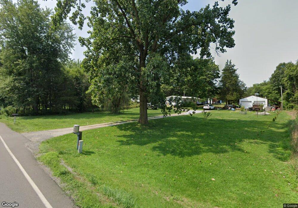
This home is located at 2655 S 700 E, Knox, IN 46534 and is currently estimated at $200,377, approximately $104 per square foot. 2655 S 700 E is a home located in Starke County with nearby schools including Knox Community Elementary School, Knox Community Middle School, and Knox Community High School.
Ownership History
Date
Name
Owned For
Owner Type
Purchase Details
Closed on
May 5, 2010
Sold by
Cunningham Robert Dean
Bought by
Cunningham Michael
Current Estimated Value
Purchase Details
Closed on
Mar 22, 2008
Sold by
Cunningham Michael L
Bought by
Cunningham Robert Dean
Purchase Details
Closed on
Apr 5, 2006
Sold by
Cunningham Robert Dean
Bought by
Cunningham Robert Dean and Cunningham Michael L
Purchase Details
Closed on
Sep 15, 2005
Sold by
Stone Donald A and Stone Julia
Bought by
Cunningham Robert Dean
Create a Home Valuation Report for This Property
The Home Valuation Report is an in-depth analysis detailing your home's value as well as a comparison with similar homes in the area
Purchase History
| Date | Buyer | Sale Price | Title Company |
|---|---|---|---|
| Cunningham Michael | -- | None Available | |
| Cunningham Robert Dean | -- | None Available | |
| Cunningham Robert Dean | -- | None Available | |
| Cunningham Robert Dean | -- | None Available |
Source: Public Records
Tax History
| Year | Tax Paid | Tax Assessment Tax Assessment Total Assessment is a certain percentage of the fair market value that is determined by local assessors to be the total taxable value of land and additions on the property. | Land | Improvement |
|---|---|---|---|---|
| 2025 | $846 | $156,600 | $20,100 | $136,500 |
| 2024 | $846 | $143,400 | $19,300 | $124,100 |
| 2023 | $833 | $134,500 | $17,500 | $117,000 |
| 2022 | $651 | $107,100 | $14,600 | $92,500 |
| 2021 | $486 | $86,500 | $14,000 | $72,500 |
| 2020 | $517 | $82,600 | $13,800 | $68,800 |
| 2019 | $450 | $78,900 | $13,800 | $65,100 |
| 2018 | $434 | $78,600 | $12,500 | $66,100 |
| 2017 | $415 | $77,100 | $12,500 | $64,600 |
| 2016 | $416 | $76,800 | $12,500 | $64,300 |
| 2014 | $373 | $77,800 | $12,500 | $65,300 |
| 2013 | $400 | $80,800 | $12,500 | $68,300 |
Source: Public Records
Map
Nearby Homes
- TBD LOT 42 Wild Rose Dr
- 6776 Fox Crossing
- - Fox Crossing
- 6540 E 200 S
- 6346 E North Dr
- 3701 S 625 E
- 3455 S 800 E
- 3872 S Hillcrest Rd
- 1750 S 600 E
- 9.08 Acres S North Dr & East of Woodland Rd E
- 0-Rear Toto Rd
- 6270 E Donald Rd
- Lot 8 E 125 S
- Lot 16 E 125 S
- Lot 4 E 125 S
- Lot 13 E 125 S
- Lot 5 E 125 S
- Lot 14 E 125 S
- Lot 17 E 125 S
- Lot 12 E 125 S
- 2675 S 700 E
- 2697 S 700 E
- 2695 S 700 E
- 2635 S 700 E
- 2715 S 700 E
- 6901 E 250 S
- 6880 E Hommette Ave
- 6905 E 250 S
- 2765 S 700 E
- 6880 Homette Ave
- 6870 Homette Ave
- 6870 E Hommette Ave
- TBD Homette Ave
- Lot 2,3, Homette Ave
- 6965 Homette Ave
- 0-TBD Homette Ave
- 0 Homette Ave
- 6903 E 250 S
- 2545 S 700 E
- 6935 E Hommette Ave
Your Personal Tour Guide
Ask me questions while you tour the home.