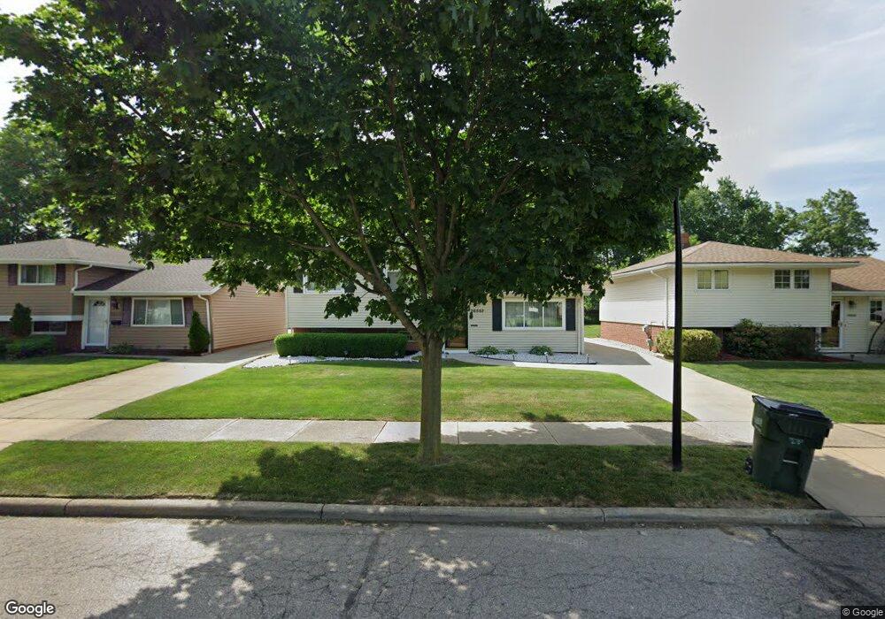
26552 Aaron Dr Euclid, OH 44132
Estimated Value: $156,000 - $194,000
2
Beds
1
Bath
1,692
Sq Ft
$101/Sq Ft
Est. Value
About This Home
This home is located at 26552 Aaron Dr, Euclid, OH 44132 and is currently estimated at $170,389, approximately $100 per square foot. 26552 Aaron Dr is a home located in Cuyahoga County with nearby schools including Shoreview Elementary School, Euclid High School, and Ss. Robert & William Catholic School.
Ownership History
Date
Name
Owned For
Owner Type
Purchase Details
Closed on
Aug 7, 2001
Sold by
Miklic Frank
Bought by
Thomas Stacey L
Current Estimated Value
Home Financials for this Owner
Home Financials are based on the most recent Mortgage that was taken out on this home.
Original Mortgage
$113,905
Interest Rate
7.15%
Purchase Details
Closed on
Dec 15, 1993
Sold by
Jakomin Mark J
Bought by
Miklic Frank
Purchase Details
Closed on
Dec 27, 1985
Sold by
Subel Edward N
Bought by
Jakomin Mark J
Purchase Details
Closed on
Apr 1, 1985
Sold by
Subel Edward N
Bought by
Subel Edward N
Purchase Details
Closed on
Nov 17, 1978
Sold by
Jonke Dennis R and Jo Ann W
Bought by
Subel Edward N
Purchase Details
Closed on
Jan 1, 1975
Bought by
Jonke Dennis R and Jo Ann W
Create a Home Valuation Report for This Property
The Home Valuation Report is an in-depth analysis detailing your home's value as well as a comparison with similar homes in the area
Home Values in the Area
Average Home Value in this Area
Purchase History
| Date | Buyer | Sale Price | Title Company |
|---|---|---|---|
| Thomas Stacey L | $119,900 | Executive Title Agency Corp | |
| Miklic Frank | $88,000 | -- | |
| Jakomin Mark J | $66,000 | -- | |
| Subel Edward N | -- | -- | |
| Subel Edward N | $62,000 | -- | |
| Jonke Dennis R | -- | -- |
Source: Public Records
Mortgage History
| Date | Status | Borrower | Loan Amount |
|---|---|---|---|
| Previous Owner | Thomas Stacey L | $113,905 |
Source: Public Records
Tax History Compared to Growth
Tax History
| Year | Tax Paid | Tax Assessment Tax Assessment Total Assessment is a certain percentage of the fair market value that is determined by local assessors to be the total taxable value of land and additions on the property. | Land | Improvement |
|---|---|---|---|---|
| 2024 | $3,681 | $53,795 | $8,155 | $45,640 |
| 2023 | $3,169 | $36,790 | $6,160 | $30,630 |
| 2022 | $3,097 | $36,785 | $6,160 | $30,625 |
| 2021 | $3,451 | $36,790 | $6,160 | $30,630 |
| 2020 | $3,271 | $31,710 | $5,320 | $26,390 |
| 2019 | $2,943 | $90,600 | $15,200 | $75,400 |
| 2018 | $2,972 | $31,710 | $5,320 | $26,390 |
| 2017 | $3,220 | $28,740 | $4,410 | $24,330 |
| 2016 | $3,227 | $28,740 | $4,410 | $24,330 |
| 2015 | $2,936 | $28,740 | $4,410 | $24,330 |
| 2014 | $2,936 | $28,740 | $4,410 | $24,330 |
Source: Public Records
Map
Nearby Homes
- 26268 Leslie Ave
- 795 E 260th St
- 780 E 266th St
- 825 E 256th St
- 26430 Drakefield Ave
- 861 E 256th St
- 754 E 256th St
- 712 E 266th St
- 635 E 261st St
- 640 E 261st St
- 25700 Briardale Ave
- 720 E 254th St
- 25750 Drakefield Ave
- 26471 Farringdon Ave
- 26351 Farringdon Ave
- 25390 Briardale Ave
- 25671 Farringdon Ave
- 25450 Farringdon Ave
- 27101 Zeman Ave
- 833 E 250th St
- 26576 Aaron Dr
- 26528 Aaron Dr
- 26600 Aaron Dr
- 26504 Aaron Dr
- 26610 Aaron Dr
- 26480 Aaron Dr
- 26456 Aaron Dr
- 26620 Leslie Ave
- 26475 Aaron Dr
- 26407 Benton Ave
- 26411 Benton Ave
- 26432 Aaron Dr
- 26533 Leslie Ave
- 26555 Leslie Ave
- 26451 Aaron Dr
- 26509 Leslie Ave
- 26577 Leslie Ave
- 26485 Leslie Ave
- 26595 Leslie Ave
- 26408 Aaron Dr
